$230,000

0 Katherine Ln Lot 7 Nehalem, OR 97131

Estimated payment $1,272/month

5 Acres
$46,000 Price per Acre
217,800 Sq Ft Lot

About This Lot

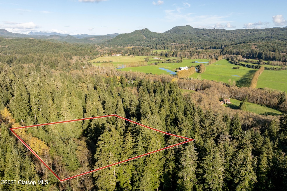
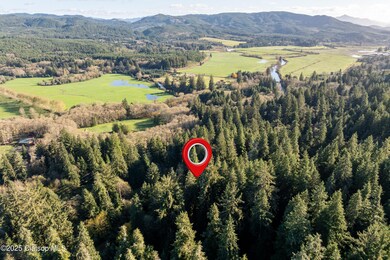
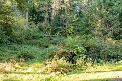
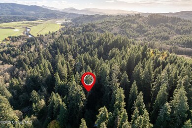
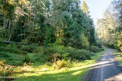
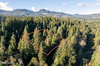
Discover this 5.39-acre wooded property that is tucked away in a peaceful neighborhood, only a short drive from downtown Nehalem and Manzanita Beach. Close enough for a quick trip to town or the ocean, but far enough to feel like it's your own private getaway surrounded by nature. Picture morning coffee surrounded by tall trees, evenings by the fire, and plenty of space to build your dream home or a cozy cabin retreat. It's a place where you can really slow down, unwind, breathe deep, and just enjoy the quiet. Well and Septic required. Electricity at street.

Listing Agent

Laura Walsh

Pete Anderson Realty, Inc. License #201237373 Listed on: 11/10/2025

Property Details

Property Type

  • Land

Est. Annual Taxes

  • $748

Lot Details

  • 5 Acre Lot
  • Property is zoned SFW10

Community Details

  • Riverbend Subdivision
  • The community has rules related to covenants, conditions, and restrictions

Listing and Financial Details

  • Assessor Parcel Number 85945

Property Details

Property Type

Land

Est. Annual Taxes

$748

Lot Details

0

Listing Details

  • Directions: 101 to Northfork Rd at blinking light in Nehalem. Left on Carol Dr through gate to Riverbend. (Contact LA for gate). Left at fork on Katherine Ln to property on lefthand side. (Just past 34650 Katherine Ln)
  • Prop. Type: Land-Residential
  • Utilities Electric: At Street
  • Average Utilities Gas: None
  • Water: None
  • Miscellaneous Survey: No
  • Utilities Septic: Not Applied For
  • Reso Property Sub Type: Land
  • Co List Office Mls Id: MZ52
  • Subdivision Name: Riverbend
  • General Property Description:View: None
  • General Property Description:View 2: None
  • General Property Description:Lot Acres: 5.39
  • Utilities:Sewer2: None
  • Location Tax and Other Information:Historic Designation2: No
  • Location Tax and Other Information:Taxes2: 748.05
  • Location Tax and Other Information:Tax Year2: 2025
  • Miscellaneous:Street Surface2: Gravel
  • General Property Description:Frontage: None
  • Location Tax and Other Information CC R: YES
  • Special Features: None
  • Property Sub Type: LotsLands

Exterior Features

  • Acres: 5.0

Lot Info

  • Zoning: SFW10
  • Lot Size Sq Ft: 217800.0
  • ResoLotSizeUnits: Acres
  • Parcel #: 85945

Tax Info

  • Tax Year: 2025
  • Tax Annual Amount: 748.05

Map

Range of Values:

Collateral Analytics

Collateral Analytics Collateral Analytics AVMs (Automated Valuation Model) employ a number of statistical approaches combined with neighborhood-specific comparable selection guarantees the most up-to-date and precise valuations.

Not Available

Collateral Analytics does not have data for the current month. Please view the chart for historical values.

ICE

ICE Mortgage Technology ICE Mortgage Technology’s AVM (Automated Valuation Model) is a state-of-the-art online residential property valuation tool that provides a quick and accurate estimate of the value of almost any home in the U.S.

Not Available

ICE Mortgage Technology does not have data for the current month. Please view the chart for historical values.

First American

First American First American Data & Analytics’ next-generation AVM combines unrivaled data assets with a blended ensemble of valuation models to produce highly accurate, reliable valuations you can trust.

Not Available

First American does not have data for the current month. Please view the chart for historical values.

Quantarium

Quantarium Quantarium’s valuation service, repeatedly proven the industry’s most accurate and comprehensive, is supercharged with a self-learning and auto-tuning AI engine that continually becomes smarter and more accurate as it processes daily inputs from the industry’s leading RE data lake.

Not Available

Quantarium does not have data for the current month. Please view the chart for historical values.

Average Value
Not Available
List Price
Sold Price
Create a Home Valuation Report for This Property
The Home Valuation Report is an in-depth analysis detailing your home's value as well as a comparison with similar homes in the area

Home Values in the Area

Source: Public Records

Average Home Value in this Area


Source: Public Records

Tax History

Year Tax Paid Tax Assessment Tax Assessment Total Assessment is a certain percentage of the fair market value that is determined by local assessors to be the total taxable value of land and additions on the property. Land Improvement
2024 $687 $68,270 $68,270 --
2023 $684 $66,290 $66,290 $0
2022 $640 $64,360 $64,360 $0
2021 $622 $62,490 $62,490 $0
2020 $596 $60,670 $60,670 $0
2019 $580 $58,910 $58,910 $0
2018 $566 $57,200 $57,200 $0
2017 $550 $55,539 $55,539 $0
2016 $535 $53,930 $53,930 $0
2015 $527 $52,360 $52,360 $0
2014 $520 $50,840 $50,840 $0
2013 $512 $49,360 $49,360 $0
Source: Public Records

Property History

Date Event Price List to Sale Price per Sq Ft
11/10/2025 11/10/25 For Sale $230,000 -- --
Source: Clatsop Association of REALTORS®

Purchase History

Date Type Sale Price Title Company
Warranty Deed $95,000 Ticor Title Ins Co
Bargain Sale Deed $45,000 None Available
Source: Public Records

Source: Clatsop Association of REALTORS®

MLS Number: 25-1058

APN: R0085945