NOT LISTED FOR SALE

0 U S 250 Unit 219490 Ashland, OH 44805

25.63 Acres
-- Price per Acre
1,116,443 Sq Ft Lot

Last Sold March 23, 2020

Last sale price $1,702,015

636 Days on Market

Highlights

  • 25.63 Acre Lot
  • Corner Lot
  • Gentle Sloping Lot

About This Lot

As of March 2020

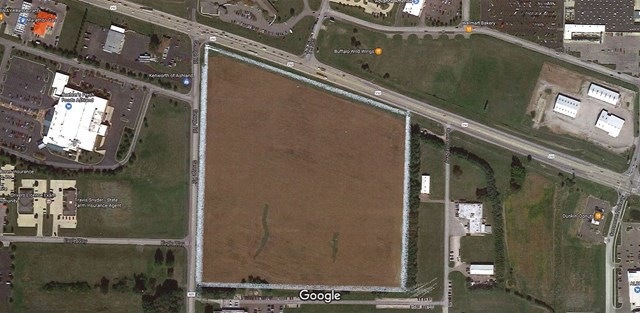
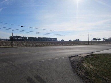
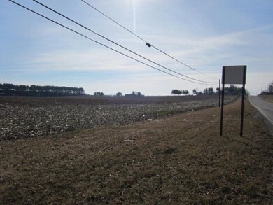
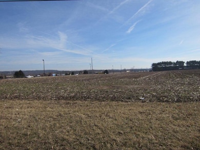
Great commercial development land , highly visible property with approx 1199 foot frontage on St Rt 250 and 1209 foot frontage on Twp Rd 805 (George Rd). This lot consists of 28.63 acres. Zones M4. Near Walmart, Home Depot, Buehler Grocery, Buffalo Wild Wings, etc. City utilities available. Real Estate taxes reflect land being in CAUV program. Located 1/2 mile for I 71.

Last Agent to Sell the Property

Rob Ward

Coldwell Banker Ward Real Estate Brokerage Phone: 4192812000 License #BRKP.0000311056 Listed on: 02/11/2017

Coldwell Banker Ward Real Estate

Last Buyer's Agent

Not Applicable

Other

Property Details

Property Type

  • Land

Est. Annual Taxes

  • $1,122

Lot Details

  • 25.63 Acre Lot
  • Corner Lot
  • Open Lot
  • Gentle Sloping Lot

Utilities

  • Phone Available

Listing and Financial Details

  • Tax Lot US Rt. 250 R=167 parcel
  • Assessor Parcel Number P441670000100

Property Details

Property Type

Land

Est. Annual Taxes

$1,122

Lot Details

0

Listing Details

  • Property Sub Type: Unimproved Land
  • Prop. Type: Land
  • Lot Size Acres: 25.63
  • Directions: Corner of US 250 East and Twp. Rd. 805 (George Rd.)
  • Attribution Contact: 4192812000
  • Special Features: None

Interior Features

  • Possible Use: Commercial, Subdevelopment, Construction Lot

Exterior Features

  • Lot Features: Construction Lot, Corner Lot, Open Lot
  • Topography: Gently Rolling

Utilities

  • Electric: Ohio Edison/First Energy
  • Sewer: Sanitary Sewer, Storm Sewer
  • Utilities: Electricity Available, Natural Gas Available, Phone Available
  • Water Source: Public

Condo/Co-op/Association

  • Association Fee Frequency: Annually

Schools

  • Junior High Dist: Ashland City

Lot Info

  • Lot Size Sq Ft: 1116442.8
  • Farm Land Area Units: Square Feet
  • Parcel #: P441670000100
  • Zoning Description: M4-Industrial & Busnss Prk Dist
  • ResoLotSizeUnits: Acres

Green Features

Multi Family

Tax Info

  • Tax Annual Amount: 1121.82
  • Tax Lot: US Rt. 250 R=167 parcel

Range of Values:

Collateral Analytics

Collateral Analytics Collateral Analytics AVMs (Automated Valuation Model) employ a number of statistical approaches combined with neighborhood-specific comparable selection guarantees the most up-to-date and precise valuations.

Not Available

Collateral Analytics does not have data for the current month. Please view the chart for historical values.

ICE

ICE Mortgage Technology ICE Mortgage Technology’s AVM (Automated Valuation Model) is a state-of-the-art online residential property valuation tool that provides a quick and accurate estimate of the value of almost any home in the U.S.

Not Available

ICE Mortgage Technology does not have data for the current month. Please view the chart for historical values.

First American

First American First American Data & Analytics’ next-generation AVM combines unrivaled data assets with a blended ensemble of valuation models to produce highly accurate, reliable valuations you can trust.

Not Available

First American does not have data for the current month. Please view the chart for historical values.

Quantarium

Quantarium Quantarium’s valuation service, repeatedly proven the industry’s most accurate and comprehensive, is supercharged with a self-learning and auto-tuning AI engine that continually becomes smarter and more accurate as it processes daily inputs from the industry’s leading RE data lake.

Not Available

Quantarium does not have data for the current month. Please view the chart for historical values.

Average Value
Not Available
List Price
Sold Price
Create a Home Valuation Report for This Property
The Home Valuation Report is an in-depth analysis detailing your home's value as well as a comparison with similar homes in the area

Home Values in the Area

Source: Public Records

Average Home Value in this Area


Source: Public Records

Property History

Date Event Price List to Sale Price per Sq Ft
03/23/2020 03/23/20 Sold $1,702,015 -41.3% --
11/21/2018 11/21/18 Pending -- -- --
02/22/2017 02/22/17 For Sale $2,900,000 -- --
Source: Ashland Board of REALTORS®

Tax History Compared to Growth

Source: Public Records

Agents Affiliated with this Home

  • Section Image
See All Agents

Map

Source: Ashland Board of REALTORS®

MLS Number: 219490