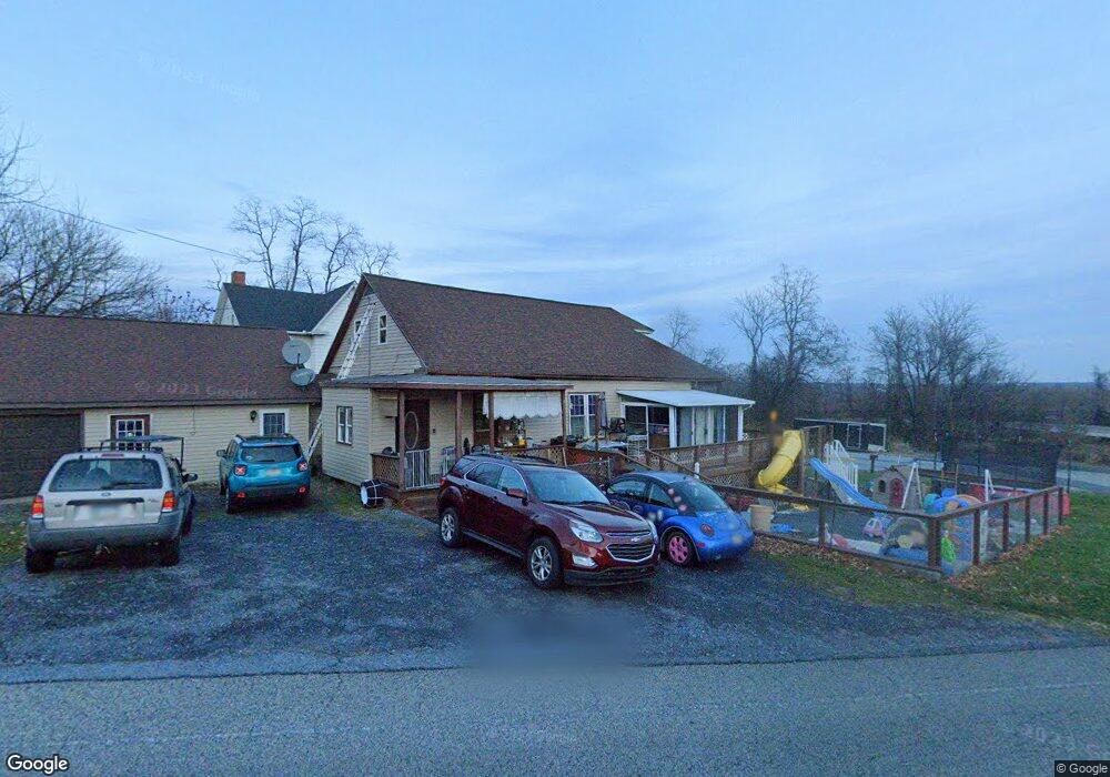
1 Anthony Dr Marysville, PA 17053
East Pennsboro NeighborhoodEstimated Value: $224,000 - $242,000
3
Beds
1
Bath
1,626
Sq Ft
$144/Sq Ft
Est. Value
About This Home
This home is located at 1 Anthony Dr, Marysville, PA 17053 and is currently estimated at $233,801, approximately $143 per square foot. 1 Anthony Dr is a home located in Cumberland County with nearby schools including East Pennsboro Area Middle School and East Pennsboro Area Senior High School.
Ownership History
Date
Name
Owned For
Owner Type
Purchase Details
Closed on
Jun 28, 2007
Sold by
Bennett Teresa A
Bought by
Kumler Roger L
Current Estimated Value
Home Financials for this Owner
Home Financials are based on the most recent Mortgage that was taken out on this home.
Original Mortgage
$125,000
Outstanding Balance
$78,048
Interest Rate
6.48%
Mortgage Type
New Conventional
Estimated Equity
$155,754
Create a Home Valuation Report for This Property
The Home Valuation Report is an in-depth analysis detailing your home's value as well as a comparison with similar homes in the area
Home Values in the Area
Average Home Value in this Area
Purchase History
| Date | Buyer | Sale Price | Title Company |
|---|---|---|---|
| Kumler Roger L | $125,000 | -- |
Source: Public Records
Mortgage History
| Date | Status | Borrower | Loan Amount |
|---|---|---|---|
| Open | Kumler Roger L | $125,000 |
Source: Public Records
Tax History Compared to Growth
Tax History
| Year | Tax Paid | Tax Assessment Tax Assessment Total Assessment is a certain percentage of the fair market value that is determined by local assessors to be the total taxable value of land and additions on the property. | Land | Improvement |
|---|---|---|---|---|
| 2025 | $2,935 | $142,200 | $33,200 | $109,000 |
| 2024 | $2,769 | $142,200 | $33,200 | $109,000 |
| 2023 | $2,612 | $142,200 | $33,200 | $109,000 |
| 2022 | $2,456 | $142,200 | $33,200 | $109,000 |
| 2021 | $2,414 | $142,200 | $33,200 | $109,000 |
| 2020 | $2,358 | $142,200 | $33,200 | $109,000 |
| 2019 | $2,329 | $142,200 | $33,200 | $109,000 |
| 2018 | $2,303 | $142,200 | $33,200 | $109,000 |
| 2017 | $2,204 | $142,200 | $33,200 | $109,000 |
| 2016 | -- | $142,200 | $33,200 | $109,000 |
| 2015 | -- | $142,200 | $33,200 | $109,000 |
| 2014 | -- | $142,200 | $33,200 | $109,000 |
Source: Public Records
Map
Nearby Homes
- 7 Forest Ave
- 205 Belle Vista Dr
- 79 Railroad Ave
- 74 Railroad Ave
- 64 Railroad Ave
- 522 Halyard Way
- 105 Miller St
- Charlotte Plan at Rockville - Rockville Estates
- Steitz Plan at Rockville - Rockville Estates
- Kinsey Plan at Rockville - Rockville Estates
- Ariel Plan at Rockville - Rockville Estates
- Heron Plan at Rockville - Rockville Estates
- 187 W Stewart Ct
- Nottingham Plan at Rockville - Rockville Estates
- Monroe Plan at Rockville - Rockville Estates
- Avery Plan at Rockville - Rockville Estates
- Maddox Plan at Rockville - Rockville Estates
- Dalton Plan at Rockville - Rockville Estates
- Mackenzie Plan at Rockville - Rockville Estates
- Sienna Plan at Rockville - Rockville Estates