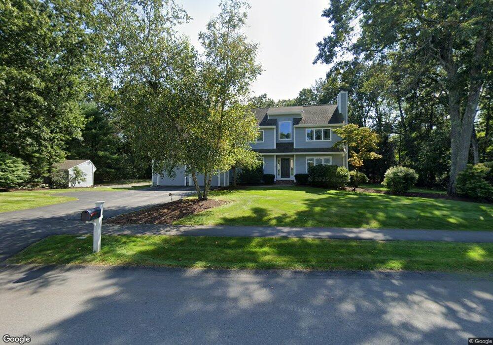
1 Buckskin Ln Natick, MA 01760
Estimated Value: $1,269,000 - $1,754,000
4
Beds
3
Baths
2,906
Sq Ft
$535/Sq Ft
Est. Value
About This Home
This home is located at 1 Buckskin Ln, Natick, MA 01760 and is currently estimated at $1,555,071, approximately $535 per square foot. 1 Buckskin Ln is a home located in Middlesex County with nearby schools including Natick High School, Memorial Elementary School, and J F Kennedy Middle School.
Ownership History
Date
Name
Owned For
Owner Type
Purchase Details
Closed on
Sep 30, 2011
Sold by
Johanson James M and Johanson Jennifer C
Bought by
Wood Brian J and Wood Jodi K
Current Estimated Value
Home Financials for this Owner
Home Financials are based on the most recent Mortgage that was taken out on this home.
Original Mortgage
$583,000
Outstanding Balance
$230,553
Interest Rate
4.15%
Mortgage Type
Purchase Money Mortgage
Estimated Equity
$1,324,518
Create a Home Valuation Report for This Property
The Home Valuation Report is an in-depth analysis detailing your home's value as well as a comparison with similar homes in the area
Home Values in the Area
Average Home Value in this Area
Purchase History
| Date | Buyer | Sale Price | Title Company |
|---|---|---|---|
| Wood Brian J | $729,900 | -- |
Source: Public Records
Mortgage History
| Date | Status | Borrower | Loan Amount |
|---|---|---|---|
| Open | Wood Brian J | $583,000 |
Source: Public Records
Tax History Compared to Growth
Tax History
| Year | Tax Paid | Tax Assessment Tax Assessment Total Assessment is a certain percentage of the fair market value that is determined by local assessors to be the total taxable value of land and additions on the property. | Land | Improvement |
|---|---|---|---|---|
| 2025 | $15,886 | $1,328,300 | $540,400 | $787,900 |
| 2024 | $15,326 | $1,250,100 | $510,400 | $739,700 |
| 2023 | $14,560 | $1,151,900 | $510,600 | $641,300 |
| 2022 | $13,814 | $1,035,500 | $423,500 | $612,000 |
| 2021 | $13,191 | $969,200 | $400,300 | $568,900 |
| 2020 | $12,064 | $886,400 | $382,900 | $503,500 |
| 2019 | $11,266 | $886,400 | $382,900 | $503,500 |
| 2018 | $10,346 | $792,800 | $366,300 | $426,500 |
| 2017 | $10,443 | $774,100 | $355,200 | $418,900 |
| 2016 | $10,452 | $770,200 | $355,200 | $415,000 |
| 2015 | $10,163 | $735,400 | $355,200 | $380,200 |
Source: Public Records
Map
Nearby Homes
- 10 Sundance Way
- 94 Woodland St
- 5 Deer Path
- 11 Avon St
- 39 Davis Brook Dr
- 15 Penobscot Rd
- 8 Floral Ave Unit 8
- 15 Church St Unit 3
- 5 Wilson St Unit 5A
- 6B Lincoln St Unit 6B
- 6 Ambler Ct
- 4B Lincoln St Unit 4B
- 48 S Main St Unit 7
- 67 E Central St & 5 Union St
- 21 Harvest Moon Dr
- 3 Wilson St Unit 3B
- 62 E Central St Unit 305
- 8 Floral Avenue Extension
- 20 Marion St
- 216-218 S Main St