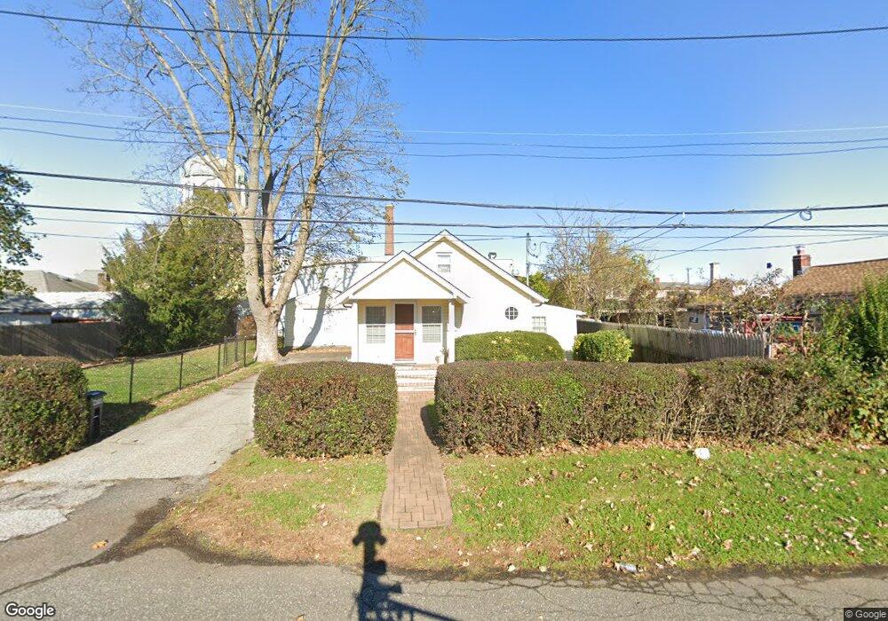
1 Dean St Farmingdale, NY 11735
Estimated Value: $540,520 - $606,000
2
Beds
1
Bath
811
Sq Ft
$707/Sq Ft
Est. Value
About This Home
This home is located at 1 Dean St, Farmingdale, NY 11735 and is currently estimated at $573,260, approximately $706 per square foot. 1 Dean St is a home located in Nassau County with nearby schools including Northside Elementary School, Weldon E. Howitt Middle School, and Farmingdale Senior High School.
Ownership History
Date
Name
Owned For
Owner Type
Purchase Details
Closed on
Apr 11, 2014
Sold by
Wulle Timothy Fj
Bought by
Wulle Timothy Fj and Mollet Pamela A
Current Estimated Value
Purchase Details
Closed on
Jan 23, 2014
Sold by
Lewis Patricia M
Bought by
Wulle Timothy Fj
Home Financials for this Owner
Home Financials are based on the most recent Mortgage that was taken out on this home.
Original Mortgage
$269,037
Interest Rate
4.4%
Mortgage Type
Purchase Money Mortgage
Purchase Details
Closed on
Oct 10, 2002
Sold by
Delalio Robert P
Create a Home Valuation Report for This Property
The Home Valuation Report is an in-depth analysis detailing your home's value as well as a comparison with similar homes in the area
Home Values in the Area
Average Home Value in this Area
Purchase History
| Date | Buyer | Sale Price | Title Company |
|---|---|---|---|
| Wulle Timothy Fj | -- | Mkm Abstract Services Inc | |
| Wulle Timothy Fj | $274,000 | Mkm Abstract Services Inc | |
| -- | $162,500 | -- |
Source: Public Records
Mortgage History
| Date | Status | Borrower | Loan Amount |
|---|---|---|---|
| Previous Owner | Wulle Timothy Fj | $269,037 |
Source: Public Records
Tax History Compared to Growth
Tax History
| Year | Tax Paid | Tax Assessment Tax Assessment Total Assessment is a certain percentage of the fair market value that is determined by local assessors to be the total taxable value of land and additions on the property. | Land | Improvement |
|---|---|---|---|---|
| 2025 | $9,792 | $369 | $212 | $157 |
| 2024 | $3,384 | $369 | $212 | $157 |
| 2023 | $9,129 | $369 | $212 | $157 |
| 2022 | $9,129 | $369 | $212 | $157 |
| 2021 | $8,992 | $355 | $204 | $151 |
| 2020 | $8,875 | $531 | $412 | $119 |
| 2019 | $8,736 | $610 | $473 | $137 |
| 2018 | $9,558 | $610 | $0 | $0 |
| 2017 | $5,114 | $591 | $473 | $118 |
| 2016 | $8,085 | $591 | $473 | $118 |
| 2015 | $2,647 | $591 | $473 | $118 |
| 2014 | $2,647 | $591 | $473 | $118 |
| 2013 | $2,451 | $591 | $473 | $118 |
Source: Public Records
Map
Nearby Homes
- 290 Eastern Pkwy
- 159 Oakview Ave
- 19 Ivy St
- 82 Jervis Ave Unit 82
- 98 Jervis Ave Unit 98
- 114 Jervis Ave
- 18 Ivy St Unit 1B
- 591 Conklin St
- 76 Balcom Rd
- 65 Sullivan Rd
- 18 Wall St
- 32 Beechwood St
- 29 Manetto Rd
- 457 Secatogue Ave
- 18 Cedar Ave
- 18 Sullivan Rd
- 45 Cedar Ave
- 530 Melville Rd
- 7 Dogwood St
- 63 Cedar Ave
- 3 Dean St
- 63 Prospect Place
- 55 Prospect Place
- 45 Prospect Place
- 2 Dean St
- 75 Prospect Place
- 4 Dean St
- 81 Prospect Place
- 10 Dean St
- 48 Prospect Place
- 52 Prospect Place
- 46 Prospect Place
- 56 Prospect Place
- 44 Prospect Place
- 745 Conklin St Unit 11
- 745 Conklin St Unit 21
- 745 Conklin St Unit 24
- 745 Conklin St Unit 23
- 745 Conklin St Unit 22
- 745 Conklin St Unit 20