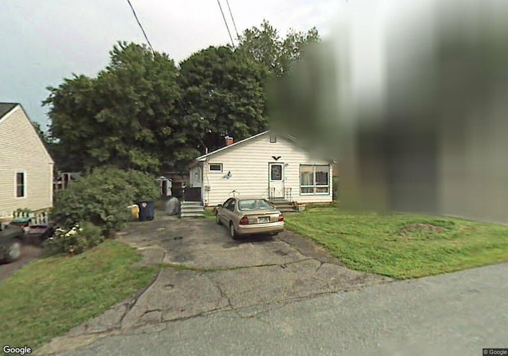
10 Bristol St Unit 91 Nashua, NH 03064
North End Nashua NeighborhoodEstimated Value: $393,000 - $467,000
2
Beds
2
Baths
1,101
Sq Ft
$392/Sq Ft
Est. Value
About This Home
This home is located at 10 Bristol St Unit 91, Nashua, NH 03064 and is currently estimated at $431,730, approximately $392 per square foot. 10 Bristol St Unit 91 is a home located in Hillsborough County with nearby schools including Charlotte Ave Elementary School, Pennichuck Middle School, and Nashua High School North.
Ownership History
Date
Name
Owned For
Owner Type
Purchase Details
Closed on
Oct 15, 2018
Sold by
Miller Grace J
Bought by
Green Angela M
Current Estimated Value
Home Financials for this Owner
Home Financials are based on the most recent Mortgage that was taken out on this home.
Original Mortgage
$187,775
Outstanding Balance
$163,751
Interest Rate
4.5%
Mortgage Type
VA
Estimated Equity
$267,979
Purchase Details
Closed on
May 19, 1983
Bought by
Miller Paul B
Create a Home Valuation Report for This Property
The Home Valuation Report is an in-depth analysis detailing your home's value as well as a comparison with similar homes in the area
Home Values in the Area
Average Home Value in this Area
Purchase History
| Date | Buyer | Sale Price | Title Company |
|---|---|---|---|
| Green Angela M | $195,000 | -- | |
| Miller Paul B | $62,900 | -- |
Source: Public Records
Mortgage History
| Date | Status | Borrower | Loan Amount |
|---|---|---|---|
| Open | Green Angela M | $187,775 |
Source: Public Records
Tax History Compared to Growth
Tax History
| Year | Tax Paid | Tax Assessment Tax Assessment Total Assessment is a certain percentage of the fair market value that is determined by local assessors to be the total taxable value of land and additions on the property. | Land | Improvement |
|---|---|---|---|---|
| 2024 | $6,330 | $398,100 | $133,600 | $264,500 |
| 2023 | $6,123 | $335,900 | $106,900 | $229,000 |
| 2022 | $6,070 | $335,900 | $106,900 | $229,000 |
| 2021 | $5,547 | $238,900 | $71,200 | $167,700 |
| 2020 | $5,402 | $238,900 | $71,200 | $167,700 |
| 2019 | $5,198 | $238,900 | $71,200 | $167,700 |
| 2018 | $5,067 | $238,900 | $71,200 | $167,700 |
| 2017 | $5,176 | $200,700 | $62,900 | $137,800 |
| 2016 | $5,032 | $200,700 | $62,900 | $137,800 |
| 2015 | $4,923 | $200,700 | $62,900 | $137,800 |
| 2014 | $4,827 | $200,700 | $62,900 | $137,800 |
Source: Public Records
Map
Nearby Homes
- 3 Wright Rd
- 44 Broad St
- 11 Amherst Terrace
- 31 Ashland St
- 30 Burgess St
- 33 Ferry Rd
- 0 Baldwin St
- 19 Dunloggin Rd
- 17 Danbury Rd
- 7 Robert Dr
- 74 Profile Cir
- 7 Bitirnas St Unit U7
- 4 Reservoir St
- 31 Juliana Ave
- 31 Juliana Ave Unit 4
- 3 Opal Way Unit 3
- 1 Opal Way Unit 1
- 2 Opal Way Unit 2
- 12 Juliana Ave Unit 14
- 123 Cannongate III
- 8 Bristol St
- 39 Pine Hill Ave
- 37 Pine Hill Ave Unit 6392
- 11 Essex St
- 11 Bristol St Unit 97100
- 3 Essex St
- 9 Bristol St Unit 102104
- 33 Pine Hill Ave Unit 61
- 6 Bristol St
- 1 Essex St
- 5 Bristol St Unit 106108
- 12 Essex St
- 45 Pine Hill Ave
- 29 Pine Hill Ave
- 4 Norfolk St
- 6 Norfolk St Unit 124
- 4 Essex St
- 30 Pine Hill Ave
- 154 Amherst St Unit 110112
- 7 Berkshire St Unit 28