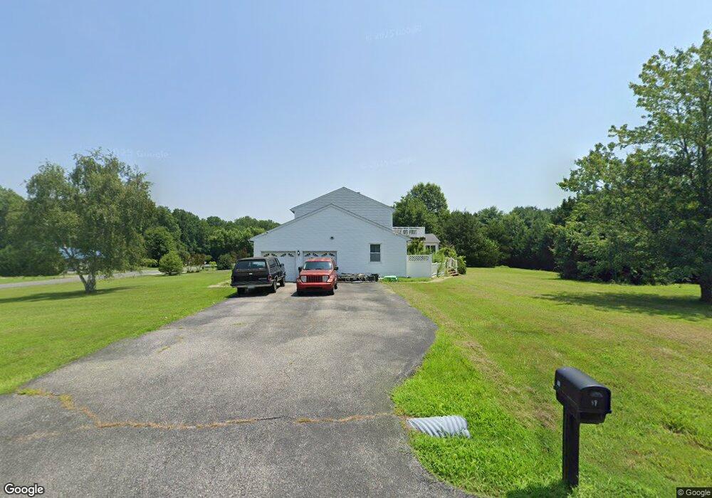
10 Lance Ct Elkton, MD 21921
Estimated Value: $528,227 - $576,000
--
Bed
3
Baths
2,534
Sq Ft
$219/Sq Ft
Est. Value
About This Home
This home is located at 10 Lance Ct, Elkton, MD 21921 and is currently estimated at $554,057, approximately $218 per square foot. 10 Lance Ct is a home located in Cecil County with nearby schools including Elk Neck Elementary School, North East Middle School, and North East High School.
Ownership History
Date
Name
Owned For
Owner Type
Purchase Details
Closed on
Dec 6, 2005
Sold by
Ayers Donald R and Ayers Sharon M
Bought by
Moore Michael K and Moore Janice L
Current Estimated Value
Home Financials for this Owner
Home Financials are based on the most recent Mortgage that was taken out on this home.
Original Mortgage
$40,000
Outstanding Balance
$22,180
Interest Rate
6.14%
Mortgage Type
Credit Line Revolving
Estimated Equity
$531,877
Purchase Details
Closed on
Nov 18, 2005
Sold by
Ayers Doanld R and Ayers Sharon M
Bought by
Moore Michael K and Moore Janice L
Home Financials for this Owner
Home Financials are based on the most recent Mortgage that was taken out on this home.
Original Mortgage
$40,000
Outstanding Balance
$22,180
Interest Rate
6.14%
Mortgage Type
Credit Line Revolving
Estimated Equity
$531,877
Purchase Details
Closed on
May 4, 1989
Sold by
Blenheim Land Development Company
Bought by
Ayers Donald R and Ayers Sharon M
Home Financials for this Owner
Home Financials are based on the most recent Mortgage that was taken out on this home.
Original Mortgage
$100,000
Interest Rate
11.03%
Purchase Details
Closed on
Jul 28, 1988
Sold by
Lent Christopher R
Bought by
Blenheim Land Development Company
Create a Home Valuation Report for This Property
The Home Valuation Report is an in-depth analysis detailing your home's value as well as a comparison with similar homes in the area
Home Values in the Area
Average Home Value in this Area
Purchase History
| Date | Buyer | Sale Price | Title Company |
|---|---|---|---|
| Moore Michael K | $384,900 | -- | |
| Moore Michael K | $384,900 | None Available | |
| Moore Michael K | $384,900 | -- | |
| Ayers Donald R | $174,900 | -- | |
| Blenheim Land Development Company | $35,000 | -- |
Source: Public Records
Mortgage History
| Date | Status | Borrower | Loan Amount |
|---|---|---|---|
| Open | Moore Michael K | $40,000 | |
| Closed | Moore Michael K | $40,000 | |
| Open | Moore Michael K | $294,900 | |
| Previous Owner | Ayers Donald R | $100,000 |
Source: Public Records
Tax History Compared to Growth
Tax History
| Year | Tax Paid | Tax Assessment Tax Assessment Total Assessment is a certain percentage of the fair market value that is determined by local assessors to be the total taxable value of land and additions on the property. | Land | Improvement |
|---|---|---|---|---|
| 2025 | $4,071 | $379,233 | $0 | $0 |
| 2024 | $3,560 | $358,367 | $0 | $0 |
| 2023 | $3,087 | $337,500 | $138,100 | $199,400 |
| 2022 | $3,772 | $329,600 | $0 | $0 |
| 2021 | $3,696 | $321,700 | $0 | $0 |
| 2020 | $3,679 | $313,800 | $138,100 | $175,700 |
| 2019 | $3,679 | $313,800 | $138,100 | $175,700 |
| 2018 | $3,679 | $313,800 | $138,100 | $175,700 |
| 2017 | $3,716 | $317,000 | $0 | $0 |
| 2016 | $3,484 | $313,767 | $0 | $0 |
| 2015 | $3,484 | $310,533 | $0 | $0 |
| 2014 | $4,053 | $307,300 | $0 | $0 |
Source: Public Records
Map
Nearby Homes
- 108 Lance Ct
- 185 Weed Ln
- 89 Greenwood St
- 85 Clearfield Ct
- 39 Wood Chip Rd
- 209 Casparus Way
- 0 Old Elk Neck Rd Unit MDCC2014240
- 41 Austins Way
- 120 White Pine Cir
- 0 Shagbark Ln
- 85 Green Haven Dr
- 1039 Old Elk Neck Rd
- 2616 Old Elk Neck Rd
- 196 Breon Ln
- 31 Borens Shore Rd
- 41 Mainsail Dr
- 0 Meadow Ln
- 38 Osprey Way
- 699 Shady Beach Rd
- 29 River Mist Dr