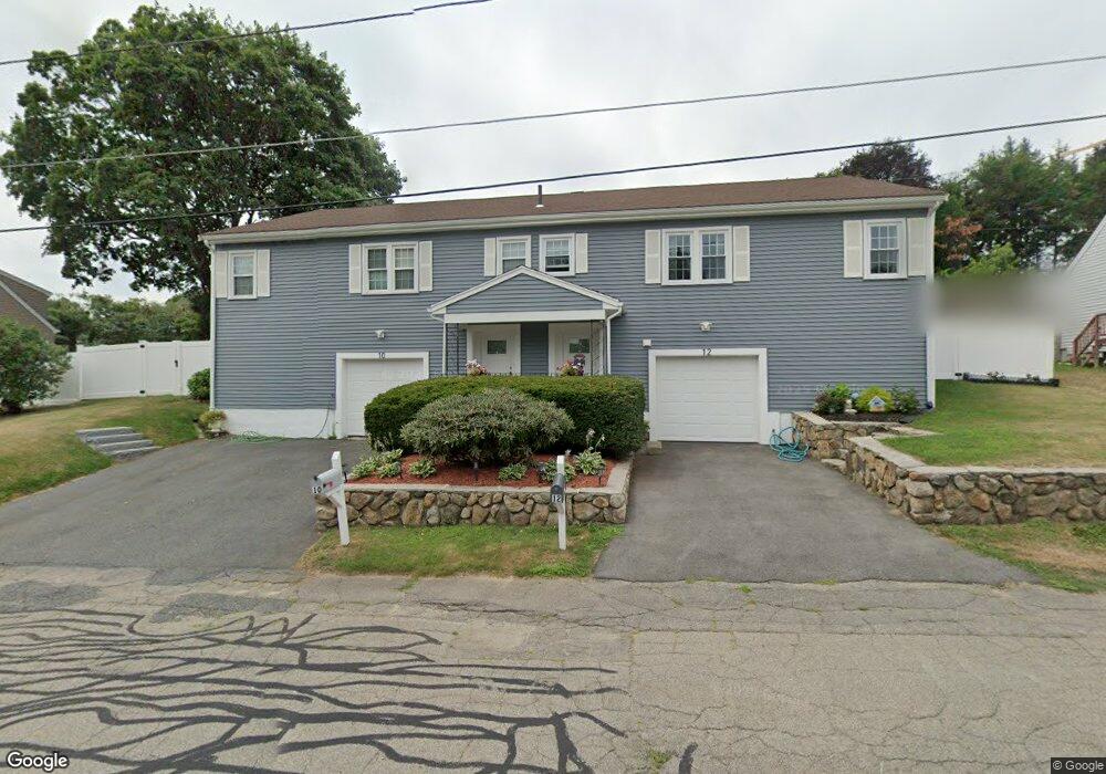
10 Park Lane Ave Milford, MA 01757
Estimated Value: $340,405 - $405,000
3
Beds
1
Bath
1,080
Sq Ft
$344/Sq Ft
Est. Value
About This Home
This home is located at 10 Park Lane Ave, Milford, MA 01757 and is currently estimated at $371,851, approximately $344 per square foot. 10 Park Lane Ave is a home located in Worcester County with nearby schools including Milford High School and Bethany Christian Academy.
Ownership History
Date
Name
Owned For
Owner Type
Purchase Details
Closed on
Jun 30, 2006
Sold by
Shields Sallie A and Harris Shannon
Bought by
Collins Timothy A
Current Estimated Value
Home Financials for this Owner
Home Financials are based on the most recent Mortgage that was taken out on this home.
Original Mortgage
$43,600
Outstanding Balance
$25,784
Interest Rate
6.58%
Mortgage Type
Purchase Money Mortgage
Estimated Equity
$346,067
Purchase Details
Closed on
May 4, 2004
Sold by
Manna Angela and Manna Dominick
Bought by
Harris Shannon L
Home Financials for this Owner
Home Financials are based on the most recent Mortgage that was taken out on this home.
Original Mortgage
$414,200
Interest Rate
5.36%
Mortgage Type
Purchase Money Mortgage
Create a Home Valuation Report for This Property
The Home Valuation Report is an in-depth analysis detailing your home's value as well as a comparison with similar homes in the area
Home Values in the Area
Average Home Value in this Area
Purchase History
| Date | Buyer | Sale Price | Title Company |
|---|---|---|---|
| Collins Timothy A | $218,000 | -- | |
| Harris Shannon L | $436,000 | -- |
Source: Public Records
Mortgage History
| Date | Status | Borrower | Loan Amount |
|---|---|---|---|
| Open | Collins Timothy A | $43,600 | |
| Previous Owner | Harris Shannon L | $414,200 |
Source: Public Records
Tax History Compared to Growth
Tax History
| Year | Tax Paid | Tax Assessment Tax Assessment Total Assessment is a certain percentage of the fair market value that is determined by local assessors to be the total taxable value of land and additions on the property. | Land | Improvement |
|---|---|---|---|---|
| 2025 | $4,131 | $322,700 | $0 | $322,700 |
| 2024 | $4,133 | $311,000 | $0 | $311,000 |
| 2023 | $4,097 | $283,500 | $0 | $283,500 |
| 2022 | $3,563 | $231,500 | $0 | $231,500 |
| 2021 | $3,436 | $215,000 | $0 | $215,000 |
| 2020 | $3,249 | $203,600 | $0 | $203,600 |
| 2019 | $3,058 | $184,900 | $0 | $184,900 |
| 2018 | $2,525 | $152,500 | $0 | $152,500 |
| 2017 | $2,450 | $145,900 | $0 | $145,900 |
| 2016 | $2,507 | $145,900 | $0 | $145,900 |
| 2015 | $2,478 | $141,200 | $0 | $141,200 |
Source: Public Records
Map
Nearby Homes
- 5 Walker Ave
- 39 Emmons St
- 9 Packard Rd
- 12 Congress Terrace
- 1 Godfrey Ln Unit 1
- 104 Purchase St
- 95 High St
- 92 High St
- 4-6 State St
- 60 Pine St
- 56 Meade St
- 8 Colonial Rd
- 7 Madden Ave
- 4 Kennedy Ln Unit 49
- 7 Shadowbrook Ln Unit 9
- 3 Shadowbrook Ln Unit 3
- 5 Shadowbrook Ln Unit 32
- 9 Hancock St
- 48 S Bow St
- 7 Highland St
- 12 Park Lane Ave
- 10-12 Park Lane Ave
- 8 Park Lane Ave
- 14 Park Lane Ave
- 7 Park Lane Ave
- 7 Rosenfeld Ave
- 5 Park Lane Ave
- 9 Rosenfeld Ave
- 9 Rosenfeld Ave Unit 9
- 5 Rosenfeld Ave Unit A
- 5 Rosenfeld Ave
- 5B Rosenfeld Ave Unit B
- 6 Park Lane Ave
- 16 Park Lane Ave
- 60 Grant St
- 2 Grant Street Extension
- 3 Park Lane Ave
- 58 Grant St
- 11 Rosenfeld Ave
- 3 Rosenfeld Ave