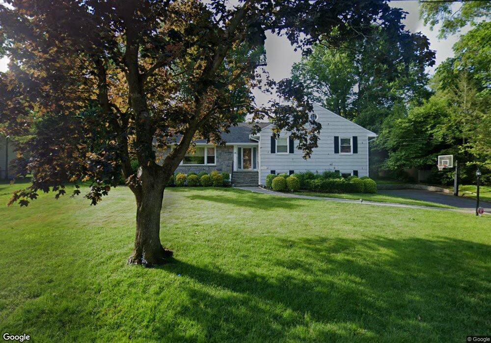
10 Springdale Rd Scarsdale, NY 10583
Secor Farms NeighborhoodEstimated Value: $1,438,000 - $1,964,000
4
Beds
3
Baths
1,945
Sq Ft
$928/Sq Ft
Est. Value
About This Home
This home is located at 10 Springdale Rd, Scarsdale, NY 10583 and is currently estimated at $1,805,728, approximately $928 per square foot. 10 Springdale Rd is a home located in Westchester County with nearby schools including Scarsdale Middle School, Scarsdale High School, and Kodomono Kuni School.
Ownership History
Date
Name
Owned For
Owner Type
Purchase Details
Closed on
Jun 11, 2010
Sold by
Polin Kenneth L and Polin Cathy
Bought by
Sosner Nathan and Sosner Ella
Current Estimated Value
Home Financials for this Owner
Home Financials are based on the most recent Mortgage that was taken out on this home.
Original Mortgage
$840,000
Outstanding Balance
$549,831
Interest Rate
4.5%
Mortgage Type
New Conventional
Estimated Equity
$1,255,897
Purchase Details
Closed on
Oct 4, 2001
Sold by
Monahan Thomas and Monahan Sonia J
Bought by
Polin Kenneth L and Polin Cathy
Purchase Details
Closed on
Apr 15, 1999
Sold by
Macaluso Josephine
Bought by
Macaluso Josephine
Create a Home Valuation Report for This Property
The Home Valuation Report is an in-depth analysis detailing your home's value as well as a comparison with similar homes in the area
Home Values in the Area
Average Home Value in this Area
Purchase History
| Date | Buyer | Sale Price | Title Company |
|---|---|---|---|
| Sosner Nathan | $1,050,000 | Skyline Title Llc | |
| Polin Kenneth L | $750,000 | The Judicial Title Ins Agenc | |
| Macaluso Josephine | -- | Ticor Title Guarantee Compan |
Source: Public Records
Mortgage History
| Date | Status | Borrower | Loan Amount |
|---|---|---|---|
| Open | Sosner Nathan | $840,000 |
Source: Public Records
Tax History Compared to Growth
Tax History
| Year | Tax Paid | Tax Assessment Tax Assessment Total Assessment is a certain percentage of the fair market value that is determined by local assessors to be the total taxable value of land and additions on the property. | Land | Improvement |
|---|---|---|---|---|
| 2024 | $33,013 | $1,200,000 | $950,000 | $250,000 |
| 2023 | $31,853 | $1,200,000 | $950,000 | $250,000 |
| 2022 | $23,833 | $1,200,000 | $950,000 | $250,000 |
| 2021 | $31,723 | $1,150,000 | $950,000 | $200,000 |
| 2020 | $31,422 | $1,250,000 | $950,000 | $300,000 |
| 2019 | $31,182 | $1,250,000 | $950,000 | $300,000 |
| 2018 | $36,374 | $1,250,000 | $950,000 | $300,000 |
| 2017 | $0 | $1,250,000 | $950,000 | $300,000 |
| 2016 | $27,197 | $1,250,000 | $950,000 | $300,000 |
| 2015 | -- | $1,057,000 | $789,000 | $268,000 |
| 2014 | -- | $1,057,000 | $789,000 | $268,000 |
| 2013 | -- | $18,700 | $8,000 | $10,700 |
Source: Public Records
Map
Nearby Homes
- 21 Springdale Rd
- 229 Mamaroneck Rd
- 28 Aspen Rd
- 66 Secor Rd
- 32 Sycamore Rd
- 96 Brookby Rd
- 18 Lincoln Rd
- 36 Secor Rd
- 101 Carthage Rd
- 8 Dell Rd
- 61 Lincoln Rd
- 2 Weaver St Unit 9
- 2 Weaver St Unit 3
- 16 Coralyn Rd
- 9 Hazelton Dr
- 14 Wakefield Rd
- 85 Wiltshire Rd Unit B11
- 103 Wiltshire Rd Unit D2
- 109 Mamaroneck Rd
- 51 Plymouth Dr
- 8 Springdale Rd
- 14 Springdale Rd
- 15 Myrtledale Rd
- 17 Myrtledale Rd
- 11 Springdale Rd
- 15 Springdale Rd
- 6 Springdale Rd
- 11 Myrtledale Rd
- 10 Aspen Rd
- 16 Myrtledale Rd
- 8 Aspen Rd
- 16 Springdale Rd
- 12 Aspen Rd
- 14 Myrtledale Rd
- 18 Myrtledale Rd
- 17 Springdale Rd
- 4 Springdale Rd
- 12 Myrtledale Rd
- 7 Myrtledale Rd
- 14 Aspen Rd