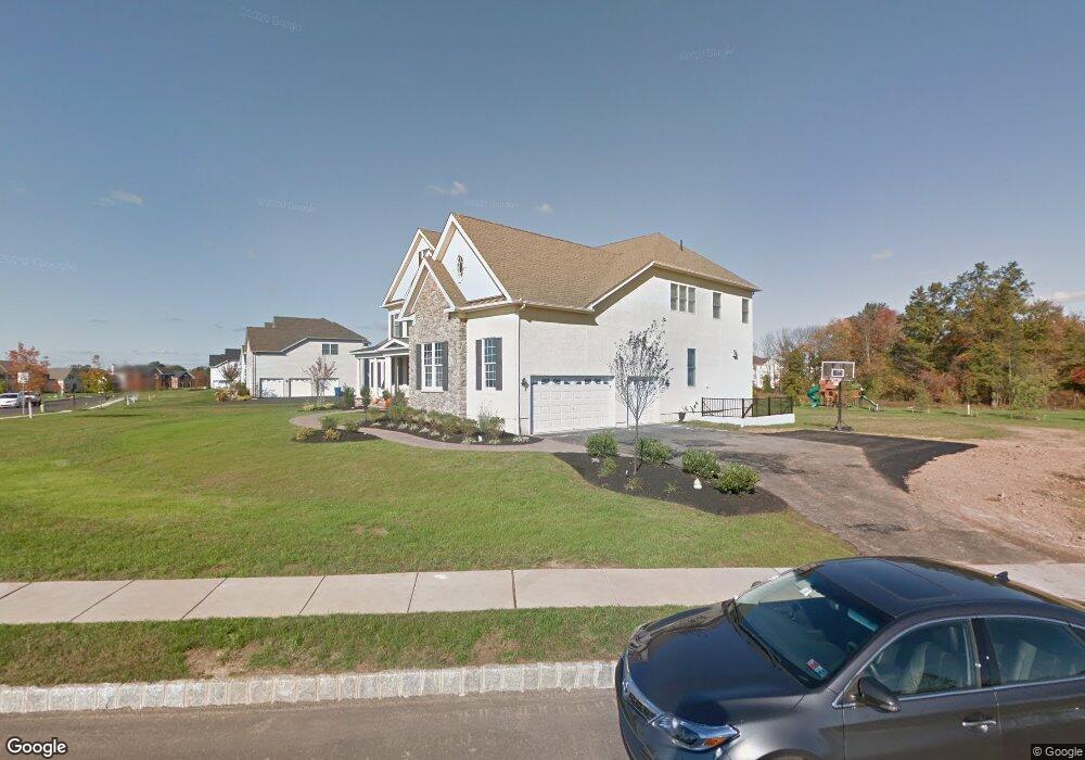
100 Abraham Dr Newtown, PA 18940
Estimated Value: $1,786,640 - $2,090,000
4
Beds
5
Baths
5,521
Sq Ft
$356/Sq Ft
Est. Value
About This Home
This home is located at 100 Abraham Dr, Newtown, PA 18940 and is currently estimated at $1,967,547, approximately $356 per square foot. 100 Abraham Dr is a home with nearby schools including Wrightstown Elementary School, Newtown Middle School, and Council Rock High School North.
Ownership History
Date
Name
Owned For
Owner Type
Purchase Details
Closed on
Sep 18, 2025
Sold by
Panyard David B and Panyard Erika
Bought by
David And Erika Panyard Revocable Living Trus and Panyard
Current Estimated Value
Purchase Details
Closed on
Jul 12, 2013
Sold by
Toll Pa Lp
Bought by
Panyard David B and Panyard Erika
Home Financials for this Owner
Home Financials are based on the most recent Mortgage that was taken out on this home.
Original Mortgage
$950,000
Interest Rate
3.83%
Mortgage Type
New Conventional
Create a Home Valuation Report for This Property
The Home Valuation Report is an in-depth analysis detailing your home's value as well as a comparison with similar homes in the area
Home Values in the Area
Average Home Value in this Area
Purchase History
| Date | Buyer | Sale Price | Title Company |
|---|---|---|---|
| David And Erika Panyard Revocable Living Trus | -- | None Listed On Document | |
| Panyard David B | $1,193,909 | None Available |
Source: Public Records
Mortgage History
| Date | Status | Borrower | Loan Amount |
|---|---|---|---|
| Previous Owner | Panyard David B | $950,000 |
Source: Public Records
Tax History Compared to Growth
Tax History
| Year | Tax Paid | Tax Assessment Tax Assessment Total Assessment is a certain percentage of the fair market value that is determined by local assessors to be the total taxable value of land and additions on the property. | Land | Improvement |
|---|---|---|---|---|
| 2025 | $19,033 | $107,770 | $13,000 | $94,770 |
| 2024 | $19,033 | $107,770 | $13,000 | $94,770 |
| 2023 | $18,229 | $107,770 | $13,000 | $94,770 |
| 2022 | $18,050 | $107,770 | $13,000 | $94,770 |
| 2021 | $17,771 | $107,770 | $13,000 | $94,770 |
| 2020 | $17,349 | $107,770 | $13,000 | $94,770 |
| 2019 | $16,951 | $107,770 | $13,000 | $94,770 |
| 2018 | $16,639 | $107,770 | $13,000 | $94,770 |
| 2017 | $15,982 | $107,770 | $13,000 | $94,770 |
| 2016 | $15,982 | $107,770 | $13,000 | $94,770 |
| 2015 | -- | $106,570 | $13,000 | $93,570 |
| 2014 | -- | $106,570 | $13,000 | $93,570 |
Source: Public Records
Map
Nearby Homes
- 288 Jane Chapman Dr E Unit E
- 101 Laurel Cir
- 401 Society Place Unit A1
- 0 Augusta Dr Unit KINGSWOOD
- 0 Augusta Dr Unit MAYWEATHER
- 0 Augusta Dr Unit RAINTREE
- 0 Augusta Dr Unit CLOVERFIELD
- 0 Augusta Dr Unit ROLLINS
- 0 Augusta Dr Unit LANEY
- 2212 Society Place Unit D2
- 702 Society Place Unit A2
- Raintree Plan at Lyondale Meadows
- Kingswood Plan at Lyondale Meadows
- Cloverfield Plan at Lyondale Meadows
- Laney Plan at Lyondale Meadows
- Mayweather Plan at Lyondale Meadows
- Rollins Plan at Lyondale Meadows
- 309 Matthews Ln
- 95 Rittenhouse Cir Unit 92
- 35 Elfreths Ct
- 268 Jane Chapman Dr E
- 101 Abraham Dr
- 273 Jane Chapman Dr E
- 104 Abraham Dr
- 269 Jane Chapman Dr E
- 264 Jane Chapman Dr E
- 105 Abraham Dr
- 277 Jane Chapman Dr E
- 106 Abraham Dr
- 280 Jane Chapman Dr E
- 265 Jane Chapman Dr E
- 236 Jane Chapman Dr E
- 260 Jane Chapman Dr E
- 285 Jane Chapman Dr E
- 232 Jane Chapman Dr E
- 257 Jane Chapman Dr E
- 284 Jane Chapman Dr E
- 240 Jane Chapman Dr E
- 228 Jane Chapman Dr E
- 288 Jane Chapman Dr E