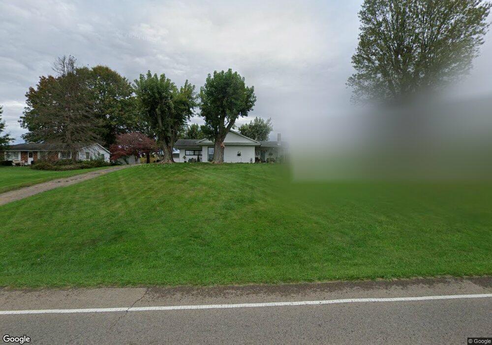
100 Airport Rd Zanesville, OH 43701
Estimated Value: $262,000 - $330,640
3
Beds
2
Baths
1,756
Sq Ft
$175/Sq Ft
Est. Value
About This Home
This home is located at 100 Airport Rd, Zanesville, OH 43701 and is currently estimated at $307,410, approximately $175 per square foot. 100 Airport Rd is a home located in Muskingum County with nearby schools including Perry Elementary School, East Muskingum Middle School, and Larry Miller Intermediate Elementary School.
Ownership History
Date
Name
Owned For
Owner Type
Purchase Details
Closed on
Jan 16, 2023
Sold by
Kirkbride Donald J and Kirkbride Pamela J
Bought by
Kirkbride Pamela J
Current Estimated Value
Purchase Details
Closed on
Sep 13, 2011
Sold by
Kirkbride Donald J and Kirkbride Pamela J
Bought by
Kirkbride Donald J and Kirkbride Pamela J
Purchase Details
Closed on
May 26, 1995
Sold by
Ward Herbert R
Bought by
Donald J Kirkbride
Home Financials for this Owner
Home Financials are based on the most recent Mortgage that was taken out on this home.
Original Mortgage
$64,762
Interest Rate
8.4%
Mortgage Type
New Conventional
Create a Home Valuation Report for This Property
The Home Valuation Report is an in-depth analysis detailing your home's value as well as a comparison with similar homes in the area
Home Values in the Area
Average Home Value in this Area
Purchase History
| Date | Buyer | Sale Price | Title Company |
|---|---|---|---|
| Kirkbride Pamela J | -- | -- | |
| Kirkbride Donald J | -- | None Available | |
| Donald J Kirkbride | $71,000 | -- |
Source: Public Records
Mortgage History
| Date | Status | Borrower | Loan Amount |
|---|---|---|---|
| Previous Owner | Donald J Kirkbride | $64,762 |
Source: Public Records
Tax History Compared to Growth
Tax History
| Year | Tax Paid | Tax Assessment Tax Assessment Total Assessment is a certain percentage of the fair market value that is determined by local assessors to be the total taxable value of land and additions on the property. | Land | Improvement |
|---|---|---|---|---|
| 2024 | $2,033 | $66,255 | $12,810 | $53,445 |
| 2023 | $1,815 | $55,300 | $9,870 | $45,430 |
| 2022 | $1,739 | $55,300 | $9,870 | $45,430 |
| 2021 | $1,719 | $55,300 | $9,870 | $45,430 |
| 2020 | $1,588 | $50,295 | $8,960 | $41,335 |
| 2019 | $1,580 | $50,295 | $8,960 | $41,335 |
| 2018 | $1,415 | $50,295 | $8,960 | $41,335 |
| 2017 | $1,187 | $40,740 | $8,960 | $31,780 |
| 2016 | $1,188 | $40,740 | $8,960 | $31,780 |
| 2015 | $1,218 | $40,740 | $8,960 | $31,780 |
| 2013 | $1,306 | $40,740 | $8,960 | $31,780 |
Source: Public Records
Map
Nearby Homes
- 130 Airport Rd
- 400 Spring Valley Dr
- 310 Trappers Hollow Rd
- 4460 East Pike
- 365 Walters Way
- 360 Walters Way
- 5180 Pine Valley Dr
- 1305 Bald Hill Rd
- 6265 Canterbury Way Unit LOT 30
- 6600 Bridgeville Dr
- 0 Sonora Rd Unit 225018643
- 0 Sonora Rd Unit 5125925
- 1605 Jackson Rd
- 7115 East Pike
- 3620 Old Wheeling Rd
- 350 Urban Hill Rd
- 380 Urban Hill Rd
- 0 E Wheeling Rd Unit 5162172
- 2835 Adamsville Rd
- 2870 Cody Dr
- 80 Airport Rd
- 60 Airport Rd
- 140 Airport Rd
- 150 Airport Rd
- 145 Airport Rd
- 4900 East Pike
- 185 Airport Rd
- 220 Airport Rd
- 4935 East Pike
- 215 Airport Rd
- 250 Airport Rd
- 4870 East Pike
- 235 Airport Rd
- 4868 East Pike
- 245 Airport Rd
- 260 Airport Rd
- 5005 East Pike
- 275 Airport Rd
- 280 Airport Rd
- 0 East Park Unit 3345727