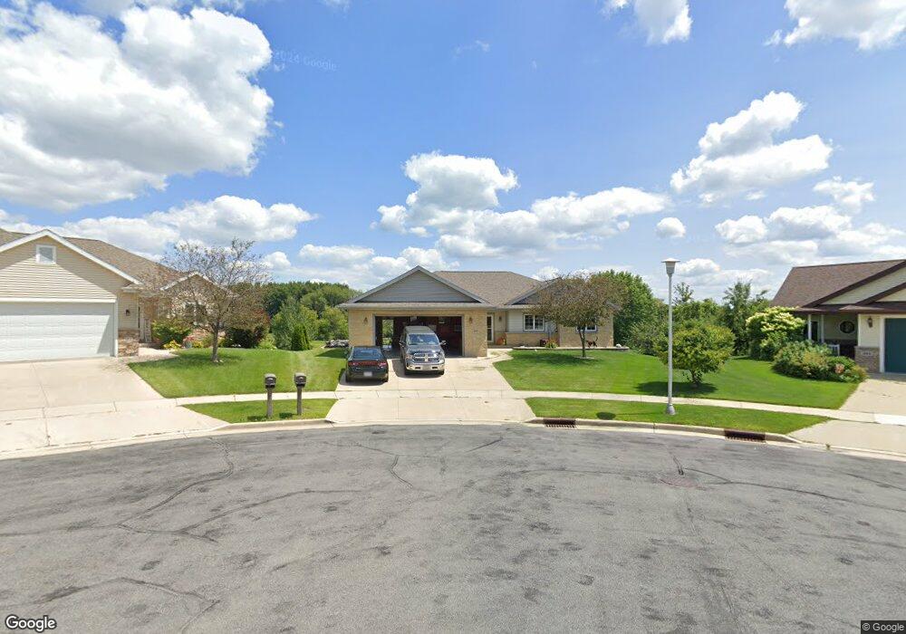
100 Empire Dr Beaver Dam, WI 53916
Estimated Value: $356,654 - $474,000
--
Bed
--
Bath
--
Sq Ft
0.38
Acres
About This Home
This home is located at 100 Empire Dr, Beaver Dam, WI 53916 and is currently estimated at $428,164. 100 Empire Dr is a home located in Dodge County with nearby schools including Beaver Dam High School, St. Katharine Drexel School, and St. Stephen's Lutheran School.
Ownership History
Date
Name
Owned For
Owner Type
Purchase Details
Closed on
May 27, 2008
Sold by
American National Bank Of Beaver Dam
Bought by
Keith Chad P and Keith Kristina M
Current Estimated Value
Home Financials for this Owner
Home Financials are based on the most recent Mortgage that was taken out on this home.
Original Mortgage
$227,998
Outstanding Balance
$146,006
Interest Rate
6.01%
Mortgage Type
Future Advance Clause Open End Mortgage
Estimated Equity
$282,158
Purchase Details
Closed on
Dec 28, 2006
Sold by
Gabryshak Development Corporation
Bought by
Kennedy Builders And Developmentts Llc
Home Financials for this Owner
Home Financials are based on the most recent Mortgage that was taken out on this home.
Original Mortgage
$206,400
Interest Rate
6.24%
Mortgage Type
Construction
Create a Home Valuation Report for This Property
The Home Valuation Report is an in-depth analysis detailing your home's value as well as a comparison with similar homes in the area
Home Values in the Area
Average Home Value in this Area
Purchase History
| Date | Buyer | Sale Price | Title Company |
|---|---|---|---|
| Keith Chad P | $130,000 | None Available | |
| Kennedy Builders And Developmentts Llc | $51,500 | Title Member State Bar Of Wi |
Source: Public Records
Mortgage History
| Date | Status | Borrower | Loan Amount |
|---|---|---|---|
| Open | Keith Chad P | $227,998 | |
| Previous Owner | Kennedy Builders And Developmentts Llc | $206,400 |
Source: Public Records
Tax History Compared to Growth
Tax History
| Year | Tax Paid | Tax Assessment Tax Assessment Total Assessment is a certain percentage of the fair market value that is determined by local assessors to be the total taxable value of land and additions on the property. | Land | Improvement |
|---|---|---|---|---|
| 2024 | $5,796 | $346,800 | $31,900 | $314,900 |
| 2023 | $6,141 | $325,400 | $31,900 | $293,500 |
| 2022 | $6,303 | $310,600 | $31,900 | $278,700 |
| 2021 | $5,752 | $271,300 | $31,900 | $239,400 |
| 2020 | $5,873 | $260,500 | $31,900 | $228,600 |
| 2019 | $5,758 | $256,700 | $31,900 | $224,800 |
| 2018 | $5,514 | $239,000 | $31,900 | $207,100 |
| 2017 | $5,526 | $229,800 | $31,900 | $197,900 |
| 2016 | $4,882 | $220,500 | $31,900 | $188,600 |
| 2015 | $4,677 | $207,200 | $31,900 | $175,300 |
| 2014 | $4,618 | $192,700 | $31,900 | $160,800 |
Source: Public Records
Map
Nearby Homes
- 100 Honeycrisp Dr
- 303 Honeycrisp Dr
- 108 Cody Dr
- 915 Madison St
- 808 Birchwood Dr
- 193 Vincent Cir
- 205 Alvin Cir
- 202 Alvin Cir
- 714 Madison St
- Lots 15 Zimmerman Dr
- Lots 25,26 &15 Zimmerman Dr
- Lots 25 Zimmerman Dr
- Lots 26 &15 Zimmerman Dr
- Lots 25 & 26 Zimmerman Dr
- 116 Rosendale St
- 31.3 ac Marsh Trail
- 104 Mallard Cir
- 907 S University Ave
- 109 La Crosse St
- 213 James St
- 101 Empire Dr
- 102 Empire Dr
- 103 Empire Dr
- 104 Empire Dr
- 105 Empire Dr
- 107 Honeycrisp Dr
- 106 Empire Dr
- 105 Honeycrisp Dr
- 201 Honeycrisp Dr
- 100 Cortland Cir
- 107 Empire Dr
- 102 Cortland Cir
- 109 Honeycrisp Dr
- 103 Honeycrisp Dr
- 203 Honeycrisp Dr
- 101 Cortland Cir
- 114 Honeycrisp Dr
- 112 Honeycrisp Dr
- 113 Honeycrisp Dr
- 104 Honeycrisp Dr