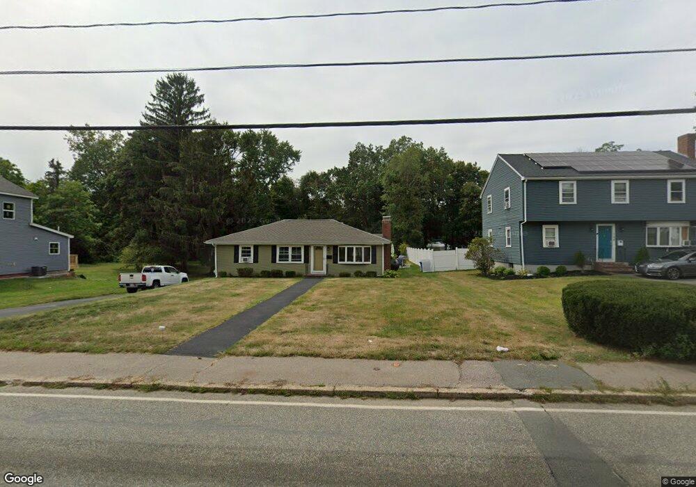
100 Liberty St Rockland, MA 02370
Estimated Value: $516,000 - $528,768
2
Beds
2
Baths
1,392
Sq Ft
$377/Sq Ft
Est. Value
About This Home
This home is located at 100 Liberty St, Rockland, MA 02370 and is currently estimated at $524,442, approximately $376 per square foot. 100 Liberty St is a home located in Plymouth County with nearby schools including Rockland Senior High School, Calvary Chapel Academy, and Holy Family Elementary School.
Ownership History
Date
Name
Owned For
Owner Type
Purchase Details
Closed on
Jul 17, 1997
Sold by
Reilly Marie C
Bought by
Donnellan Janine M and Donnellan Wayne V
Current Estimated Value
Home Financials for this Owner
Home Financials are based on the most recent Mortgage that was taken out on this home.
Original Mortgage
$127,500
Interest Rate
7.79%
Mortgage Type
Purchase Money Mortgage
Create a Home Valuation Report for This Property
The Home Valuation Report is an in-depth analysis detailing your home's value as well as a comparison with similar homes in the area
Home Values in the Area
Average Home Value in this Area
Purchase History
| Date | Buyer | Sale Price | Title Company |
|---|---|---|---|
| Donnellan Janine M | $135,000 | -- |
Source: Public Records
Mortgage History
| Date | Status | Borrower | Loan Amount |
|---|---|---|---|
| Open | Donnellan Janine M | $156,949 | |
| Closed | Donnellan Janine M | $153,000 | |
| Closed | Donnellan Janine M | $14,000 | |
| Closed | Donnellan Janine M | $127,500 |
Source: Public Records
Tax History Compared to Growth
Tax History
| Year | Tax Paid | Tax Assessment Tax Assessment Total Assessment is a certain percentage of the fair market value that is determined by local assessors to be the total taxable value of land and additions on the property. | Land | Improvement |
|---|---|---|---|---|
| 2025 | $6,579 | $481,300 | $220,800 | $260,500 |
| 2024 | $6,386 | $454,200 | $208,300 | $245,900 |
| 2023 | $6,190 | $406,700 | $181,000 | $225,700 |
| 2022 | $5,971 | $356,500 | $157,400 | $199,100 |
| 2021 | $5,479 | $317,100 | $143,100 | $174,000 |
| 2020 | $5,285 | $302,000 | $136,300 | $165,700 |
| 2019 | $5,159 | $287,900 | $129,800 | $158,100 |
| 2018 | $4,777 | $262,200 | $129,800 | $132,400 |
| 2017 | $4,626 | $250,300 | $129,800 | $120,500 |
| 2016 | $4,451 | $240,700 | $124,800 | $115,900 |
| 2015 | $4,249 | $223,300 | $116,600 | $106,700 |
| 2014 | $3,993 | $217,700 | $114,400 | $103,300 |
Source: Public Records
Map
Nearby Homes
- 106 Liberty St
- 116 Liberty St Unit 118
- 84 Liberty St
- 103 Liberty St
- 91 Liberty St
- 117 Liberty St
- 77 Liberty St
- 74 Liberty St Unit 76
- 128 Liberty St
- 74-76 Liberty St
- 121 Liberty St
- 4 Fitzgibbons Ln
- 134 Liberty St
- 71 Liberty St
- 2 Fitzgibbons Ln
- 72 Liberty St
- 1 Patrick Donovan Way
- 135 Liberty St
- 56 Liberty St
- 231-233 Vernon St