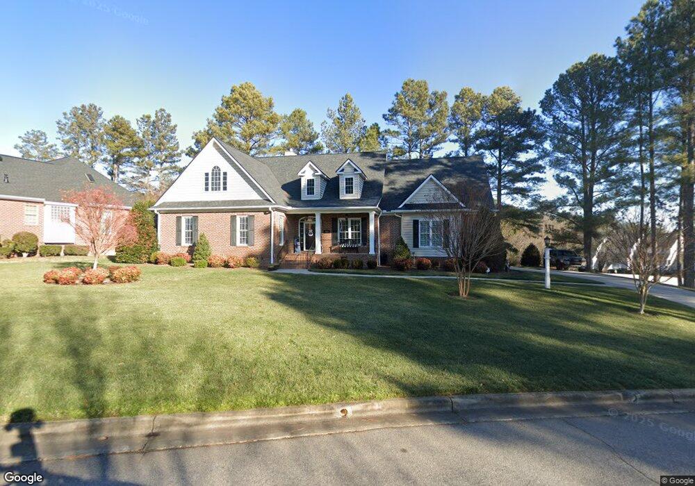
100 Par Dr Henderson, NC 27536
Estimated Value: $361,000 - $545,000
3
Beds
2
Baths
1,933
Sq Ft
$229/Sq Ft
Est. Value
About This Home
This home is located at 100 Par Dr, Henderson, NC 27536 and is currently estimated at $442,082, approximately $228 per square foot. 100 Par Dr is a home located in Vance County with nearby schools including E.M. Rollins Elementary School, Vance County Middle School, and Vance County High School.
Ownership History
Date
Name
Owned For
Owner Type
Purchase Details
Closed on
Nov 1, 2017
Sold by
Childress Betty R
Bought by
Ayscue Jerry L and Ayscue Carolyn P
Current Estimated Value
Home Financials for this Owner
Home Financials are based on the most recent Mortgage that was taken out on this home.
Original Mortgage
$160,000
Outstanding Balance
$85,793
Interest Rate
3.13%
Mortgage Type
New Conventional
Estimated Equity
$356,289
Purchase Details
Closed on
Feb 19, 2010
Sold by
Rogers John C and Rogers Stephanie H
Bought by
Childeress Betty R
Create a Home Valuation Report for This Property
The Home Valuation Report is an in-depth analysis detailing your home's value as well as a comparison with similar homes in the area
Home Values in the Area
Average Home Value in this Area
Purchase History
| Date | Buyer | Sale Price | Title Company |
|---|---|---|---|
| Ayscue Jerry L | $275,000 | None Available | |
| Childeress Betty R | $40,500 | -- |
Source: Public Records
Mortgage History
| Date | Status | Borrower | Loan Amount |
|---|---|---|---|
| Open | Ayscue Jerry L | $160,000 |
Source: Public Records
Tax History Compared to Growth
Tax History
| Year | Tax Paid | Tax Assessment Tax Assessment Total Assessment is a certain percentage of the fair market value that is determined by local assessors to be the total taxable value of land and additions on the property. | Land | Improvement |
|---|---|---|---|---|
| 2025 | $5,243 | $373,971 | $20,879 | $353,092 |
| 2024 | $5,222 | $373,971 | $20,879 | $353,092 |
| 2023 | $4,895 | $291,171 | $35,000 | $256,171 |
| 2022 | $4,785 | $291,171 | $35,000 | $256,171 |
| 2021 | $4,665 | $291,171 | $35,000 | $256,171 |
| 2020 | $4,782 | $291,171 | $35,000 | $256,171 |
| 2019 | $4,777 | $291,171 | $35,000 | $256,171 |
| 2018 | $4,330 | $270,293 | $35,000 | $235,293 |
| 2017 | $4,435 | $270,293 | $35,000 | $235,293 |
| 2016 | $4,480 | $273,081 | $35,000 | $238,081 |
| 2015 | $3,927 | $32,000 | $32,000 | $0 |
| 2014 | $3,711 | $255,376 | $32,000 | $223,376 |
Source: Public Records
Map
Nearby Homes
- 404 Eagle Ct
- 407 Eagle Ct
- 409 Eagle Ct
- 1822 Ruin Creek Rd
- Lot 5 Sidney Hill
- 2535 Fairway Dr Unit 3
- 3002 Sidney Hill
- 105 Fernwood Creek Ct
- 3070 Cameron Dr
- 3203 Cameron Dr
- 1612 Lynne Ave
- 1744 Parker Ln
- 1224 Oakridge Ave
- 2118 N Woodland Rd
- 65 Pine View Rd
- 1542 Oakdale Cir
- 1530 Oakdale Cir
- 1105 Dabney Dr
- 415 Beechwood Trail
- 115 Red Bud Dr
- 400 Eagle Ct
- 101 Par Dr
- 101 Eagle Ct
- Lot 18 Eagle Ct
- 0 Eagle Ct Unit 1799669
- 0 Eagle Ct Unit 1799664
- 0 Eagle Ct Unit 1799674
- 0 Eagle Ct Unit TR2188663
- 0 Eagle Ct Unit 14 1799674
- 0 Eagle Ct Unit 18 1799664
- 0 Eagle Ct Unit 15 1799669
- Lot 18 Eagle Ct Unit 18
- Lot 15 Eagle Ct Unit 15
- Lot 14 Eagle Ct Unit 14
- Lot 15 Eagle Ct
- Lot 14 Eagle Ct
- 0 Eagle Ct
- 0000 Eagle Ct
- 000 Eagle Ct
- 4 Eagle Ct