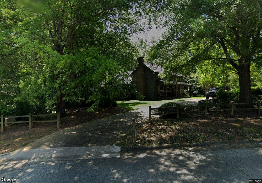
100 Sudley Cir Salisbury, NC 28144
Estimated Value: $443,000 - $545,000
--
Bed
3
Baths
2,602
Sq Ft
$189/Sq Ft
Est. Value
About This Home
This home is located at 100 Sudley Cir, Salisbury, NC 28144 and is currently estimated at $492,492, approximately $189 per square foot. 100 Sudley Cir is a home located in Rowan County with nearby schools including Carroll T Overton Elementary School, Knox Middle School, and North Rowan Middle School.
Ownership History
Date
Name
Owned For
Owner Type
Purchase Details
Closed on
Jan 15, 2020
Sold by
Beaver Barbara M and Beaver John Michael
Bought by
Austin Matthew Ray and Austin Britt Miller
Current Estimated Value
Home Financials for this Owner
Home Financials are based on the most recent Mortgage that was taken out on this home.
Original Mortgage
$299,250
Outstanding Balance
$264,399
Interest Rate
3.6%
Mortgage Type
New Conventional
Estimated Equity
$228,093
Create a Home Valuation Report for This Property
The Home Valuation Report is an in-depth analysis detailing your home's value as well as a comparison with similar homes in the area
Home Values in the Area
Average Home Value in this Area
Purchase History
| Date | Buyer | Sale Price | Title Company |
|---|---|---|---|
| Austin Matthew Ray | $315,000 | First American |
Source: Public Records
Mortgage History
| Date | Status | Borrower | Loan Amount |
|---|---|---|---|
| Open | Austin Matthew Ray | $299,250 |
Source: Public Records
Tax History Compared to Growth
Tax History
| Year | Tax Paid | Tax Assessment Tax Assessment Total Assessment is a certain percentage of the fair market value that is determined by local assessors to be the total taxable value of land and additions on the property. | Land | Improvement |
|---|---|---|---|---|
| 2025 | $5,177 | $432,864 | $75,000 | $357,864 |
| 2024 | $5,177 | $432,864 | $75,000 | $357,864 |
| 2023 | $5,177 | $432,864 | $75,000 | $357,864 |
| 2022 | $3,808 | $276,498 | $75,000 | $201,498 |
| 2021 | $3,808 | $276,498 | $75,000 | $201,498 |
| 2020 | $3,808 | $276,498 | $75,000 | $201,498 |
| 2019 | $3,808 | $276,498 | $75,000 | $201,498 |
| 2018 | $3,620 | $266,452 | $75,000 | $191,452 |
| 2017 | $3,601 | $266,452 | $75,000 | $191,452 |
| 2016 | $3,502 | $266,452 | $75,000 | $191,452 |
| 2015 | $3,524 | $266,452 | $75,000 | $191,452 |
| 2014 | $3,610 | $276,238 | $75,000 | $201,238 |
Source: Public Records
Map
Nearby Homes
- 2 Pickett Ave
- 316 W 14th St
- 241 Stonewall Rd
- 321 W 14th St
- 105 W 17th St
- 921 Confederate Ave
- 209 11th St
- 911 S Spencer Ave
- 910 S Spencer Ave
- 1550 N Lee St
- 1231 Maxwell St
- 931 Cedar St Unit 1
- 0 S Salisbury Ave
- 212 E 11th St
- 815 Cedar St
- 324 Club Dr
- 0 Correll St
- 00 Correll St
- 1201 N Church St
- 929 S Long St
- 100 Sudley Cir Unit 20
- 104 Sudley Cir
- 600 Anderson Ave
- 529 Anderson Ave
- 603 Anderson Ave
- 28 Beauregard Dr
- 105 Sudley Cir
- 30 Beauregard Dr
- 604 Anderson Ave
- 112 Sudley Cir
- 22 Beauregard Dr
- 32 Beauregard Dr
- 607 Anderson Ave
- 300 Stuart St
- 29 Beauregard Dr
- 1 Stuart Dr
- 25 Beauregard Dr
- 31 Beauregard Dr
- 521 Anderson Ave
- 0 Beauregard Dr Unit 27