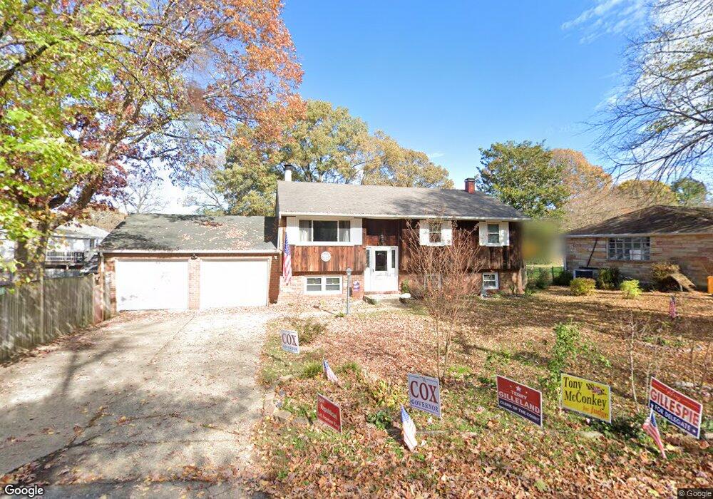
1000 Mountain Top Dr Annapolis, MD 21409
Cape Saint Claire NeighborhoodEstimated Value: $427,653 - $530,000
--
Bed
2
Baths
994
Sq Ft
$503/Sq Ft
Est. Value
About This Home
This home is located at 1000 Mountain Top Dr, Annapolis, MD 21409 and is currently estimated at $499,913, approximately $502 per square foot. 1000 Mountain Top Dr is a home located in Anne Arundel County with nearby schools including Cape St. Claire Elementary School, Magothy River Middle School, and Broadneck High School.
Ownership History
Date
Name
Owned For
Owner Type
Purchase Details
Closed on
Mar 6, 2002
Sold by
Bloh John F
Bought by
Bloh Patricia T
Current Estimated Value
Purchase Details
Closed on
Feb 28, 1991
Sold by
Kneessi Donald F
Bought by
Bloh John F
Home Financials for this Owner
Home Financials are based on the most recent Mortgage that was taken out on this home.
Original Mortgage
$127,466
Interest Rate
9.29%
Create a Home Valuation Report for This Property
The Home Valuation Report is an in-depth analysis detailing your home's value as well as a comparison with similar homes in the area
Home Values in the Area
Average Home Value in this Area
Purchase History
| Date | Buyer | Sale Price | Title Company |
|---|---|---|---|
| Bloh Patricia T | -- | -- | |
| Bloh John F | $125,000 | -- |
Source: Public Records
Mortgage History
| Date | Status | Borrower | Loan Amount |
|---|---|---|---|
| Previous Owner | Bloh John F | $127,466 |
Source: Public Records
Tax History Compared to Growth
Tax History
| Year | Tax Paid | Tax Assessment Tax Assessment Total Assessment is a certain percentage of the fair market value that is determined by local assessors to be the total taxable value of land and additions on the property. | Land | Improvement |
|---|---|---|---|---|
| 2025 | $3,373 | $396,767 | -- | -- |
| 2024 | $3,373 | $379,300 | $237,700 | $141,600 |
| 2023 | $3,227 | $372,700 | $0 | $0 |
| 2022 | $3,024 | $366,100 | $0 | $0 |
| 2021 | $5,946 | $359,500 | $237,700 | $121,800 |
| 2020 | $2,879 | $345,900 | $0 | $0 |
| 2019 | $2,823 | $332,300 | $0 | $0 |
| 2018 | $433 | $318,700 | $192,000 | $126,700 |
| 2017 | $2,645 | $303,633 | $0 | $0 |
| 2016 | $433 | $288,567 | $0 | $0 |
| 2015 | $433 | $273,500 | $0 | $0 |
| 2014 | -- | $273,500 | $0 | $0 |
Source: Public Records
Map
Nearby Homes
- 1162 Saint George Dr
- 1044 Skyview Dr
- 1217 Hampton Rd
- 1219 Hampton Rd
- 1023 Mountain Top Dr
- 1160 Skyview Dr
- 1014 St Charles Dr
- 1031 Lake Claire Dr
- 971 Saint Margarets Dr
- 1094 Linden Tree Drive - Taft Model
- 1096
- 1062 Broadview Dr
- 810 Chestnut Tree Dr
- 1199 Ramblewood Dr
- 1181 Ramblewood Dr
- 1214 Ramblewood Dr
- 1165 Green Holly Ct
- 1247 Ramblewood Dr
- 1167 Green Holly Dr
- 1366 Almond Dr
- 1193 Hampton Rd
- 1195 Hampton Rd
- 1191 Hampton Rd
- 1004 Mountain Top Dr
- 1197 Hampton Rd
- 1189 Hampton Rd
- 1188 Saint George Dr
- 1005 Mountain Top Dr
- 1190 Hampton Rd
- 1192 Hampton Rd
- 1188 Hampton Rd
- 1199 Hampton Rd
- 1187 Hampton Rd
- 1194 Hampton Rd
- 998 Dogwood Tree Dr
- 1184 Saint George Dr
- 1201 Hampton Rd
- 1185 Hampton Rd
- 1184 Hampton Rd
- 1007 Mountain Top Dr