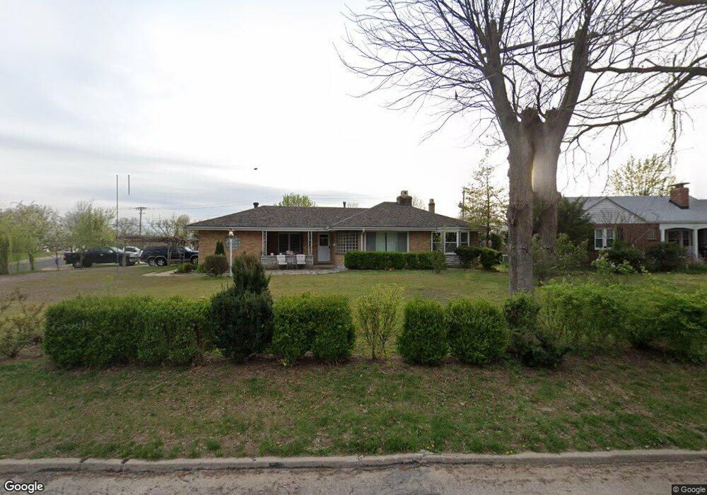
1000 Reavis Barracks Rd Saint Louis, MO 63125
Mehlville NeighborhoodEstimated Value: $272,556 - $280,000
2
Beds
2
Baths
1,550
Sq Ft
$178/Sq Ft
Est. Value
About This Home
This home is located at 1000 Reavis Barracks Rd, Saint Louis, MO 63125 and is currently estimated at $276,139, approximately $178 per square foot. 1000 Reavis Barracks Rd is a home located in St. Louis County with nearby schools including Forder Elementary School, Margaret Buerkle Middle School, and Mehlville High School.
Ownership History
Date
Name
Owned For
Owner Type
Purchase Details
Closed on
Oct 31, 2005
Sold by
Hanning Michael K and Hanning Connie L
Bought by
Zilic Mirsad and Zilic Amela
Current Estimated Value
Home Financials for this Owner
Home Financials are based on the most recent Mortgage that was taken out on this home.
Original Mortgage
$30,000
Interest Rate
6.04%
Mortgage Type
Fannie Mae Freddie Mac
Purchase Details
Closed on
Dec 30, 2003
Sold by
Hanning Charlotte L
Bought by
Hanning Michael K and Hanning Connie L
Purchase Details
Closed on
Apr 14, 1997
Sold by
Hanning Charlotte L
Bought by
Hanning Michael K and Hanning Connie L
Create a Home Valuation Report for This Property
The Home Valuation Report is an in-depth analysis detailing your home's value as well as a comparison with similar homes in the area
Home Values in the Area
Average Home Value in this Area
Purchase History
| Date | Buyer | Sale Price | Title Company |
|---|---|---|---|
| Zilic Mirsad | $120,000 | Nations Title Agency Mo Inc | |
| Hanning Michael K | -- | -- | |
| Hanning Michael K | -- | -- |
Source: Public Records
Mortgage History
| Date | Status | Borrower | Loan Amount |
|---|---|---|---|
| Closed | Zilic Mirsad | $30,000 | |
| Open | Zilic Mirsad | $120,000 |
Source: Public Records
Tax History Compared to Growth
Tax History
| Year | Tax Paid | Tax Assessment Tax Assessment Total Assessment is a certain percentage of the fair market value that is determined by local assessors to be the total taxable value of land and additions on the property. | Land | Improvement |
|---|---|---|---|---|
| 2025 | $2,796 | $45,180 | $16,680 | $28,500 |
| 2024 | $2,796 | $41,170 | $10,850 | $30,320 |
| 2023 | $2,760 | $41,170 | $10,850 | $30,320 |
| 2022 | $2,362 | $32,660 | $10,850 | $21,810 |
| 2021 | $2,096 | $32,660 | $10,850 | $21,810 |
| 2020 | $2,004 | $29,680 | $10,850 | $18,830 |
| 2019 | $1,998 | $29,680 | $10,850 | $18,830 |
| 2018 | $1,656 | $22,140 | $6,310 | $15,830 |
| 2017 | $1,653 | $22,140 | $6,310 | $15,830 |
| 2016 | $1,598 | $20,520 | $5,450 | $15,070 |
| 2015 | $1,499 | $20,520 | $5,450 | $15,070 |
| 2014 | $1,535 | $20,820 | $5,620 | $15,200 |
Source: Public Records
Map
Nearby Homes
- 1153 Calley Dr Unit 1153
- 1275 Gardens Circle Dr Unit A
- 669 Vista Conn Dr
- 2460 Lampong Dr Unit 100C
- 645 Vista Conn Dr
- 660 Rochester Dr
- 669 Bellsworth Dr
- 2669 Jonathan Dr
- 2105 Telford Dr
- 2216 Apple Bud Ln
- 502 Nannette Dr
- 2228 Hagenstone Terrace
- 600 Ellwine Dr
- 2215 Apple Bud Ln
- 32 Buckley Meadows Dr
- 1716 Mayenne Ct Unit E
- 317 Tacoma Dr
- 800 Dumont Place Unit B
- 1745 Herault Place Unit E
- 1725 Herault Place Unit G
- 1008 Reavis Barracks Rd
- 2509 Rosegarden Dr
- 1014 Reavis Barracks Rd
- 1001 Roxbury Dr
- 2500 Rosegarden Dr
- 897 Reavis Barracks Rd
- 1017 Roxbury Dr
- 1001 Reavis Barracks Rd
- 1018 Reavis Barracks Rd
- 2510 Rosegarden Dr
- 893 Reavis Barracks Rd
- 1017 Reavis Barracks Rd
- 1022 Reavis Barracks Rd
- 2514 Rosegarden Dr
- 1029 Roxbury Dr
- 2334 Rosegarden Dr
- 2331 Rosegarden Dr
- 2518 Rosegarden Dr
- 1023 Reavis Barracks Rd
- 1000 Roxbury Dr