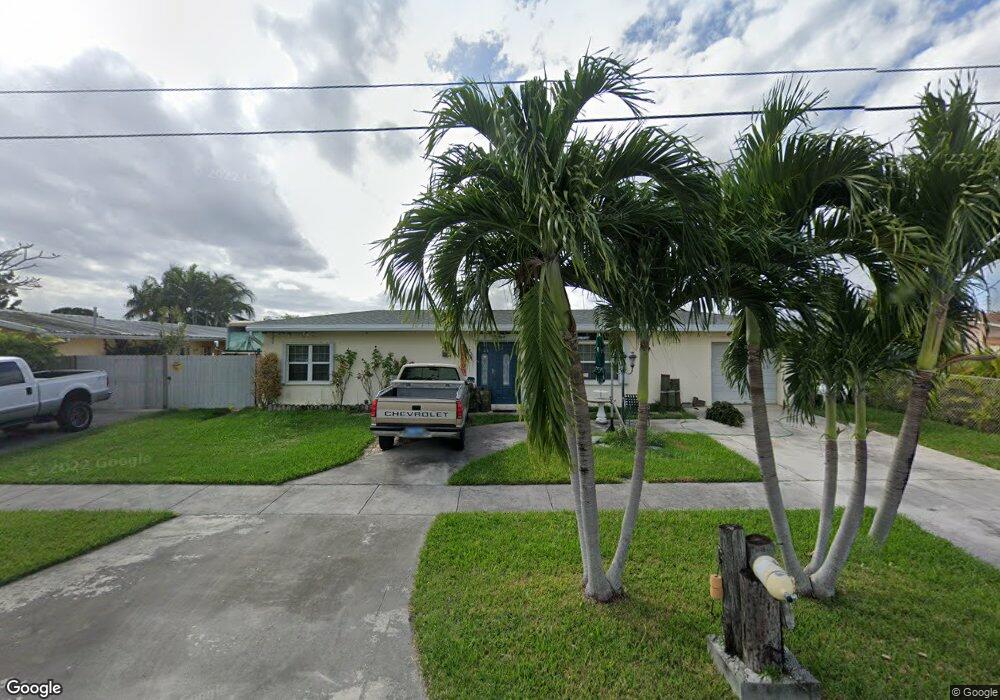
10000 Broad Channel Dr Cutler Bay, FL 33157
Estimated Value: $558,919 - $684,000
2
Beds
2
Baths
1,672
Sq Ft
$375/Sq Ft
Est. Value
About This Home
This home is located at 10000 Broad Channel Dr, Cutler Bay, FL 33157 and is currently estimated at $626,230, approximately $374 per square foot. 10000 Broad Channel Dr is a home located in Miami-Dade County with nearby schools including Bel-Aire Elementary School, Cutler Bay Middle, and Miami Southridge Senior High School.
Ownership History
Date
Name
Owned For
Owner Type
Purchase Details
Closed on
Aug 31, 2006
Sold by
Bean Stephanie and Wells Stephanie
Bought by
Bean Jeffrey and Bean Stephanie
Current Estimated Value
Purchase Details
Closed on
Jun 30, 2003
Sold by
Michaud Thomas and Armas Christina
Bought by
Wells Stephanie L
Home Financials for this Owner
Home Financials are based on the most recent Mortgage that was taken out on this home.
Original Mortgage
$195,700
Interest Rate
5.62%
Mortgage Type
Unknown
Create a Home Valuation Report for This Property
The Home Valuation Report is an in-depth analysis detailing your home's value as well as a comparison with similar homes in the area
Home Values in the Area
Average Home Value in this Area
Purchase History
| Date | Buyer | Sale Price | Title Company |
|---|---|---|---|
| Bean Jeffrey | -- | None Available | |
| Wells Stephanie L | $215,000 | Express Land Title Services |
Source: Public Records
Mortgage History
| Date | Status | Borrower | Loan Amount |
|---|---|---|---|
| Previous Owner | Wells Stephanie L | $195,700 |
Source: Public Records
Tax History Compared to Growth
Tax History
| Year | Tax Paid | Tax Assessment Tax Assessment Total Assessment is a certain percentage of the fair market value that is determined by local assessors to be the total taxable value of land and additions on the property. | Land | Improvement |
|---|---|---|---|---|
| 2025 | $2,812 | $158,505 | -- | -- |
| 2024 | $2,504 | $154,038 | -- | -- |
| 2023 | $2,504 | $149,552 | $0 | $0 |
| 2022 | $2,384 | $145,197 | $0 | $0 |
| 2021 | $2,343 | $140,968 | $0 | $0 |
| 2020 | $2,296 | $139,022 | $0 | $0 |
| 2019 | $2,227 | $135,897 | $0 | $0 |
| 2018 | $2,114 | $133,364 | $0 | $0 |
| 2017 | $2,088 | $130,621 | $0 | $0 |
| 2016 | $2,052 | $127,935 | $0 | $0 |
| 2015 | $2,072 | $127,046 | $0 | $0 |
| 2014 | $2,092 | $126,038 | $0 | $0 |
Source: Public Records
Map
Nearby Homes
- 19200 Belview Dr
- 18800 Lenaire Dr
- 18710 Belmont Dr
- 9817 SW 194th St
- 18700 Belmont Dr
- 18690 Belview Dr
- 9985 Marlin Rd
- 9905 SW 196th St
- 18745 SW 99th Rd
- 18811 SW 97th Ave
- 19310 Christmas Rd
- 19600 Gulfstream Rd
- 18601 SW 98th Ave
- 19630 Sterling Dr
- 19550 Belview Dr
- 9971 SW 198th St
- 9520 Holiday Rd
- 19701 Belmont Dr
- 19201 Flag Dr
- 19810 Eagle Nest Rd
- 9990 Broad Channel Dr
- 9980 Broad Channel Dr
- 19011 Belmont Dr
- 19030 Sterling Dr
- 10020 Broad Channel Dr
- 9970 Broad Channel Dr
- 18940 Belmont Dr
- 10030 Broad Channel Dr
- 19020 Sterling Dr
- 9960 Broad Channel Dr
- 18930 Belmont Dr
- 19010 Sterling Dr
- 19111 Sterling Dr
- 18931 Belmont Dr
- 18921 Belview Dr
- 10040 Broad Channel Dr
- 19101 Sterling Dr
- 18920 Belmont Dr
- 18921 Belmont Dr