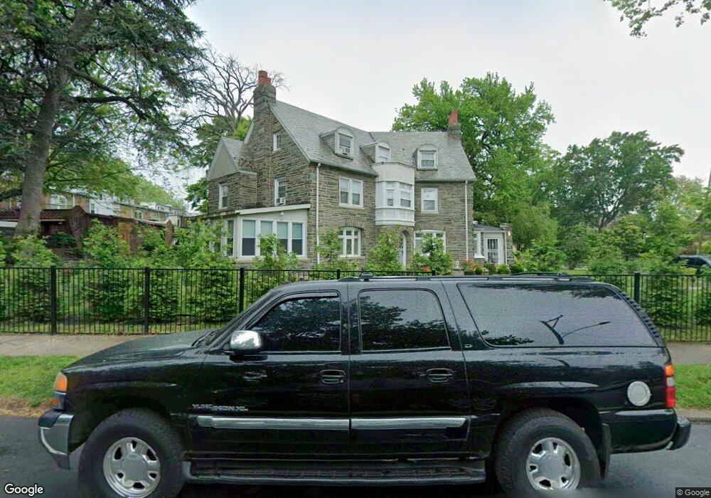
1001 Dyre St Philadelphia, PA 19124
Lawncrest NeighborhoodEstimated Value: $318,000 - $519,374
--
Bed
--
Bath
4,914
Sq Ft
$94/Sq Ft
Est. Value
About This Home
This home is located at 1001 Dyre St, Philadelphia, PA 19124 and is currently estimated at $461,844, approximately $93 per square foot. 1001 Dyre St is a home located in Philadelphia County with nearby schools including Frankford High School, The Philadelphia Charter School for the Arts & Sciences, and Northwood Academy Charter School.
Ownership History
Date
Name
Owned For
Owner Type
Purchase Details
Closed on
Nov 12, 2020
Sold by
Bernardo Nicholas R and Bernardo Susan A
Bought by
Taman Ibrahim and Chehab Amira
Current Estimated Value
Home Financials for this Owner
Home Financials are based on the most recent Mortgage that was taken out on this home.
Original Mortgage
$342,950
Outstanding Balance
$304,480
Interest Rate
2.8%
Mortgage Type
New Conventional
Estimated Equity
$157,364
Purchase Details
Closed on
Dec 15, 1988
Bought by
Bernardo Nicholas and Bernardo Susan A
Create a Home Valuation Report for This Property
The Home Valuation Report is an in-depth analysis detailing your home's value as well as a comparison with similar homes in the area
Home Values in the Area
Average Home Value in this Area
Purchase History
| Date | Buyer | Sale Price | Title Company |
|---|---|---|---|
| Taman Ibrahim | $361,000 | Universal Setmnt Svcs Llc | |
| Bernardo Nicholas | $100,000 | -- |
Source: Public Records
Mortgage History
| Date | Status | Borrower | Loan Amount |
|---|---|---|---|
| Open | Taman Ibrahim | $342,950 |
Source: Public Records
Tax History Compared to Growth
Tax History
| Year | Tax Paid | Tax Assessment Tax Assessment Total Assessment is a certain percentage of the fair market value that is determined by local assessors to be the total taxable value of land and additions on the property. | Land | Improvement |
|---|---|---|---|---|
| 2026 | $4,895 | $403,799 | $80,760 | $323,039 |
| 2025 | $4,895 | $403,799 | $80,760 | $323,039 |
| 2024 | $4,895 | $403,799 | $80,760 | $323,039 |
| 2023 | $4,895 | $349,699 | $69,940 | $279,759 |
| 2022 | $4,204 | $304,700 | $69,940 | $234,760 |
| 2021 | $29,264 | $0 | $0 | $0 |
| 2020 | $29,264 | $0 | $0 | $0 |
| 2019 | $29,264 | $0 | $0 | $0 |
| 2018 | $0 | $0 | $0 | $0 |
| 2017 | $0 | $0 | $0 | $0 |
| 2016 | $3,772 | $0 | $0 | $0 |
| 2015 | $3,611 | $0 | $0 | $0 |
| 2014 | -- | $299,500 | $231,600 | $67,900 |
| 2012 | -- | $41,920 | $10,916 | $31,004 |
Source: Public Records
Map
Nearby Homes
- 1048 Bridge St
- 1052 Allengrove St
- 4046 E Roosevelt Blvd
- 5505 Loretto Ave
- 1859 Harrison St
- 1204 Pratt St
- 1137 Bridge St
- 1218 Pratt St
- 1220 Pratt St
- 5640 Miriam Rd
- 1208 Haworth St
- 5659 Miriam Rd
- 5661 Miriam Rd
- 1214 Haworth St
- 5118 Oakland St
- 926 Foulkrod St
- 934 Brill St
- 894 Granite St
- 991 Carver St
- 996 Anchor St