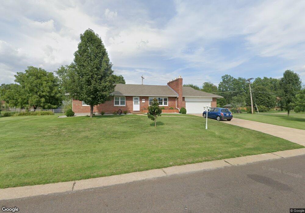
1001 Roxbury Dr Saint Louis, MO 63125
Mehlville NeighborhoodEstimated Value: $230,000 - $297,000
3
Beds
1
Bath
1,428
Sq Ft
$191/Sq Ft
Est. Value
About This Home
This home is located at 1001 Roxbury Dr, Saint Louis, MO 63125 and is currently estimated at $272,767, approximately $191 per square foot. 1001 Roxbury Dr is a home located in St. Louis County with nearby schools including Forder Elementary School, Margaret Buerkle Middle School, and Mehlville High School.
Ownership History
Date
Name
Owned For
Owner Type
Purchase Details
Closed on
Jul 28, 2004
Sold by
Manor Real Estate Residential Llc
Bought by
Rama Agim and Rama Zoje
Current Estimated Value
Home Financials for this Owner
Home Financials are based on the most recent Mortgage that was taken out on this home.
Original Mortgage
$134,900
Outstanding Balance
$67,570
Interest Rate
6.26%
Mortgage Type
Purchase Money Mortgage
Estimated Equity
$205,197
Purchase Details
Closed on
Jun 7, 2004
Sold by
Moeller Amy and Hall Jim
Bought by
Manor Real Estate Residential Llc
Home Financials for this Owner
Home Financials are based on the most recent Mortgage that was taken out on this home.
Original Mortgage
$134,900
Outstanding Balance
$67,570
Interest Rate
6.26%
Mortgage Type
Purchase Money Mortgage
Estimated Equity
$205,197
Create a Home Valuation Report for This Property
The Home Valuation Report is an in-depth analysis detailing your home's value as well as a comparison with similar homes in the area
Home Values in the Area
Average Home Value in this Area
Purchase History
| Date | Buyer | Sale Price | Title Company |
|---|---|---|---|
| Rama Agim | $142,000 | -- | |
| Manor Real Estate Residential Llc | $122,500 | -- |
Source: Public Records
Mortgage History
| Date | Status | Borrower | Loan Amount |
|---|---|---|---|
| Open | Rama Agim | $134,900 |
Source: Public Records
Tax History Compared to Growth
Tax History
| Year | Tax Paid | Tax Assessment Tax Assessment Total Assessment is a certain percentage of the fair market value that is determined by local assessors to be the total taxable value of land and additions on the property. | Land | Improvement |
|---|---|---|---|---|
| 2025 | $3,063 | $51,410 | $21,220 | $30,190 |
| 2024 | $3,063 | $45,140 | $13,810 | $31,330 |
| 2023 | $3,024 | $45,140 | $13,810 | $31,330 |
| 2022 | $2,698 | $37,370 | $13,810 | $23,560 |
| 2021 | $2,395 | $37,370 | $13,810 | $23,560 |
| 2020 | $2,279 | $33,800 | $13,430 | $20,370 |
| 2019 | $2,272 | $33,800 | $13,430 | $20,370 |
| 2018 | $2,000 | $26,830 | $7,700 | $19,130 |
| 2017 | $1,998 | $26,830 | $7,700 | $19,130 |
| 2016 | $2,021 | $26,050 | $6,750 | $19,300 |
| 2015 | $1,895 | $26,050 | $6,750 | $19,300 |
| 2014 | $2,311 | $31,540 | $9,880 | $21,660 |
Source: Public Records
Map
Nearby Homes
- 1153 Calley Dr Unit 1153
- 1275 Gardens Circle Dr Unit A
- 660 Rochester Dr
- 2669 Jonathan Dr
- 669 Bellsworth Dr
- 32 Buckley Meadows Dr
- 669 Vista Conn Dr
- 2460 Lampong Dr Unit 100C
- 600 Ellwine Dr
- 502 Nannette Dr
- 645 Vista Conn Dr
- 2216 Apple Bud Ln
- 2228 Hagenstone Terrace
- 2745 Granda Dr
- 2105 Telford Dr
- 2215 Apple Bud Ln
- 317 Tacoma Dr
- 3618 Tracey Rich Rd Unit 1B
- 2907 Hubert Dr
- 121 Jefferson Barracks Rd
- 2509 Rosegarden Dr
- 1017 Roxbury Dr
- 1008 Roxbury Dr
- 1000 Roxbury Dr
- 1000 Reavis Barracks Rd
- 1008 Reavis Barracks Rd
- 1020 Roxbury Dr
- 1014 Reavis Barracks Rd
- 2510 Rosegarden Dr
- 1029 Roxbury Dr
- 2514 Rosegarden Dr
- 2508 Rustic Dr
- 2527 Rosegarden Dr
- 2500 Rosegarden Dr
- 2518 Rosegarden Dr
- 1018 Reavis Barracks Rd
- 2522 Rosegarden Dr
- 1026 Roxbury Dr
- 1033 Roxbury Dr
- 2509 Rustic Dr