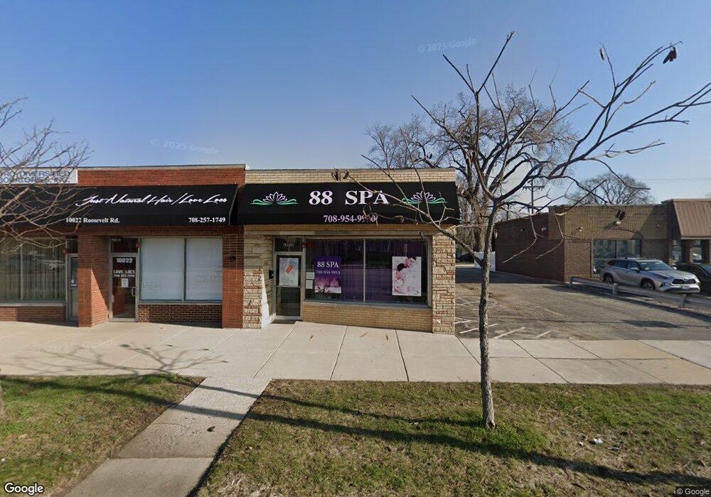
10020 Roosevelt Rd Westchester, IL 60154
--
Bed
--
Bath
1,500
Sq Ft
0.6
Acres
About This Home
This home is located at 10020 Roosevelt Rd, Westchester, IL 60154. 10020 Roosevelt Rd is a home located in Cook County with nearby schools including Westchester Primary School, Westchester Intermediate School, and Westchester Middle School.
Ownership History
Date
Name
Owned For
Owner Type
Purchase Details
Closed on
Jan 14, 2022
Sold by
Roosevelt Road Property Enterprises Llc
Bought by
Pesek Jeffry A and Pesek Jeffry A
Home Financials for this Owner
Home Financials are based on the most recent Mortgage that was taken out on this home.
Original Mortgage
$290,250
Outstanding Balance
$248,615
Interest Rate
3.11%
Purchase Details
Closed on
Dec 13, 2021
Sold by
Roosevelt Road Property Enterprises Llc
Bought by
Pesek Jeffry A and Pesek Jeffry A
Home Financials for this Owner
Home Financials are based on the most recent Mortgage that was taken out on this home.
Original Mortgage
$290,250
Outstanding Balance
$248,615
Interest Rate
3.11%
Create a Home Valuation Report for This Property
The Home Valuation Report is an in-depth analysis detailing your home's value as well as a comparison with similar homes in the area
Home Values in the Area
Average Home Value in this Area
Purchase History
| Date | Buyer | Sale Price | Title Company |
|---|---|---|---|
| Pesek Jeffry A | $387,000 | -- | |
| Pesek Jeffry A | $387,000 | -- |
Source: Public Records
Mortgage History
| Date | Status | Borrower | Loan Amount |
|---|---|---|---|
| Open | Pesek Jeffry A | $290,250 |
Source: Public Records
Tax History Compared to Growth
Tax History
| Year | Tax Paid | Tax Assessment Tax Assessment Total Assessment is a certain percentage of the fair market value that is determined by local assessors to be the total taxable value of land and additions on the property. | Land | Improvement |
|---|---|---|---|---|
| 2024 | $4,967 | $18,928 | $9,188 | $9,740 |
| 2023 | $8,496 | $18,928 | $9,188 | $9,740 |
| 2022 | $8,496 | $27,850 | $9,188 | $18,662 |
| 2021 | $8,224 | $27,848 | $9,187 | $18,661 |
| 2020 | $4,551 | $15,774 | $9,187 | $6,587 |
| 2019 | $5,085 | $18,000 | $8,203 | $9,797 |
| 2018 | $5,018 | $18,000 | $8,203 | $9,797 |
| 2017 | $4,922 | $18,000 | $8,203 | $9,797 |
| 2016 | $4,927 | $16,892 | $7,875 | $9,017 |
| 2015 | $4,863 | $16,892 | $7,875 | $9,017 |
| 2014 | $4,751 | $16,892 | $7,875 | $9,017 |
| 2013 | $4,326 | $17,208 | $7,875 | $9,333 |
Source: Public Records
Map
Nearby Homes
- 1119 Newcastle Ave
- 10072 Drury Ln
- 920 Suffolk Ave
- 814 Norfolk Ave
- 923 Manchester Ave
- 805 Norfolk Ave
- 750 Bristol Ave
- 626 Manchester Ave
- 723 Balmoral Ave
- 1247 S Mannheim Rd Unit 3
- 1500 Bristol Ave
- 1136 Park Place
- 1108 31st Ave
- 1102 31st Ave
- 1035 Bohland Ave
- 1034 31st Ave
- 1023 Rice Ave
- 1022 Eastern Ave
- 1102 Marshall Ave
- 1601 Bristol Ave
- 10026 W Roosevelt Rd
- 1143 Portsmouth Ave
- 1142 Suffolk Ave
- 1137 Portsmouth Ave
- 1136 Suffolk Ave
- 10031 W Roosevelt Rd Unit 101
- 10031 W Roosevelt Rd
- 1140 Portsmouth Ave
- 1132 Suffolk Ave
- 1127 Portsmouth Ave
- 1134 Portsmouth Ave
- 1126 Suffolk Ave
- 10055 W Roosevelt Rd Unit B
- 10055 W Roosevelt Rd
- 10050 Roosevelt Rd
- 1128 Portsmouth Ave
- 1121 Portsmouth Ave
- 1143 Suffolk Ave
- 1143 Suffolk Ave Unit ID1237899P