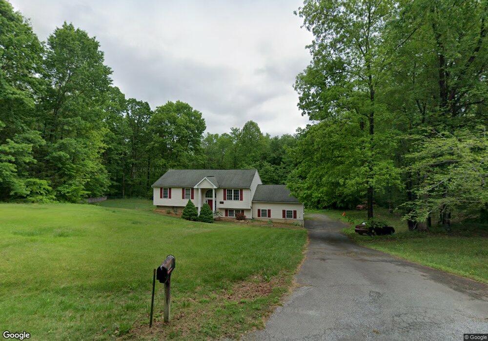
10021 Landrum Rd Spotsylvania, VA 22553
Spotsylvania Courthouse NeighborhoodEstimated Value: $420,000 - $498,000
4
Beds
3
Baths
1,130
Sq Ft
$406/Sq Ft
Est. Value
About This Home
This home is located at 10021 Landrum Rd, Spotsylvania, VA 22553 and is currently estimated at $458,441, approximately $405 per square foot. 10021 Landrum Rd is a home located in Spotsylvania County with nearby schools including Spotsylvania Elementary School, Post Oak Middle School, and Spotsylvania High School.
Ownership History
Date
Name
Owned For
Owner Type
Purchase Details
Closed on
Dec 15, 2017
Sold by
Oglesby Norman G
Bought by
Oglesby Lisa M
Current Estimated Value
Purchase Details
Closed on
Dec 13, 2001
Sold by
Charleston Co
Bought by
Oglesby Lisa M
Home Financials for this Owner
Home Financials are based on the most recent Mortgage that was taken out on this home.
Original Mortgage
$137,700
Interest Rate
6.6%
Mortgage Type
New Conventional
Purchase Details
Closed on
Jul 30, 2001
Sold by
Mcdill Marvella J D
Bought by
The Charleston Co
Create a Home Valuation Report for This Property
The Home Valuation Report is an in-depth analysis detailing your home's value as well as a comparison with similar homes in the area
Home Values in the Area
Average Home Value in this Area
Purchase History
| Date | Buyer | Sale Price | Title Company |
|---|---|---|---|
| Oglesby Lisa M | $5,000 | None Available | |
| Oglesby Lisa M | $162,600 | -- | |
| The Charleston Co | $21,500 | -- |
Source: Public Records
Mortgage History
| Date | Status | Borrower | Loan Amount |
|---|---|---|---|
| Previous Owner | Oglesby Lisa M | $137,700 |
Source: Public Records
Tax History Compared to Growth
Tax History
| Year | Tax Paid | Tax Assessment Tax Assessment Total Assessment is a certain percentage of the fair market value that is determined by local assessors to be the total taxable value of land and additions on the property. | Land | Improvement |
|---|---|---|---|---|
| 2025 | $2,409 | $328,100 | $121,000 | $207,100 |
| 2024 | $2,409 | $328,100 | $121,000 | $207,100 |
| 2023 | $2,108 | $273,200 | $100,000 | $173,200 |
| 2022 | $2,015 | $273,200 | $100,000 | $173,200 |
| 2021 | $1,936 | $239,200 | $79,000 | $160,200 |
| 2020 | $1,936 | $239,200 | $79,000 | $160,200 |
| 2019 | $1,901 | $224,300 | $72,000 | $152,300 |
| 2018 | $1,868 | $224,300 | $72,000 | $152,300 |
| 2017 | $1,740 | $204,700 | $65,000 | $139,700 |
| 2016 | $1,740 | $204,700 | $65,000 | $139,700 |
| 2015 | -- | $196,800 | $65,000 | $131,800 |
| 2014 | -- | $196,800 | $65,000 | $131,800 |
Source: Public Records
Map
Nearby Homes
- 10108 Willow Ridge Ln
- 7802 Lyndhurst Ct
- 10504 Big Horn Dr
- 6815 Bloomsbury Ln
- 8100 Battle Trace Ln
- 10724 Tealwing Cove
- 8112 Battle Trace Ln
- 9910 Agnes Ln
- 9603 Conaty Cir
- 7239 Smith Station Rd
- 10318 Shaw Dr
- 10704 Whispering Way
- 10416 Ni River Dr
- 10820 Cloverdale St
- 8205 Colise Ln
- 10415 Shaw Dr
- 9212 Isle of Laurels
- 9770 Courthouse Rd
- 10041 Gander Ct
- 10811 Honorable Ct
- 10031 Landrum Rd
- 10000 Landrum Rd
- 7501 Scotts Farm Rd
- 10041 Landrum Rd
- 10011 Landrum Rd
- 7511 Scotts Farm Rd
- 10101 Landrum Rd
- 10001 Landrum Rd
- 7510 Scotts Farm Rd
- 10100 Landrum Rd
- 10111 Landrum Rd
- 7520 Scotts Farm Rd
- 7521 Scotts Farm Rd
- 10110 Landrum Rd
- 10121 Landrum Rd
- 10101 River Will Rd
- 7531 Scotts Farm Rd
- 10120 Landrum Rd
- 7530 Scotts Farm Rd
- 7500 Browns Farm Rd