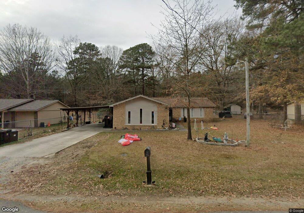
1003 Jones Dr Sheridan, AR 72150
Estimated Value: $168,000 - $206,000
3
Beds
2
Baths
1,724
Sq Ft
$111/Sq Ft
Est. Value
About This Home
This home is located at 1003 Jones Dr, Sheridan, AR 72150 and is currently estimated at $190,518, approximately $110 per square foot. 1003 Jones Dr is a home located in Grant County with nearby schools including Sheridan High School.
Ownership History
Date
Name
Owned For
Owner Type
Purchase Details
Closed on
Jun 13, 2014
Bought by
Boice Tad
Current Estimated Value
Purchase Details
Closed on
Jun 11, 2014
Bought by
Boice Tad and Boice Becky
Purchase Details
Closed on
Apr 16, 2013
Sold by
Ottinger Billy and Ottinger Larenda
Bought by
Jpmorgan Chase Bank Na
Purchase Details
Closed on
Mar 19, 2009
Sold by
Crouse Bill and Crouse Diana
Bought by
Ottinger Billy and Ottinger Larenda
Home Financials for this Owner
Home Financials are based on the most recent Mortgage that was taken out on this home.
Original Mortgage
$112,200
Interest Rate
5.14%
Mortgage Type
New Conventional
Purchase Details
Closed on
Jan 30, 2009
Sold by
Hsbc Mortgage Services Inc
Bought by
Crouse Bill
Home Financials for this Owner
Home Financials are based on the most recent Mortgage that was taken out on this home.
Original Mortgage
$112,200
Interest Rate
5.14%
Mortgage Type
New Conventional
Purchase Details
Closed on
Dec 16, 2004
Bought by
Bryant
Create a Home Valuation Report for This Property
The Home Valuation Report is an in-depth analysis detailing your home's value as well as a comparison with similar homes in the area
Home Values in the Area
Average Home Value in this Area
Purchase History
| Date | Buyer | Sale Price | Title Company |
|---|---|---|---|
| Boice Tad | $60,000 | -- | |
| Boice Tad | -- | -- | |
| Jpmorgan Chase Bank Na | $92,906 | None Available | |
| Ottinger Billy | $110,000 | Professional Land Title Comp | |
| Crouse Bill | $105,000 | None Available | |
| Bryant | $86,000 | -- |
Source: Public Records
Mortgage History
| Date | Status | Borrower | Loan Amount |
|---|---|---|---|
| Previous Owner | Ottinger Billy | $112,200 |
Source: Public Records
Tax History Compared to Growth
Tax History
| Year | Tax Paid | Tax Assessment Tax Assessment Total Assessment is a certain percentage of the fair market value that is determined by local assessors to be the total taxable value of land and additions on the property. | Land | Improvement |
|---|---|---|---|---|
| 2025 | $1,245 | $34,570 | $5,300 | $29,270 |
| 2024 | $1,145 | $25,860 | $5,200 | $20,660 |
| 2023 | $720 | $25,860 | $5,200 | $20,660 |
| 2022 | $720 | $25,860 | $5,200 | $20,660 |
| 2021 | $670 | $25,860 | $5,200 | $20,660 |
| 2020 | $620 | $22,110 | $3,800 | $18,310 |
| 2019 | $620 | $22,110 | $3,800 | $18,310 |
| 2018 | $645 | $22,110 | $3,800 | $18,310 |
| 2017 | $645 | $22,110 | $3,800 | $18,310 |
| 2015 | -- | $20,800 | $3,400 | $17,400 |
| 2014 | -- | $20,800 | $3,400 | $17,400 |
| 2012 | -- | $20,800 | $3,400 | $17,400 |
Source: Public Records
Map
Nearby Homes
- 1005 Kari Dr
- 915 Jones Dr
- 0 Freda Lane (North Lot)
- 0 Freda Lane (South Lot)
- 700 Shannon Ln
- 1105 S Rose St
- 7 Robin Dr
- 50 Toler St
- 25 Leif Tyler Dr
- 507 Gary Ln
- 0 Gary
- 534 Shackleford Rd
- 904 Grant 9
- 39 Valley Ct
- 38 Valley Ct
- 00 Grant County 9
- 27 Carolyn Rd
- 92 Hudson Dr
- 0 Grant 9 Unit 25044833
- 610 S Rock St