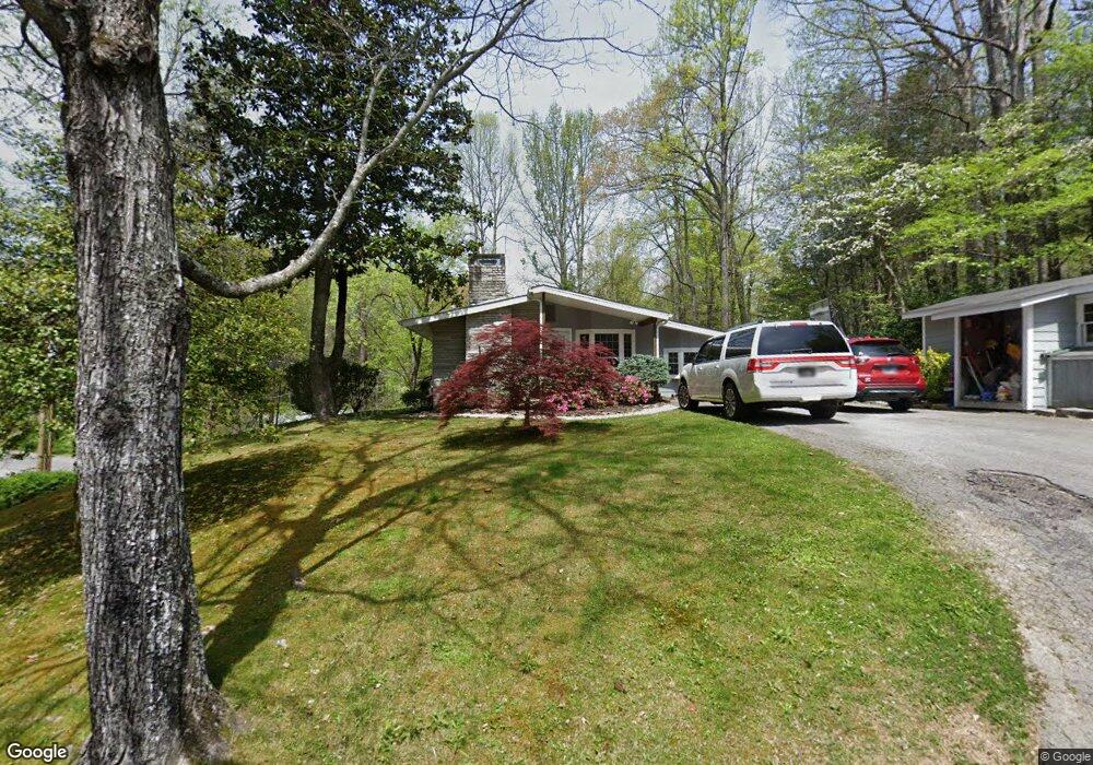
1005 H And o Dr Gatlinburg, TN 37738
Estimated Value: $401,000 - $403,957
--
Bed
2
Baths
1,840
Sq Ft
$219/Sq Ft
Est. Value
About This Home
This home is located at 1005 H And o Dr, Gatlinburg, TN 37738 and is currently estimated at $402,479, approximately $218 per square foot. 1005 H And o Dr is a home located in Sevier County with nearby schools including Catons Chapel Elementary School, Jones Cove Elementary School, and Northview Elementary School.
Ownership History
Date
Name
Owned For
Owner Type
Purchase Details
Closed on
Jun 26, 2019
Sold by
Citizens National Bank
Bought by
Mccown David T
Current Estimated Value
Home Financials for this Owner
Home Financials are based on the most recent Mortgage that was taken out on this home.
Original Mortgage
$100,000
Outstanding Balance
$65,960
Interest Rate
4%
Mortgage Type
Future Advance Clause Open End Mortgage
Estimated Equity
$336,519
Purchase Details
Closed on
Jul 14, 2004
Sold by
Bachtal Leo L
Bought by
Ted Mullikin
Purchase Details
Closed on
Mar 19, 1998
Sold by
Reed and Shary
Bought by
Ted Mullikin
Purchase Details
Closed on
Oct 30, 1989
Bought by
Reed James and Reed Shary
Purchase Details
Closed on
Oct 26, 1988
Bought by
Burnsed Ira D and Burnsed Inez
Create a Home Valuation Report for This Property
The Home Valuation Report is an in-depth analysis detailing your home's value as well as a comparison with similar homes in the area
Home Values in the Area
Average Home Value in this Area
Purchase History
| Date | Buyer | Sale Price | Title Company |
|---|---|---|---|
| Mccown David T | $180,000 | Titles Archived | |
| Ted Mullikin | -- | -- | |
| Ted Mullikin | $76,261 | -- | |
| Reed James | $68,500 | -- | |
| Burnsed Ira D | $57,500 | -- |
Source: Public Records
Mortgage History
| Date | Status | Borrower | Loan Amount |
|---|---|---|---|
| Open | Mccown David T | $100,000 |
Source: Public Records
Tax History Compared to Growth
Tax History
| Year | Tax Paid | Tax Assessment Tax Assessment Total Assessment is a certain percentage of the fair market value that is determined by local assessors to be the total taxable value of land and additions on the property. | Land | Improvement |
|---|---|---|---|---|
| 2025 | $739 | $49,950 | $6,375 | $43,575 |
| 2024 | $739 | $49,950 | $6,375 | $43,575 |
| 2023 | $739 | $49,950 | $0 | $0 |
| 2022 | $802 | $49,950 | $6,375 | $43,575 |
| 2021 | $802 | $49,950 | $6,375 | $43,575 |
| 2020 | $683 | $49,950 | $6,375 | $43,575 |
| 2019 | $684 | $33,850 | $6,375 | $27,475 |
| 2018 | $684 | $33,850 | $6,375 | $27,475 |
| 2017 | $684 | $33,850 | $6,375 | $27,475 |
| 2016 | $684 | $33,850 | $6,375 | $27,475 |
| 2015 | -- | $36,975 | $0 | $0 |
| 2014 | $661 | $36,965 | $0 | $0 |
Source: Public Records
Map
Nearby Homes
- 1106 Anastasia Way
- 1104 Anastasia Way
- 1132 Anastasia Way
- 1123 Anastasia Way
- 1128 Anastasia Way
- 1115 Anastasia Way
- 0 King Rd Unit 1299069
- 662 Morning Mist Way
- 510 Branson Dr
- 810 Blacksmith Way
- 661 Morning Mist Way
- 0 Ownby Cir Unit 308755
- 459 Ownby Cir
- 659 Morning Mist Way
- 626 Morning Mist Way
- 638 Morning Mist Way
- 1018 Potters Way
- 1745 Mountain Shadows Way
- 1011 Potters Way
- 1013 Potters Way