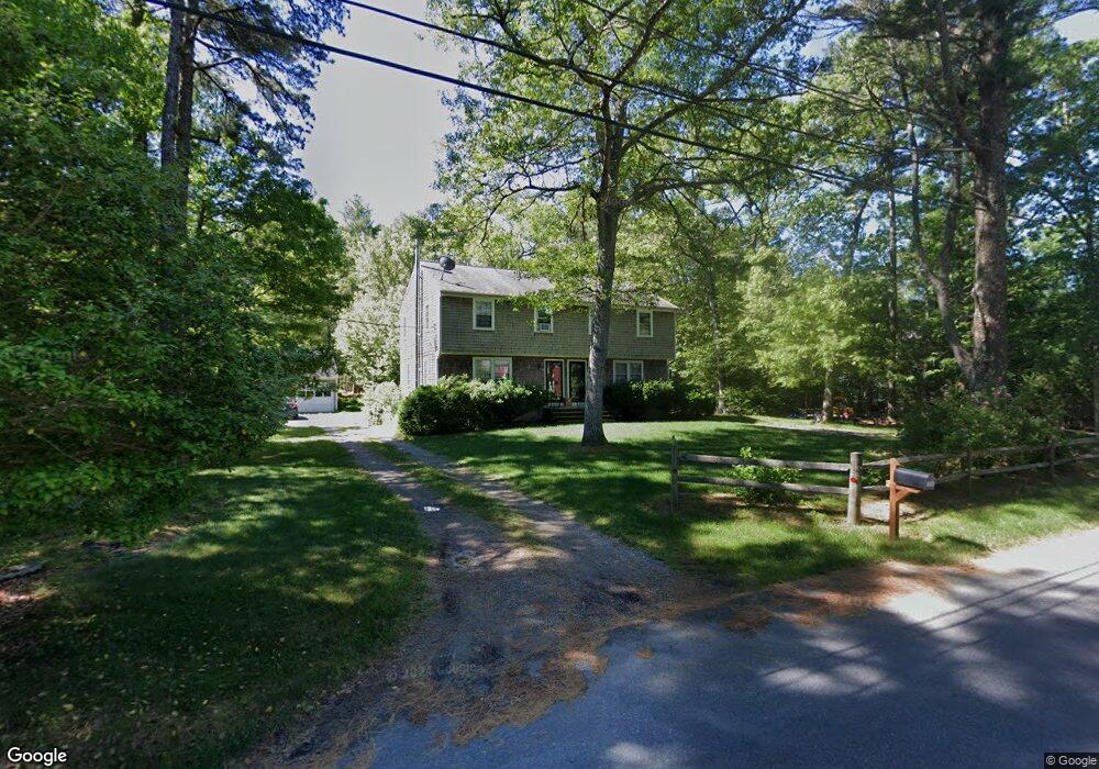
100B John Ewer Rd Sandwich, MA 02563
Estimated Value: $715,962 - $1,027,000
4
Beds
4
Baths
2,268
Sq Ft
$372/Sq Ft
Est. Value
About This Home
This home is located at 100B John Ewer Rd, Sandwich, MA 02563 and is currently estimated at $843,987, approximately $372 per square foot. 100B John Ewer Rd is a home located in Barnstable County with nearby schools including Sandwich Middle High School and Sandwich Montessori School.
Ownership History
Date
Name
Owned For
Owner Type
Purchase Details
Closed on
Sep 30, 2020
Sold by
Sandwich Shore Lines Lp
Bought by
Oconnor Corey F
Current Estimated Value
Home Financials for this Owner
Home Financials are based on the most recent Mortgage that was taken out on this home.
Original Mortgage
$375,000
Outstanding Balance
$333,542
Interest Rate
2.9%
Mortgage Type
New Conventional
Estimated Equity
$510,445
Purchase Details
Closed on
Aug 4, 2014
Sold by
Oconnor Lisa A
Bought by
Sandwich Shore Lines L
Purchase Details
Closed on
May 17, 2010
Sold by
Hamilton Anne M
Bought by
Balboni Helen E and Oconnor Lisa A
Purchase Details
Closed on
Mar 15, 2010
Sold by
Ap Rt and Hamilton Anne M
Bought by
Hamilton Anne M
Purchase Details
Closed on
Aug 30, 1996
Sold by
E&E Rt and Hamilton Earl E
Bought by
Ap Rt and Hamilton Perry J
Create a Home Valuation Report for This Property
The Home Valuation Report is an in-depth analysis detailing your home's value as well as a comparison with similar homes in the area
Home Values in the Area
Average Home Value in this Area
Purchase History
| Date | Buyer | Sale Price | Title Company |
|---|---|---|---|
| Oconnor Corey F | $500,000 | None Available | |
| Sandwich Shore Lines L | -- | -- | |
| Oconnor Lisa A | -- | -- | |
| Balboni Helen E | $330,000 | -- | |
| Hamilton Anne M | -- | -- | |
| Ap Rt | $70,000 | -- |
Source: Public Records
Mortgage History
| Date | Status | Borrower | Loan Amount |
|---|---|---|---|
| Open | Oconnor Corey F | $375,000 | |
| Previous Owner | Ap Rt | $69,767 |
Source: Public Records
Tax History Compared to Growth
Tax History
| Year | Tax Paid | Tax Assessment Tax Assessment Total Assessment is a certain percentage of the fair market value that is determined by local assessors to be the total taxable value of land and additions on the property. | Land | Improvement |
|---|---|---|---|---|
| 2025 | $6,133 | $580,200 | $205,100 | $375,100 |
| 2024 | $5,909 | $547,100 | $183,200 | $363,900 |
| 2023 | $6,149 | $534,700 | $166,500 | $368,200 |
| 2022 | $5,927 | $450,400 | $148,700 | $301,700 |
| 2021 | $5,788 | $420,300 | $148,000 | $272,300 |
| 2020 | $5,813 | $406,200 | $147,800 | $258,400 |
| 2019 | $5,542 | $387,000 | $145,100 | $241,900 |
| 2018 | $5,676 | $357,200 | $132,400 | $224,800 |
| 2017 | $5,040 | $337,600 | $128,100 | $209,500 |
| 2016 | $4,751 | $328,300 | $123,800 | $204,500 |
| 2015 | $4,468 | $301,500 | $100,700 | $200,800 |
Source: Public Records
Map
Nearby Homes
- 58 Southpoint Dr Unit J
- 59 Southpoint Dr Unit 59
- 5 Aviators Ln
- 22 Sconset Cir
- 3 Glenwood Ln
- 93 Deerfield Rd
- 185 Cotuit Rd Unit BE4
- 185 Cotuit Rd Unit JP1
- 185 Cotuit Rd Unit C5 Aspen
- 10 Wintergreen Ln
- 15 Hunters Tr
- 15 Hunters Trail
- 96 Pimlico Pond Rd
- 7 Open Trail Rd
- 3 Anne Cir
- 18 Katian Way
- 23 Old Fields Rd
- 4 Lan Rd
- 100 John Ewer Rd Unit A+B
- 100 John Ewer Rd
- 98 John Ewer Rd Unit B
- 98 John Ewer Rd Unit A
- 98 John Ewer Rd
- 98 John Ewer Rd Unit 2B
- 98 John Ewer Rd Unit 2A
- 102 John Ewer Rd Unit B
- 102 John Ewer Rd Unit A
- 102 John Ewer Rd Unit A/B/Office
- 102 John Ewer Rd Unit A & B
- 102 John Ewer Rd
- 103 John Ewer Rd
- 96 John Ewer Rd
- 96 John Ewer Rd Unit A&B
- 2 Wildwood Way
- 131 Farmersville Rd
- 104 John Ewer Rd
- 105 John Ewer Rd
- 60 Southpoint Dr