Estimated Value: $438,000 - $523,000
--
Bed
--
Bath
2,688
Sq Ft
$176/Sq Ft
Est. Value
About This Home
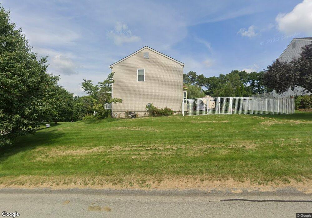
This home is located at 101 Aerie Dr, Irwin, PA 15642 and is currently estimated at $474,000, approximately $176 per square foot. 101 Aerie Dr is a home with nearby schools including Sunset Valley El School, Hillcrest Intermediate School, and Norwin Middle School.
Ownership History
Date
Name
Owned For
Owner Type
Purchase Details
Closed on
Jun 25, 2010
Sold by
Houle Kevin J and Houle Patricia
Bought by
King Curtiss R and King Mariafe L
Current Estimated Value
Home Financials for this Owner
Home Financials are based on the most recent Mortgage that was taken out on this home.
Original Mortgage
$254,900
Interest Rate
4.88%
Mortgage Type
VA
Purchase Details
Closed on
Jun 15, 2001
Sold by
Defelice Michael J and Defelice Geralyn O
Bought by
Zdobinski Edward H and Zdobinski Carrie D
Home Financials for this Owner
Home Financials are based on the most recent Mortgage that was taken out on this home.
Original Mortgage
$198,550
Interest Rate
7.09%
Mortgage Type
Purchase Money Mortgage
Create a Home Valuation Report for This Property
The Home Valuation Report is an in-depth analysis detailing your home's value as well as a comparison with similar homes in the area
Home Values in the Area
Average Home Value in this Area
Purchase History
| Date | Buyer | Sale Price | Title Company |
|---|---|---|---|
| King Curtiss R | $254,900 | None Available | |
| Zdobinski Edward H | $209,000 | -- |
Source: Public Records
Mortgage History
| Date | Status | Borrower | Loan Amount |
|---|---|---|---|
| Closed | King Curtiss R | $254,900 | |
| Previous Owner | Zdobinski Edward H | $198,550 |
Source: Public Records
Tax History Compared to Growth
Tax History
| Year | Tax Paid | Tax Assessment Tax Assessment Total Assessment is a certain percentage of the fair market value that is determined by local assessors to be the total taxable value of land and additions on the property. | Land | Improvement |
|---|---|---|---|---|
| 2025 | $6,066 | $46,070 | $9,220 | $36,850 |
| 2024 | $5,797 | $46,070 | $9,220 | $36,850 |
| 2023 | $5,475 | $46,070 | $9,220 | $36,850 |
| 2022 | $5,429 | $46,070 | $9,220 | $36,850 |
| 2021 | $5,429 | $46,070 | $9,220 | $36,850 |
| 2020 | $5,318 | $46,070 | $9,220 | $36,850 |
| 2019 | $5,185 | $46,070 | $9,220 | $36,850 |
| 2018 | $5,074 | $46,070 | $9,220 | $36,850 |
| 2017 | $4,964 | $46,070 | $9,220 | $36,850 |
| 2016 | $4,768 | $46,070 | $9,220 | $36,850 |
| 2015 | $4,768 | $46,070 | $9,220 | $36,850 |
| 2014 | $4,683 | $46,070 | $9,220 | $36,850 |
Source: Public Records
Map
Nearby Homes
- 1060 Aerie Dr
- 491 Peregrine Dr
- 1766 Ivanhoe Dr
- 1823 Ivanhoe Dr
- 3271 Hawk Dr
- 2217 George St
- 1371 Hemlock Dr
- Lot 13 Clay Pike
- Lot 5 Clay Pike
- 2780 Ipnar Rd
- 5832 Sabato Dr
- 1974 Tara Dr
- 11320 James St
- 2030 Leo St
- 1200 Hahntown Wendel Rd
- 1460 Guffey Rd
- 11740 Dennis Cir
- 10142 Lavonne Dr
- 0 E Route 30 Unit 1694478
- 0 Shaw Jefferson Ave Unit 1715661
- 101 Falcon Ridge Dr
- 1111 Aerie Dr
- 100 Falcon Ridge Dr
- 111 Falcon Ridge Dr
- 1121 Aerie Dr
- 1019 Aerie Dr
- 1090 Aerie Dr
- 1081 Aerie Dr
- 10491 Barnes Lake Rd
- 121 Falcon Ridge Dr
- 300 Talon Dr
- 1080 Aerie Dr
- 1071 Aerie Dr
- 310 Talon Dr
- 1141 Aerie Dr
- 120 Falcon Ridge Dr
- 1070 Aerie Dr
- 131 Falcon Ridge Dr
- 10421 Barnes Lake Rd
- 1061 Aerie Dr