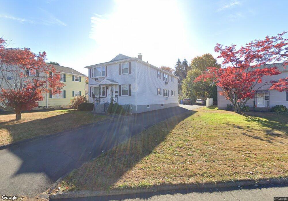
101 Carroll St New Britain, CT 06053
Estimated Value: $368,230 - $492,000
6
Beds
2
Baths
2,704
Sq Ft
$161/Sq Ft
Est. Value
About This Home
This home is located at 101 Carroll St, New Britain, CT 06053 and is currently estimated at $434,558, approximately $160 per square foot. 101 Carroll St is a home located in Hartford County with nearby schools including Holmes School, Pulaski Middle School, and Mountain Laurel Sudbury School.
Ownership History
Date
Name
Owned For
Owner Type
Purchase Details
Closed on
May 11, 2022
Sold by
Catanzaro Caterina
Bought by
Catanzaro Caterina and Fiumara Rita
Current Estimated Value
Purchase Details
Closed on
Aug 2, 2012
Sold by
Ghamo Salvatore and Ghamo Maria
Bought by
Ghamo Joseph M and Ghamo Luciano A
Purchase Details
Closed on
Mar 8, 2010
Sold by
Crispo Natalina A
Bought by
Catanzaro Caterina and Fiumara Rita
Create a Home Valuation Report for This Property
The Home Valuation Report is an in-depth analysis detailing your home's value as well as a comparison with similar homes in the area
Home Values in the Area
Average Home Value in this Area
Purchase History
| Date | Buyer | Sale Price | Title Company |
|---|---|---|---|
| Catanzaro Caterina | -- | None Available | |
| Ghamo Joseph M | -- | -- | |
| Catanzaro Caterina | -- | -- |
Source: Public Records
Mortgage History
| Date | Status | Borrower | Loan Amount |
|---|---|---|---|
| Previous Owner | Catanzaro Caterina | $40,000 |
Source: Public Records
Tax History Compared to Growth
Tax History
| Year | Tax Paid | Tax Assessment Tax Assessment Total Assessment is a certain percentage of the fair market value that is determined by local assessors to be the total taxable value of land and additions on the property. | Land | Improvement |
|---|---|---|---|---|
| 2025 | $8,894 | $227,010 | $73,430 | $153,580 |
| 2024 | $8,987 | $227,010 | $73,430 | $153,580 |
| 2023 | $8,690 | $227,010 | $73,430 | $153,580 |
| 2022 | $7,107 | $143,570 | $33,810 | $109,760 |
| 2021 | $7,107 | $143,570 | $33,810 | $109,760 |
| 2020 | $7,250 | $143,570 | $33,810 | $109,760 |
| 2019 | $7,250 | $143,570 | $33,810 | $109,760 |
| 2018 | $7,250 | $143,570 | $33,810 | $109,760 |
| 2017 | $6,572 | $130,130 | $30,870 | $99,260 |
| 2016 | $6,572 | $130,130 | $30,870 | $99,260 |
| 2015 | $6,376 | $130,130 | $30,870 | $99,260 |
| 2014 | $6,376 | $130,130 | $30,870 | $99,260 |
Source: Public Records
Map
Nearby Homes
- 83 Kim Dr
- 394 Mcclintock St
- 67 Eastwick Rd
- 2453 Corbin Ave
- 34 Hutchinson St
- 258 Eddy Glover Blvd
- 410 Farmington Ave Unit O6
- 51 Tunxis St
- 59 Heather Ln
- 108 Commonwealth Ave
- 34 Oneida St
- 152 Oakland Ave
- 79 Helen Dr
- 187 Miriam Rd
- 335 Commonwealth Ave
- 234 Pierremount Ave
- 34 Dorman Rd
- 910 Farmington Ave
- 95 Pierremount Ave
- 57 Merigold Dr