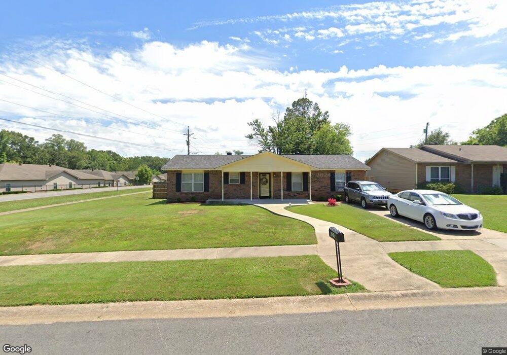
101 Lonsdale Cir Jacksonville, AR 72076
Estimated Value: $109,000 - $144,000
--
Bed
3
Baths
1,288
Sq Ft
$97/Sq Ft
Est. Value
About This Home
This home is located at 101 Lonsdale Cir, Jacksonville, AR 72076 and is currently estimated at $124,822, approximately $96 per square foot. 101 Lonsdale Cir is a home located in Pulaski County with nearby schools including Murrell Taylor Elementary School, Jacksonville Middle School, and Jacksonville High School.
Ownership History
Date
Name
Owned For
Owner Type
Purchase Details
Closed on
Jun 28, 2002
Sold by
Moore James D
Bought by
Perry Felton J
Current Estimated Value
Home Financials for this Owner
Home Financials are based on the most recent Mortgage that was taken out on this home.
Original Mortgage
$47,920
Interest Rate
6.16%
Mortgage Type
Purchase Money Mortgage
Create a Home Valuation Report for This Property
The Home Valuation Report is an in-depth analysis detailing your home's value as well as a comparison with similar homes in the area
Home Values in the Area
Average Home Value in this Area
Purchase History
| Date | Buyer | Sale Price | Title Company |
|---|---|---|---|
| Perry Felton J | $60,000 | -- |
Source: Public Records
Mortgage History
| Date | Status | Borrower | Loan Amount |
|---|---|---|---|
| Closed | Perry Felton J | $47,920 | |
| Closed | Perry Felton J | $11,980 |
Source: Public Records
Tax History Compared to Growth
Tax History
| Year | Tax Paid | Tax Assessment Tax Assessment Total Assessment is a certain percentage of the fair market value that is determined by local assessors to be the total taxable value of land and additions on the property. | Land | Improvement |
|---|---|---|---|---|
| 2025 | $972 | $19,023 | $1,200 | $17,823 |
| 2024 | $781 | $19,023 | $1,200 | $17,823 |
| 2023 | $781 | $19,023 | $1,200 | $17,823 |
| 2022 | $850 | $19,023 | $1,200 | $17,823 |
| 2021 | $810 | $13,190 | $1,600 | $11,590 |
| 2020 | $435 | $13,190 | $1,600 | $11,590 |
| 2019 | $435 | $13,190 | $1,600 | $11,590 |
| 2018 | $460 | $13,190 | $1,600 | $11,590 |
| 2017 | $460 | $13,190 | $1,600 | $11,590 |
| 2016 | $546 | $14,590 | $2,400 | $12,190 |
| 2015 | $785 | $14,590 | $2,400 | $12,190 |
| 2014 | $785 | $14,590 | $2,400 | $12,190 |
Source: Public Records
Map
Nearby Homes
- 219 Lonsdale Cir
- 1404 Southeastern Ave
- 813 Lehman Dr
- 13 Michelle Ln Unit A
- 2209 Old Military Rd
- 2003 Old Military Rd
- 720 Southeastern Ave
- 600 Sorrells Dr
- 1305 Glenn Rd
- 1401 Tamara Park
- 0 S J P Wright Loop Rd
- 1302 King St
- 32 Ross Cir
- 26 Wright Cir
- 910 Ray Rd
- 1110 Wright St
- 419 Church St
- 203 Boston St
- 5821 Arkansas 294
- 221 Pearl St
- 103 Lonsdale Cir
- 100 Briarfield Cove
- 105 Lonsdale Cir
- 102 Briarfield Cove
- 100 Lonsdale Cir
- 104 Briarfield Cove
- 102 Lonsdale Cir
- 107 Lonsdale Cir
- 104 Lonsdale Cir
- 106 Briarfield Cove
- 109 Lonsdale Cir
- 106 Lonsdale Cir
- 108 Briarfield Cove
- 101 Briarfield Cove
- 1811 Corbin St
- 1809 Corbin St
- 108 Lonsdale Cir
- 111 Lonsdale Cir
- 0 Briarfield Cove
- 103 Briarfield Cove