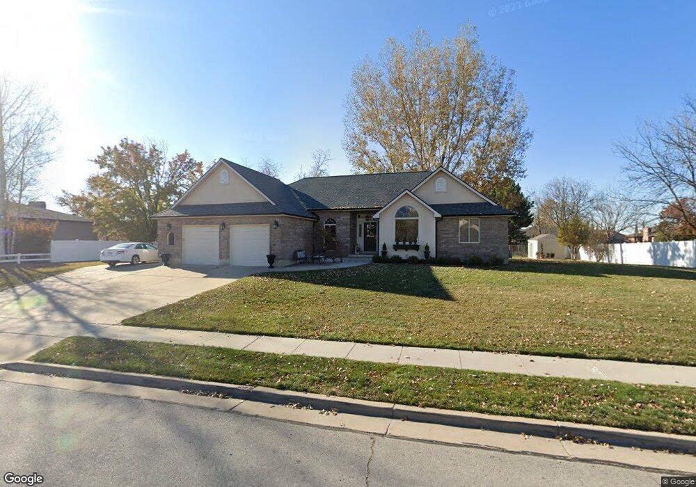
101 N Kays Dr Kaysville, UT 84037
West Kaysville NeighborhoodEstimated Value: $710,000 - $1,067,000
6
Beds
4
Baths
3,578
Sq Ft
$243/Sq Ft
Est. Value
About This Home
This home is located at 101 N Kays Dr, Kaysville, UT 84037 and is currently estimated at $868,237, approximately $242 per square foot. 101 N Kays Dr is a home located in Davis County with nearby schools including Kaysville Elementary School, Farmington High, and Centennial Junior High School.
Ownership History
Date
Name
Owned For
Owner Type
Purchase Details
Closed on
Jan 20, 2011
Sold by
Stevenson Kendall T
Bought by
Stephens Shawn H and Stephens Carol
Current Estimated Value
Home Financials for this Owner
Home Financials are based on the most recent Mortgage that was taken out on this home.
Original Mortgage
$264,000
Outstanding Balance
$178,604
Interest Rate
4.62%
Mortgage Type
New Conventional
Estimated Equity
$689,633
Purchase Details
Closed on
Jul 29, 2009
Sold by
Craig Cecil
Bought by
Kaysville City
Purchase Details
Closed on
Feb 26, 2009
Sold by
Clark Alan L and Clark Sonja C
Bought by
Kaysville City
Purchase Details
Closed on
Feb 18, 2009
Sold by
West Darrell Ray and West Barbara
Bought by
Kaysville City
Purchase Details
Closed on
Sep 1, 2004
Sold by
Stevenson Kendall T and Stevenson Susan W
Bought by
Stevenson Kendall T
Home Financials for this Owner
Home Financials are based on the most recent Mortgage that was taken out on this home.
Original Mortgage
$256,500
Interest Rate
5.92%
Mortgage Type
New Conventional
Create a Home Valuation Report for This Property
The Home Valuation Report is an in-depth analysis detailing your home's value as well as a comparison with similar homes in the area
Home Values in the Area
Average Home Value in this Area
Purchase History
| Date | Buyer | Sale Price | Title Company |
|---|---|---|---|
| Stephens Shawn H | -- | First American Title | |
| Kaysville City | -- | None Available | |
| Kaysville City | -- | None Available | |
| Kaysville City | -- | None Available | |
| Stevenson Kendall T | -- | Security Title Company |
Source: Public Records
Mortgage History
| Date | Status | Borrower | Loan Amount |
|---|---|---|---|
| Open | Stephens Shawn H | $264,000 | |
| Previous Owner | Stevenson Kendall T | $256,500 |
Source: Public Records
Tax History Compared to Growth
Tax History
| Year | Tax Paid | Tax Assessment Tax Assessment Total Assessment is a certain percentage of the fair market value that is determined by local assessors to be the total taxable value of land and additions on the property. | Land | Improvement |
|---|---|---|---|---|
| 2025 | $3,468 | $385,000 | $222,582 | $162,418 |
| 2024 | $3,468 | $365,750 | $212,006 | $153,744 |
| 2023 | $3,454 | $645,000 | $373,351 | $271,649 |
| 2022 | $3,460 | $362,450 | $203,651 | $158,799 |
| 2021 | $3,134 | $492,000 | $245,063 | $246,937 |
| 2020 | $2,825 | $432,000 | $209,995 | $222,005 |
| 2019 | $2,711 | $407,000 | $208,155 | $198,845 |
| 2018 | $2,518 | $377,000 | $176,865 | $200,135 |
| 2016 | $2,377 | $187,055 | $82,474 | $104,581 |
| 2015 | $2,262 | $168,960 | $82,474 | $86,486 |
| 2014 | $2,327 | $176,971 | $66,010 | $110,961 |
| 2013 | -- | $161,335 | $39,557 | $121,778 |
Source: Public Records
Map
Nearby Homes
- 1087 Barnes Dr
- 48 S Flint St
- 1429 W Lincoln Way
- 129 N Mountain Vistas Rd
- 454 S Jay St W
- 917 S Main St Unit H
- 1566 Pheasant Meadow Dr
- 895 S Main St Unit E
- 256 Seemore Dr
- 444 Creekside Way
- 71 S Harvs Ln
- 424 W Creekside Ln
- 1456 Willow Brook Ln
- 203 S Larkin Ln
- 51 N Hayfield Cir
- Trio Plan at The Preserve
- Yalecrest Plan at The Preserve
- Madrigal Plan at The Preserve
- Ballad Plan at The Preserve
- Interlude Plan at The Preserve