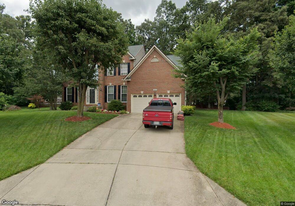
10100 Linford Terrace Lanham, MD 20706
Estimated Value: $567,306 - $750,000
--
Bed
3
Baths
2,629
Sq Ft
$248/Sq Ft
Est. Value
About This Home
This home is located at 10100 Linford Terrace, Lanham, MD 20706 and is currently estimated at $651,327, approximately $247 per square foot. 10100 Linford Terrace is a home located in Prince George's County with nearby schools including Seabrook Elementary School, Thomas Johnson Middle School, and Duval High School.
Ownership History
Date
Name
Owned For
Owner Type
Purchase Details
Closed on
Jan 12, 1995
Sold by
Lovell Regency Homes Lp
Bought by
Wildy Michael J
Current Estimated Value
Home Financials for this Owner
Home Financials are based on the most recent Mortgage that was taken out on this home.
Original Mortgage
$227,800
Interest Rate
9.23%
Purchase Details
Closed on
May 4, 1993
Sold by
Glenn Development Corporation
Bought by
U S Home Corp
Create a Home Valuation Report for This Property
The Home Valuation Report is an in-depth analysis detailing your home's value as well as a comparison with similar homes in the area
Home Values in the Area
Average Home Value in this Area
Purchase History
| Date | Buyer | Sale Price | Title Company |
|---|---|---|---|
| Wildy Michael J | $253,121 | -- | |
| U S Home Corp | $5,115,500 | -- |
Source: Public Records
Mortgage History
| Date | Status | Borrower | Loan Amount |
|---|---|---|---|
| Closed | Wildy Michael J | $227,800 |
Source: Public Records
Tax History Compared to Growth
Tax History
| Year | Tax Paid | Tax Assessment Tax Assessment Total Assessment is a certain percentage of the fair market value that is determined by local assessors to be the total taxable value of land and additions on the property. | Land | Improvement |
|---|---|---|---|---|
| 2025 | $7,641 | $521,567 | -- | -- |
| 2024 | $7,641 | $487,333 | $0 | $0 |
| 2023 | $7,131 | $453,100 | $102,700 | $350,400 |
| 2022 | $6,926 | $439,333 | $0 | $0 |
| 2021 | $6,722 | $425,567 | $0 | $0 |
| 2020 | $6,517 | $411,800 | $81,300 | $330,500 |
| 2019 | $6,115 | $384,733 | $0 | $0 |
| 2018 | $5,713 | $357,667 | $0 | $0 |
| 2017 | $5,779 | $330,600 | $0 | $0 |
| 2016 | -- | $322,100 | $0 | $0 |
| 2015 | $6,173 | $313,600 | $0 | $0 |
| 2014 | $6,173 | $305,100 | $0 | $0 |
Source: Public Records
Map
Nearby Homes
- 5704 Lyngate Ct
- 10004 Enford Ct
- 10300 Ackerly Terrace
- 5802 Shepherd Ln
- 5546 Amber St
- 9807 Locust Ave
- 9603 Woodland Ave
- 9719 Vang Dr
- 5513 Lanteen St
- 0 Franklin St
- 9628 Block St
- 10210 Poplar St
- 6107 Wood Pointe Dr
- 5110 Baltimore Ln
- 6203 Wood Pointe Dr
- 9912 Ridge St
- 9911 Ridge St
- 10811 Electric Ave
- 9910 Locust St
- 0 Bell (Total of Five (5) Lots) Rd Unit MDPG2150980
- 10102 Linford Terrace
- 10101 Linford Terrace
- 10119 Ellard Dr
- 10117 Ellard Dr
- 10121 Ellard Dr
- 5702 Lyngate Ct
- 10103 Linford Terrace
- 10113 Ellard Dr
- 10123 Ellard Dr
- 5700 Lyngate Ct
- 5706 Lyngate Ct
- 10105 Linford Terrace
- 10109 Ellard Dr
- 10125 Ellard Dr
- 10002 Enford Ct
- 10120 Ellard Dr
- 10118 Ellard Dr
- 10122 Ellard Dr
- 10127 Ellard Dr