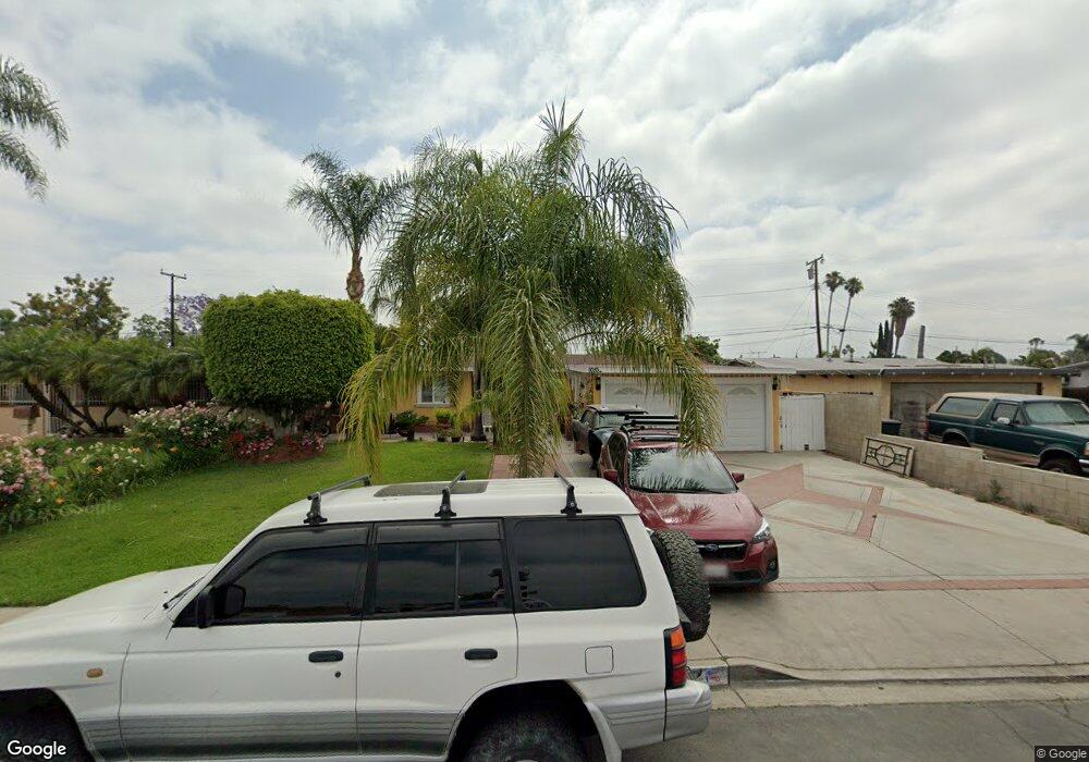
10102 Perdido St Anaheim, CA 92804
West Anaheim NeighborhoodEstimated Value: $902,000 - $938,000
4
Beds
2
Baths
1,435
Sq Ft
$644/Sq Ft
Est. Value
About This Home
This home is located at 10102 Perdido St, Anaheim, CA 92804 and is currently estimated at $924,607, approximately $644 per square foot. 10102 Perdido St is a home located in Orange County with nearby schools including Walt Disney Elementary School, Dale Jr High School, and Magnolia High.
Ownership History
Date
Name
Owned For
Owner Type
Purchase Details
Closed on
Jul 24, 2025
Sold by
Sandoval Susana and Marquez Susana Sandoval
Bought by
Sandoval Family Trust and Marquez
Current Estimated Value
Purchase Details
Closed on
Apr 17, 2002
Sold by
Pinedo Raul
Bought by
Sandoval Susana
Purchase Details
Closed on
May 30, 2000
Sold by
Raymond Shafer Mark
Bought by
Sandoval Susana
Home Financials for this Owner
Home Financials are based on the most recent Mortgage that was taken out on this home.
Original Mortgage
$164,700
Interest Rate
8.63%
Purchase Details
Closed on
Oct 6, 1998
Sold by
Shafer Jennie A
Bought by
Shafer Mark Raymond
Home Financials for this Owner
Home Financials are based on the most recent Mortgage that was taken out on this home.
Original Mortgage
$113,000
Interest Rate
6.71%
Mortgage Type
Stand Alone First
Create a Home Valuation Report for This Property
The Home Valuation Report is an in-depth analysis detailing your home's value as well as a comparison with similar homes in the area
Home Values in the Area
Average Home Value in this Area
Purchase History
| Date | Buyer | Sale Price | Title Company |
|---|---|---|---|
| Sandoval Family Trust | -- | None Listed On Document | |
| Sandoval Susana | -- | -- | |
| Sandoval Susana | $183,000 | Stewart Title | |
| Shafer Mark Raymond | -- | Gateway Title Company |
Source: Public Records
Mortgage History
| Date | Status | Borrower | Loan Amount |
|---|---|---|---|
| Previous Owner | Sandoval Susana | $164,700 | |
| Previous Owner | Shafer Mark Raymond | $113,000 |
Source: Public Records
Tax History Compared to Growth
Tax History
| Year | Tax Paid | Tax Assessment Tax Assessment Total Assessment is a certain percentage of the fair market value that is determined by local assessors to be the total taxable value of land and additions on the property. | Land | Improvement |
|---|---|---|---|---|
| 2025 | $3,858 | $322,059 | $210,752 | $111,307 |
| 2024 | $3,858 | $315,745 | $206,620 | $109,125 |
| 2023 | $3,771 | $309,554 | $202,568 | $106,986 |
| 2022 | $3,752 | $303,485 | $198,596 | $104,889 |
| 2021 | $3,702 | $297,535 | $194,702 | $102,833 |
| 2020 | $3,681 | $294,485 | $192,706 | $101,779 |
| 2019 | $3,600 | $288,711 | $188,927 | $99,784 |
| 2018 | $3,537 | $283,050 | $185,222 | $97,828 |
| 2017 | $3,418 | $277,500 | $181,590 | $95,910 |
| 2016 | $3,402 | $272,059 | $178,029 | $94,030 |
| 2015 | $2,952 | $229,434 | $175,355 | $54,079 |
| 2014 | $2,822 | $224,940 | $171,920 | $53,020 |
Source: Public Records
Map
Nearby Homes
- 10301 Antigua St
- 10301 Rhiems Rd
- 998 S Crossbow Ln Unit 12D
- 994 S Sutter Creek Rd Unit 60
- 958 S Crossbow Ln Unit 8
- 938 S Sutter Creek Rd Unit 54
- 917 S Sutter Creek Rd Unit 46
- 1250 S Brookhurst St Unit 1059
- 1250 S Brookhurst St Unit 2028
- 1250 S Brookhurst St Unit 2080
- 1250 S Brookhurst St
- 1250 S Brookhurst St Unit 2033
- 1350 S Ashington Ln
- 927 S Webster Ave
- 9272 Cerritos Ave
- 2131 W Niobe Ave
- 2217 W Orange Ave
- 2217 W Orange Ave Unit 18
- 2211 W Orange Ave
- 2211 W Orange Ave Unit 23
- 10092 Perdido St
- 10112 Perdido St
- 10101 Antigua St
- 10122 Perdido St
- 10072 Perdido St
- 10111 Antigua St
- 10091 Antigua St
- 10121 Antigua St
- 10071 Antigua St
- 10101 Perdido St
- 10132 Perdido St
- 10091 Perdido St
- 10111 Perdido St
- 10071 Perdido St
- 10131 Antigua St
- 10121 Perdido St
- 10142 Perdido St
- 10052 Perdido St
- 10141 Antigua St
- 10131 Perdido St