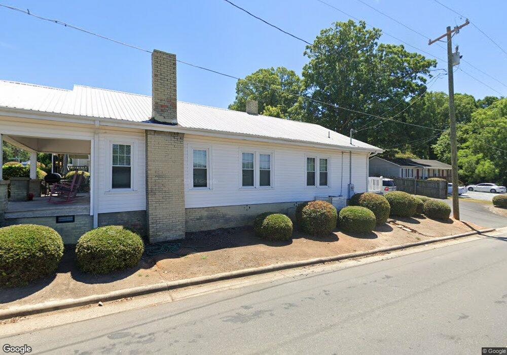
1011 Sunset Ave Asheboro, NC 27203
Estimated Value: $112,953 - $183,000
--
Bed
1
Bath
1,418
Sq Ft
$105/Sq Ft
Est. Value
About This Home
This home is located at 1011 Sunset Ave, Asheboro, NC 27203 and is currently estimated at $148,738, approximately $104 per square foot. 1011 Sunset Ave is a home located in Randolph County with nearby schools including Donna L. Loflin Elementary School, South Asheboro Middle School, and Asheboro High School.
Ownership History
Date
Name
Owned For
Owner Type
Purchase Details
Closed on
Sep 7, 2006
Sold by
Griffin Cornelius
Bought by
Griffin Cornelius and Griffin Julia Y
Current Estimated Value
Purchase Details
Closed on
Jul 6, 2005
Sold by
Schwarz Properties Llc
Bought by
Griffin Cornelius
Home Financials for this Owner
Home Financials are based on the most recent Mortgage that was taken out on this home.
Original Mortgage
$43,125
Outstanding Balance
$22,238
Interest Rate
5.57%
Mortgage Type
Fannie Mae Freddie Mac
Estimated Equity
$126,500
Purchase Details
Closed on
Aug 27, 2003
Bought by
Griffin Cornelius Iii Griffin Jul
Create a Home Valuation Report for This Property
The Home Valuation Report is an in-depth analysis detailing your home's value as well as a comparison with similar homes in the area
Home Values in the Area
Average Home Value in this Area
Purchase History
| Date | Buyer | Sale Price | Title Company |
|---|---|---|---|
| Griffin Cornelius | -- | None Available | |
| Griffin Cornelius | $58,000 | -- | |
| Griffin Cornelius Iii Griffin Jul | $35,000 | -- |
Source: Public Records
Mortgage History
| Date | Status | Borrower | Loan Amount |
|---|---|---|---|
| Open | Griffin Cornelius | $43,125 |
Source: Public Records
Tax History Compared to Growth
Tax History
| Year | Tax Paid | Tax Assessment Tax Assessment Total Assessment is a certain percentage of the fair market value that is determined by local assessors to be the total taxable value of land and additions on the property. | Land | Improvement |
|---|---|---|---|---|
| 2025 | $947 | $71,420 | $32,080 | $39,340 |
| 2024 | $947 | $71,420 | $32,080 | $39,340 |
| 2023 | $947 | $71,420 | $32,080 | $39,340 |
| 2022 | $848 | $58,850 | $32,080 | $26,770 |
| 2021 | $848 | $58,850 | $32,080 | $26,770 |
| 2020 | $848 | $58,850 | $32,080 | $26,770 |
| 2019 | $848 | $58,850 | $32,080 | $26,770 |
| 2018 | $807 | $54,970 | $32,080 | $22,890 |
| 2016 | $807 | $54,967 | $32,080 | $22,887 |
| 2015 | $808 | $54,967 | $32,080 | $22,887 |
| 2014 | -- | $54,967 | $32,080 | $22,887 |
Source: Public Records
Map
Nearby Homes
- 830 Sunset Ave
- 135 West St
- 711 Sunset Ave Unit E
- 401 Uwharrie St
- 1263 Winslow Ave Unit A, B & C
- 612 Sunset Ave Unit 6
- 923 Arnold St
- 135 Dixon St
- 617 Uwharrie St Unit N
- 631 W Kivett St
- 806 Windermere Ct
- 627 Lee St
- 435 Peachtree St
- 828 Windermere Ct
- 516 and 518 Peachtree St
- 855 Lee St
- 737 Britt Ave
- 627 Oakmont Dr
- TBD Oakland Ave
- 330 W Presnell St Unit 37
- 1007 Sunset Ave
- 1003 Sunset Ave
- 115 Farmer Rd
- 1001 Sunset Ave
- 118 Spring Garden St
- 1029 Sunset Ave
- 1006 Sunset Ave
- 124 Spring Garden St
- 929 Sunset Ave
- 122 Farmer Rd
- 928 Sunset Ave
- 128 Spring Garden St
- 121 Spring Garden St
- 923 Sunset Ave
- 132 Spring Garden St
- 125 Spring Garden St
- 138 Farmer Rd
- 915 Sunset Ave
- 133 Farmer Rd
- 129 Spring Garden St