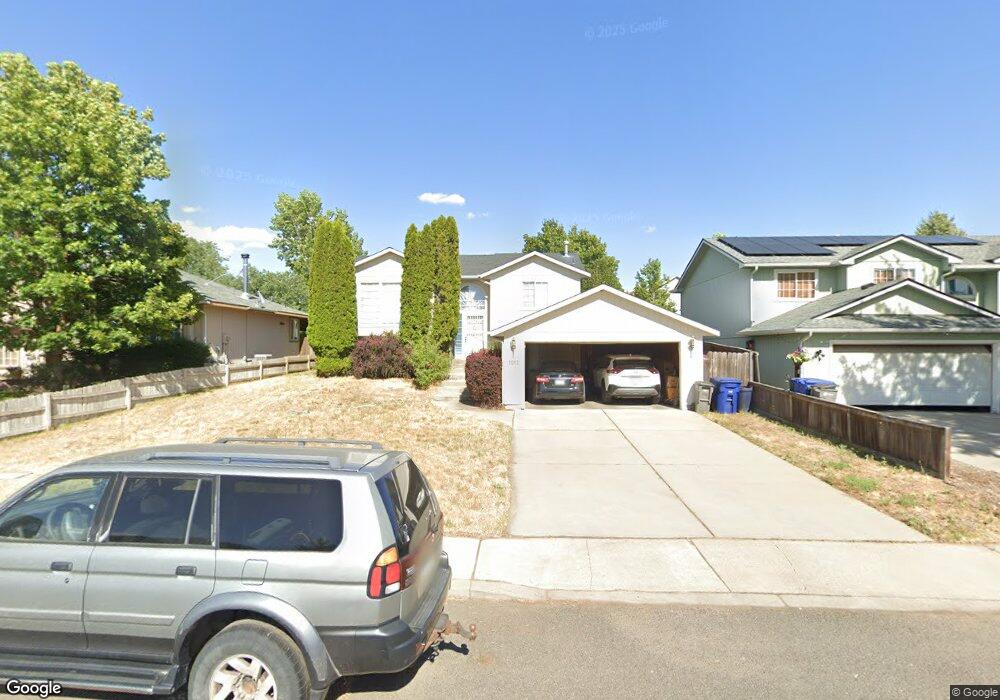
1012 N Lindsay St Medical Lake, WA 99022
Estimated Value: $371,354 - $431,000
2
Beds
1
Bath
1,260
Sq Ft
$316/Sq Ft
Est. Value
About This Home
This home is located at 1012 N Lindsay St, Medical Lake, WA 99022 and is currently estimated at $397,839, approximately $315 per square foot. 1012 N Lindsay St is a home located in Spokane County with nearby schools including Medical Lake High School.
Ownership History
Date
Name
Owned For
Owner Type
Purchase Details
Closed on
May 2, 2001
Sold by
Condron Construction Inc
Bought by
Clemence Dan R and Clemence Josephine
Current Estimated Value
Home Financials for this Owner
Home Financials are based on the most recent Mortgage that was taken out on this home.
Original Mortgage
$119,085
Outstanding Balance
$44,005
Interest Rate
6.89%
Mortgage Type
VA
Estimated Equity
$353,834
Create a Home Valuation Report for This Property
The Home Valuation Report is an in-depth analysis detailing your home's value as well as a comparison with similar homes in the area
Home Values in the Area
Average Home Value in this Area
Purchase History
| Date | Buyer | Sale Price | Title Company |
|---|---|---|---|
| Clemence Dan R | $116,749 | Pacific Nw Title |
Source: Public Records
Mortgage History
| Date | Status | Borrower | Loan Amount |
|---|---|---|---|
| Open | Clemence Dan R | $119,085 |
Source: Public Records
Tax History Compared to Growth
Tax History
| Year | Tax Paid | Tax Assessment Tax Assessment Total Assessment is a certain percentage of the fair market value that is determined by local assessors to be the total taxable value of land and additions on the property. | Land | Improvement |
|---|---|---|---|---|
| 2025 | $2,897 | $311,400 | $80,000 | $231,400 |
| 2024 | $2,897 | $310,300 | $80,000 | $230,300 |
| 2023 | $2,543 | $313,900 | $75,000 | $238,900 |
| 2022 | $2,472 | $302,400 | $60,000 | $242,400 |
| 2021 | $2,315 | $212,800 | $40,000 | $172,800 |
| 2020 | $1,946 | $185,700 | $35,000 | $150,700 |
| 2019 | $1,778 | $170,200 | $35,000 | $135,200 |
| 2018 | $1,774 | $156,700 | $35,000 | $121,700 |
| 2017 | $1,608 | $146,100 | $35,000 | $111,100 |
| 2016 | $1,639 | $143,000 | $35,000 | $108,000 |
| 2015 | $1,547 | $130,500 | $25,000 | $105,500 |
| 2014 | -- | $134,300 | $25,000 | $109,300 |
| 2013 | -- | $0 | $0 | $0 |
Source: Public Records
Map
Nearby Homes
- 1027 N Stanley St
- 730 E Kathy Lee Ave
- 931 N Stanley St
- 805 E Justin Ave S
- 614 N Grant Ave
- 7709 S Keene Rd
- xxx W Brooks Rd
- 403 N Jefferson St
- 18307 W Barker Rd
- 716 W 6th St
- XXX W Thorpe Ave
- 12000 S Meadow Rd Unit approx address
- 122 E Lake St
- 1212 S Brooks Rd
- 1228 E Lake St
- 500 E Campbell St Unit 35
- 204 E Campbell St
- 423 S Brower St
- 520 S Stanley St
- 522 S Stanley St
- 1014 N Lindsay St
- 1010 N Lindsay St
- 1011 N Christopher St
- 1016 N Lindsay St
- 1008 N Lindsay St
- 1009 N Christopher St
- 1013 N Christopher St
- 1015 N Lindsay St
- 1015 N Christopher St
- 1018 N Lindsay St
- 1013 N Lindsay St
- 1007 N Christopher St
- 1011 N Lindsay St
- 1009 N Lindsay St
- 1005 N Christopher St
- 1017 N Christopher St
- 1017 N Lindsay St
- 1003 N Christopher St
- 1020 N Lindsay St
- 1019 N Lindsay St