Estimated Value: $306,000 - $504,685
--
Bed
1
Bath
1,579
Sq Ft
$264/Sq Ft
Est. Value
About This Home
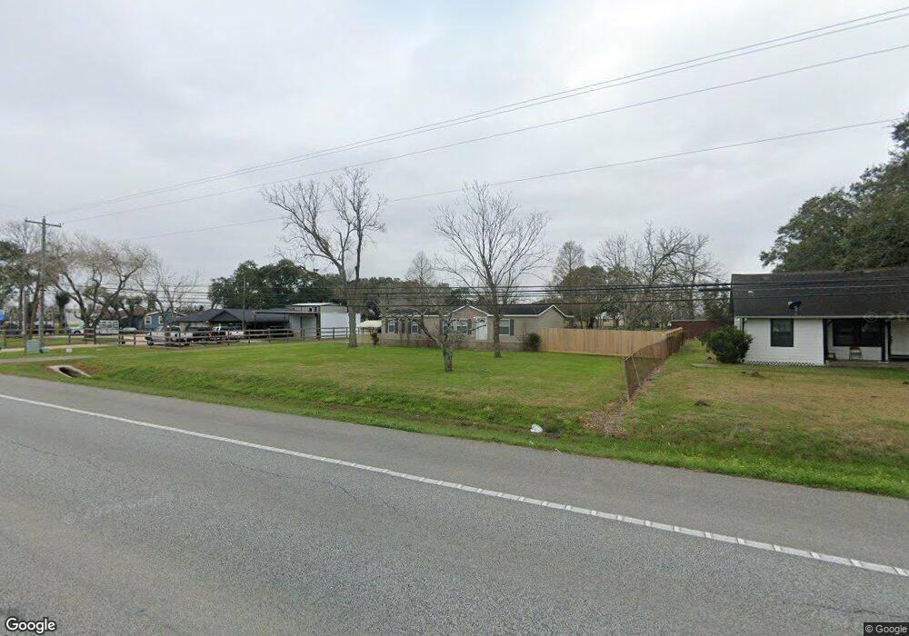
This home is located at 1013 Fm 517 Rd, Alvin, TX 77511 and is currently estimated at $416,562, approximately $263 per square foot. 1013 Fm 517 Rd is a home located in Brazoria County with nearby schools including G.W. Harby Junior High School, Alvin High School, and Living Stones Christian School.
Ownership History
Date
Name
Owned For
Owner Type
Purchase Details
Closed on
Jun 20, 2024
Sold by
Bryant Kristy Lynn and Bonilla Oscar
Bought by
Bryant Kristy Lynn and Bonilla Oscar
Current Estimated Value
Purchase Details
Closed on
Jun 26, 2023
Sold by
Bryant Kristy Lynn and Bryant Oscar
Bought by
Bonilla Oscar and Bryant Kelly W
Purchase Details
Closed on
Dec 14, 2016
Sold by
Schmidt Linda Bryant
Bought by
Leleu Stephen L and Leleu Tiffany
Purchase Details
Closed on
Mar 14, 2012
Sold by
Bryant Kenneth and Bryant Joy Cecil
Bought by
Schmidt Linda Bryant
Create a Home Valuation Report for This Property
The Home Valuation Report is an in-depth analysis detailing your home's value as well as a comparison with similar homes in the area
Home Values in the Area
Average Home Value in this Area
Purchase History
| Date | Buyer | Sale Price | Title Company |
|---|---|---|---|
| Bryant Kristy Lynn | -- | Great American Title | |
| Bonilla Oscar | -- | None Listed On Document | |
| Bryant Judy | -- | None Listed On Document | |
| Leleu Stephen L | -- | None Available | |
| Schmidt Linda Bryant | -- | None Available |
Source: Public Records
Tax History Compared to Growth
Tax History
| Year | Tax Paid | Tax Assessment Tax Assessment Total Assessment is a certain percentage of the fair market value that is determined by local assessors to be the total taxable value of land and additions on the property. | Land | Improvement |
|---|---|---|---|---|
| 2025 | $4,073 | $386,829 | $319,600 | $201,960 |
| 2023 | $4,073 | $541,110 | $383,520 | $157,590 |
| 2022 | $8,226 | $386,090 | $335,580 | $50,510 |
| 2021 | $5,035 | $226,880 | $147,370 | $79,510 |
| 2020 | $4,963 | $220,710 | $136,040 | $84,670 |
| 2019 | $2,927 | $126,450 | $35,090 | $91,360 |
| 2018 | $3,047 | $131,270 | $42,110 | $89,160 |
| 2017 | $2,889 | $122,960 | $42,120 | $80,840 |
| 2016 | $2,816 | $122,960 | $42,120 | $80,840 |
| 2015 | $1,210 | $108,730 | $35,090 | $73,640 |
| 2014 | $1,210 | $109,440 | $29,770 | $79,670 |
Source: Public Records
Map
Nearby Homes
- 860 Farm To Market Road 517
- 609 County Road 351 Beers
- 1176 Fm 517 Rd
- 691 County Road 351
- 2702 Silver Maple Dr
- 2112 Washington Ave
- 1483 E Highway 6
- 2126 County Road 367
- 2002 E Highway 6
- 3373 E Highway 6
- 3150 E Highway 6
- 3610 E Highway 6
- 1300 Dickinson Rd
- 1018 Bluegill Ln
- 4140 E Highway 6
- 1021 Bluegill Dr
- 1016 Bluegill Dr
- 1024 Bluegill Ln
- Estero Plan at Watermark
- Franklin Plan at Watermark
- 1005 Fm 517 Rd
- 1029 Fm 517 Rd
- 1006 Fm 517 Rd Unit H
- 1006 Fm 517 Rd Unit F
- 1006 Fm 517 Rd
- 522 County Road 351
- 473 County Road 545
- 1046 Fm 517 Rd
- 1030 Fm 517 Rd
- 524 County Road 351
- 468 County Road 545
- 451 County Road 545
- 535 County Road 351
- 1080 Fm 517 Rd
- 541 County Road 351
- 541 County Road 906
- 447 County Road 545
- 467 County Road 545
- 436 County Road 545
- 568 County Road 351