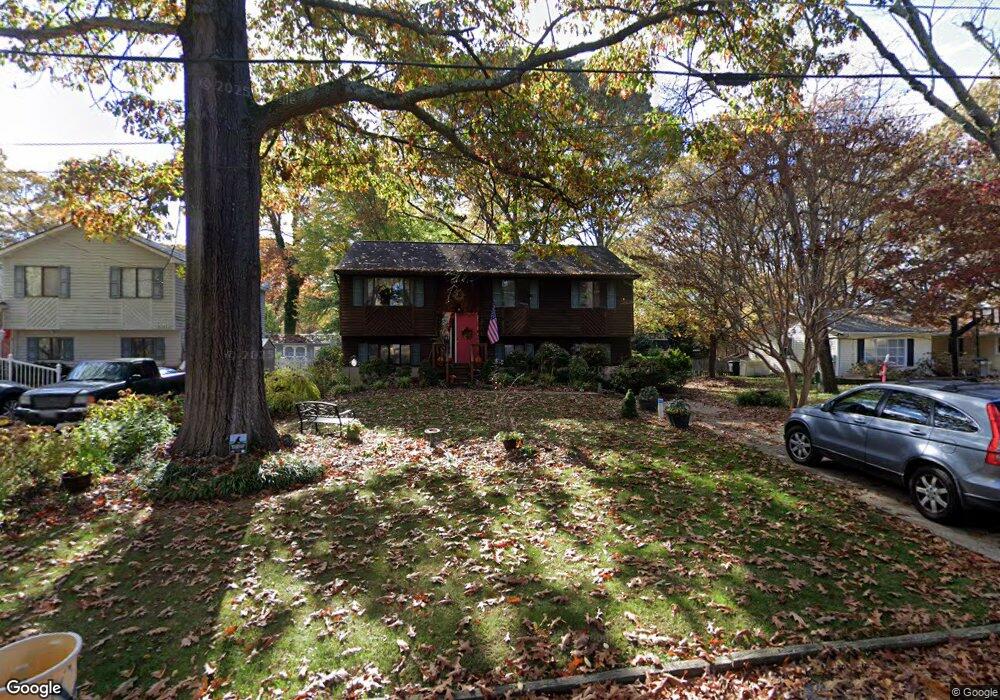
1013 Mount Holly Dr Annapolis, MD 21409
Cape Saint Claire NeighborhoodEstimated Value: $424,422 - $540,000
--
Bed
2
Baths
1,034
Sq Ft
$470/Sq Ft
Est. Value
About This Home
This home is located at 1013 Mount Holly Dr, Annapolis, MD 21409 and is currently estimated at $486,106, approximately $470 per square foot. 1013 Mount Holly Dr is a home located in Anne Arundel County with nearby schools including Cape St. Claire Elementary School, Magothy River Middle School, and Broadneck High School.
Ownership History
Date
Name
Owned For
Owner Type
Purchase Details
Closed on
Sep 17, 2025
Sold by
Mcdiarmid Scott Edmund and Sullivan-Mcdiarmid Eileen Ann
Bought by
Scott Edmund Mcdiarmid Revocable Trust and Eileen Ann Sullivan-Mcdiarmid Revocable Trust
Current Estimated Value
Purchase Details
Closed on
Nov 4, 2022
Sold by
Sullivan Barbara J
Bought by
Sullivan Anne Megan
Create a Home Valuation Report for This Property
The Home Valuation Report is an in-depth analysis detailing your home's value as well as a comparison with similar homes in the area
Home Values in the Area
Average Home Value in this Area
Purchase History
| Date | Buyer | Sale Price | Title Company |
|---|---|---|---|
| Scott Edmund Mcdiarmid Revocable Trust | -- | None Listed On Document | |
| Sullivan-Mcdiarmid Eileen Ann | -- | None Listed On Document | |
| Sullivan Anne Megan | -- | -- |
Source: Public Records
Tax History Compared to Growth
Tax History
| Year | Tax Paid | Tax Assessment Tax Assessment Total Assessment is a certain percentage of the fair market value that is determined by local assessors to be the total taxable value of land and additions on the property. | Land | Improvement |
|---|---|---|---|---|
| 2025 | $4,734 | $378,233 | -- | -- |
| 2024 | $4,734 | $361,700 | $230,000 | $131,700 |
| 2023 | $4,566 | $355,500 | $0 | $0 |
| 2022 | $4,280 | $349,300 | $0 | $0 |
| 2021 | $0 | $343,100 | $230,000 | $113,100 |
| 2020 | $4,034 | $329,967 | $0 | $0 |
| 2019 | $3,894 | $316,833 | $0 | $0 |
| 2018 | $3,080 | $303,700 | $186,200 | $117,500 |
| 2017 | $3,505 | $289,200 | $0 | $0 |
| 2016 | -- | $274,700 | $0 | $0 |
| 2015 | -- | $260,200 | $0 | $0 |
| 2014 | -- | $260,200 | $0 | $0 |
Source: Public Records
Map
Nearby Homes
- 1217 Hampton Rd
- 1219 Hampton Rd
- 1023 Mountain Top Dr
- 1044 Skyview Dr
- 1014 St Charles Dr
- 1160 Skyview Dr
- 1162 Saint George Dr
- 971 Saint Margarets Dr
- 1031 Lake Claire Dr
- 1094 Linden Tree Drive - Taft Model
- 1096
- 1062 Broadview Dr
- 810 Chestnut Tree Dr
- 1366 Almond Dr
- 1199 Ramblewood Dr
- 1576 Bay Head Rd
- 621 Snow Goose Ln
- 1214 Ramblewood Dr
- 1181 Ramblewood Dr
- 1247 Ramblewood Dr
- 1015 Mount Holly Dr
- 1011 Mount Holly Dr
- 1017 Mount Holly Dr
- 1006 Mount Holly Dr
- 892 Chestnut Tree Dr
- 896 Chestnut Tree Dr
- 1010 Mount Holly Dr
- 898 Chestnut Tree Dr
- 890 Chestnut Tree Dr
- 1019 Mount Holly Dr
- Lot 7 Mount Holly Drive - Taft Model
- 888 Chestnut Tree Dr
- 1208 Hilltop Dr
- 1014 Mount Holly Dr
- Mount Holly Dr
- 1013 Mountain Top Dr
- 1004 Mount Holly Dr
- 886 Chestnut Tree Dr
- 1210 Hilltop Dr
- 1003 Mount Holly Dr