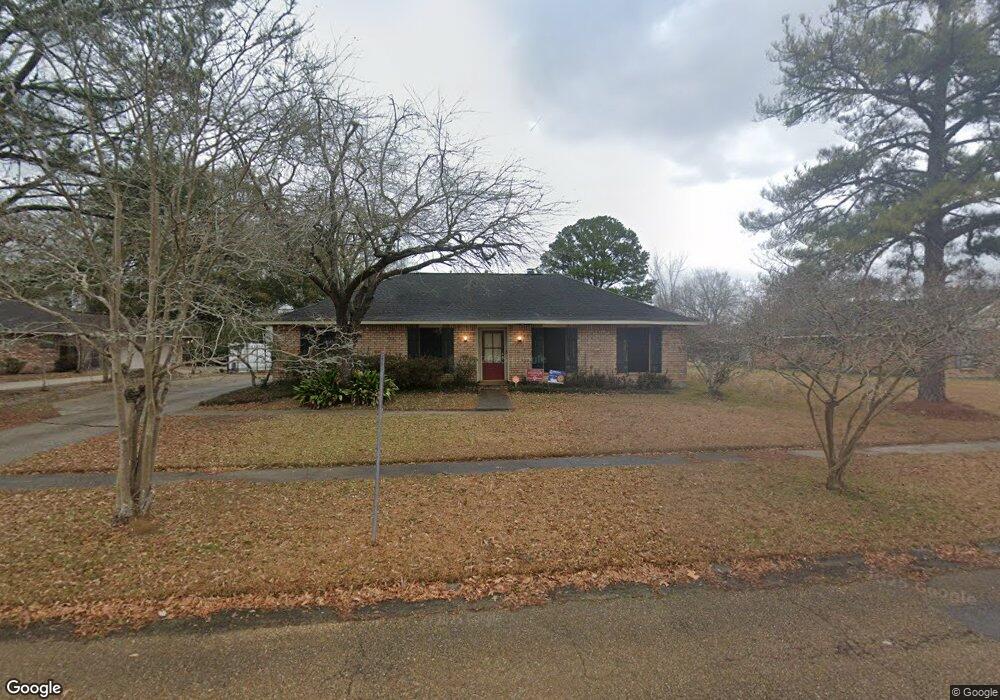
10142 W Brookside Dr Baton Rouge, LA 70818
Estimated Value: $232,000 - $326,000
3
Beds
2
Baths
1,862
Sq Ft
$146/Sq Ft
Est. Value
About This Home
This home is located at 10142 W Brookside Dr, Baton Rouge, LA 70818 and is currently estimated at $271,090, approximately $145 per square foot. 10142 W Brookside Dr is a home located in East Baton Rouge Parish with nearby schools including Bellingrath Hills Elementary School, Central Intermediate School, and Tanglewood Elementary School.
Ownership History
Date
Name
Owned For
Owner Type
Purchase Details
Closed on
Oct 31, 2016
Sold by
Guilbeau Wilfred M and Guilbeau Melissa Minton
Bought by
Sandifer Randall Scott and Sandifer Susan Valentine
Current Estimated Value
Home Financials for this Owner
Home Financials are based on the most recent Mortgage that was taken out on this home.
Original Mortgage
$152,000
Outstanding Balance
$122,260
Interest Rate
3.48%
Mortgage Type
Future Advance Clause Open End Mortgage
Estimated Equity
$148,830
Create a Home Valuation Report for This Property
The Home Valuation Report is an in-depth analysis detailing your home's value as well as a comparison with similar homes in the area
Home Values in the Area
Average Home Value in this Area
Purchase History
| Date | Buyer | Sale Price | Title Company |
|---|---|---|---|
| Sandifer Randall Scott | $190,000 | None Available |
Source: Public Records
Mortgage History
| Date | Status | Borrower | Loan Amount |
|---|---|---|---|
| Open | Sandifer Randall Scott | $152,000 |
Source: Public Records
Tax History Compared to Growth
Tax History
| Year | Tax Paid | Tax Assessment Tax Assessment Total Assessment is a certain percentage of the fair market value that is determined by local assessors to be the total taxable value of land and additions on the property. | Land | Improvement |
|---|---|---|---|---|
| 2024 | $2,107 | $23,875 | $2,000 | $21,875 |
| 2023 | $2,107 | $21,010 | $2,000 | $19,010 |
| 2022 | $2,807 | $21,010 | $2,000 | $19,010 |
| 2021 | $2,807 | $21,010 | $2,000 | $19,010 |
| 2020 | $2,754 | $21,010 | $2,000 | $19,010 |
| 2019 | $2,567 | $19,000 | $2,000 | $17,000 |
| 2018 | $2,539 | $19,000 | $2,000 | $17,000 |
| 2017 | $2,539 | $19,000 | $2,000 | $17,000 |
| 2016 | $1,406 | $18,150 | $1,500 | $16,650 |
| 2015 | $1,231 | $16,600 | $1,500 | $15,100 |
| 2014 | $1,188 | $16,600 | $1,500 | $15,100 |
| 2013 | -- | $16,600 | $1,500 | $15,100 |
Source: Public Records
Map
Nearby Homes
- 14932 & 14934 Forest Grove Ave
- Lot A-1-E Wax Rd
- 14921 & 14923 Central Woods Ave
- 9823 Banway Dr
- TBD Banway Dr
- 9532 Sullivan Rd
- 9512 Overwood Dr
- 10213 Alderman Dr
- 13013 N Vieux Carre Cir
- 17468 Wax Rd
- 17486 Wax Rd
- 14045 Grand Settlement Blvd
- 9986 Couret Dr
- 9976 Couret Dr
- 13985 Highgrove Ave
- 13952 Grand Settlement Blvd
- 13975 Highgrove Ave
- 11115 Sullivan Rd
- 11116 Sullivan Rd
- 8600 Sullivan Rd
- 10132 W Brookside Dr
- 10214 W Brookside Dr
- 10133 W Brookside Dr
- 10122 W Brookside Dr
- 10224 W Brookside Dr
- 10215 W Brookside Dr
- 15050 Jenson Ave
- 10234 W Brookside Dr
- 15071 Roanoke Ave
- 10225 W Brookside Dr
- 10112 W Brookside Dr
- 15061 Roanoke Ave
- 10235 W Brookside Dr
- 15040 Jenson Ave
- 10314 W Brookside Dr
- 15051 Roanoke Ave
- 10207 E Brookside Dr
- 15055 Jenson Ave
- 10143 E Brookside Dr
- 10219 E Brookside Dr