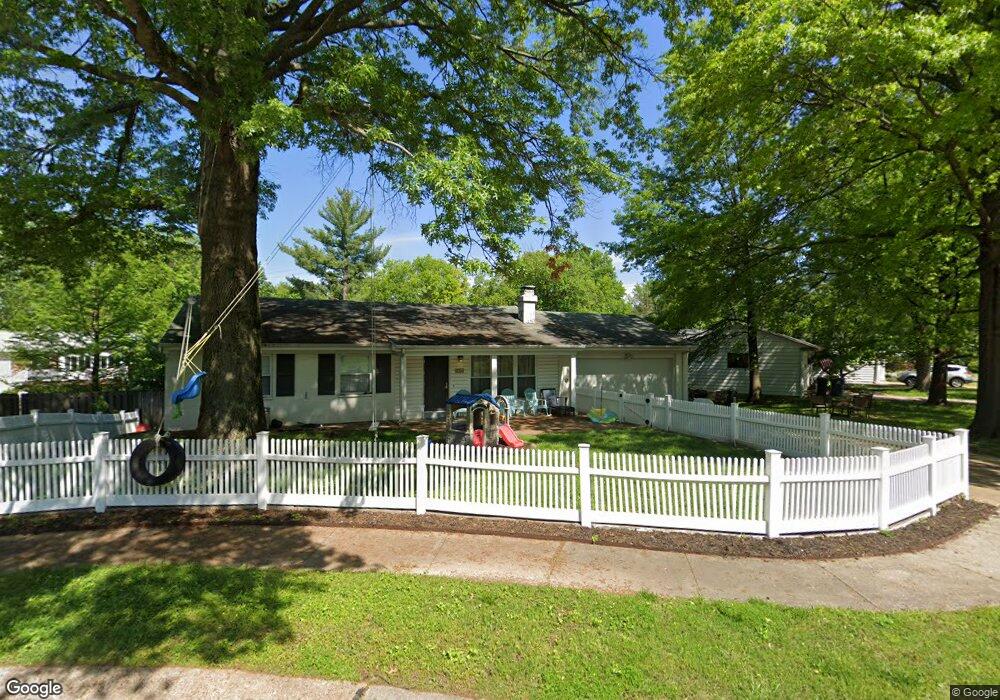
1015 Danworth Ct Saint Louis, MO 63122
Estimated Value: $366,000 - $399,205
3
Beds
2
Baths
1,290
Sq Ft
$295/Sq Ft
Est. Value
About This Home
This home is located at 1015 Danworth Ct, Saint Louis, MO 63122 and is currently estimated at $380,551, approximately $295 per square foot. 1015 Danworth Ct is a home located in St. Louis County with nearby schools including George R. Robinson Elementary School, Nipher Middle School, and Kirkwood Senior High School.
Ownership History
Date
Name
Owned For
Owner Type
Purchase Details
Closed on
Aug 4, 2006
Sold by
Sokoloski Audrey Z
Bought by
Frillman William P and Frillman Amy N
Current Estimated Value
Home Financials for this Owner
Home Financials are based on the most recent Mortgage that was taken out on this home.
Original Mortgage
$183,500
Interest Rate
6.66%
Mortgage Type
FHA
Create a Home Valuation Report for This Property
The Home Valuation Report is an in-depth analysis detailing your home's value as well as a comparison with similar homes in the area
Home Values in the Area
Average Home Value in this Area
Purchase History
| Date | Buyer | Sale Price | Title Company |
|---|---|---|---|
| Frillman William P | -- | None Available | |
| Frillman William P | $185,000 | Ust |
Source: Public Records
Mortgage History
| Date | Status | Borrower | Loan Amount |
|---|---|---|---|
| Previous Owner | Frillman William P | $183,500 |
Source: Public Records
Tax History Compared to Growth
Tax History
| Year | Tax Paid | Tax Assessment Tax Assessment Total Assessment is a certain percentage of the fair market value that is determined by local assessors to be the total taxable value of land and additions on the property. | Land | Improvement |
|---|---|---|---|---|
| 2025 | $4,043 | $67,320 | $66,140 | $1,180 |
| 2024 | $4,043 | $64,370 | $42,520 | $21,850 |
| 2023 | $3,980 | $64,370 | $42,520 | $21,850 |
| 2022 | $3,511 | $48,920 | $37,790 | $11,130 |
| 2021 | $3,176 | $48,920 | $37,790 | $11,130 |
| 2020 | $3,074 | $45,530 | $28,030 | $17,500 |
| 2019 | $3,106 | $45,530 | $28,030 | $17,500 |
| 2018 | $3,287 | $42,580 | $22,670 | $19,910 |
| 2017 | $3,283 | $42,580 | $22,670 | $19,910 |
| 2016 | $2,766 | $36,100 | $18,890 | $17,210 |
| 2015 | $2,762 | $36,100 | $18,890 | $17,210 |
| 2014 | $2,824 | $36,110 | $9,030 | $27,080 |
Source: Public Records
Map
Nearby Homes
- 1011 Brooksgate Manor Dr
- 1074 Brooksgate Manor Dr
- 303 Danworth Ct
- 222 Charmers Ct Unit 222
- 10835 Big Bend Rd
- 1211 S Geyer Rd
- 1053 Geyer Grove Unit 9
- 420 W Rose Hill Ave
- 1 Boxwood Ln
- 558 S Geyer Rd
- 1016 Forest Ave
- 717 Mclain Ln
- 517 S Harrison Ave
- 630 Candleberry Ct Unit D
- 506 Coverdale Ln
- 202 Commerce Ave
- 1264 Wilton Ln
- 489 S Clay Ave
- 119 Monica Dr
- 301 Memphis St
- 1007 Danworth Ct
- 1021 Danworth Ct
- 1016 Maeville Dr
- 1001 Danworth Ct
- 1008 Maeville Dr
- 1016 Danworth Ct
- 1027 Danworth Ct
- 10944 Big Bend Rd
- 1028 Danworth Ct
- 1022 Maeville Dr
- 1022 Danworth Ct
- 328 Danworth Ct
- 1002 Danworth Ct
- 345 Geyer Forest Dr
- 351 Geyer Forest Dr
- 1021 Maeville Dr
- 322 Danworth Ct
- 321 Danworth Ct
- 1007 Maeville Dr
- 10937 Big Bend Rd