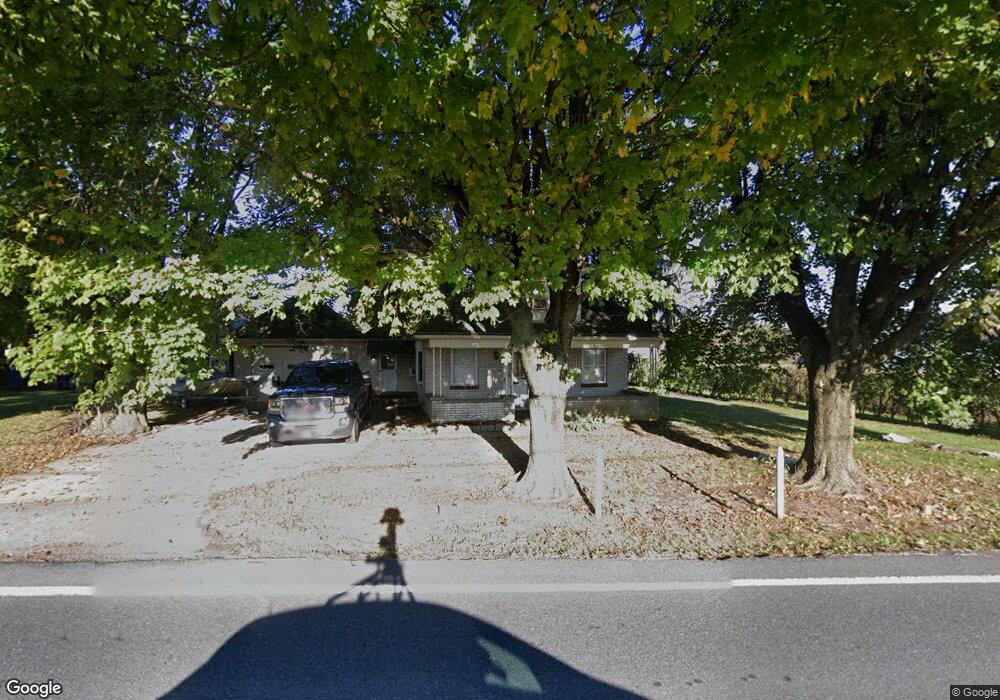
1015 Mount Zion Rd Lebanon, PA 17046
Estimated Value: $212,000 - $269,000
3
Beds
1
Bath
1,041
Sq Ft
$233/Sq Ft
Est. Value
About This Home
This home is located at 1015 Mount Zion Rd, Lebanon, PA 17046 and is currently estimated at $242,520, approximately $232 per square foot. 1015 Mount Zion Rd is a home located in Lebanon County with nearby schools including Union Canal Elementary School, Cedar Crest Middle School, and Cedar Crest High School.
Ownership History
Date
Name
Owned For
Owner Type
Purchase Details
Closed on
Jan 23, 2024
Sold by
Nolt Tirrell and Nolt Mary Lou
Bought by
Nolt Delvin L
Current Estimated Value
Home Financials for this Owner
Home Financials are based on the most recent Mortgage that was taken out on this home.
Original Mortgage
$186,000
Outstanding Balance
$182,745
Interest Rate
6.95%
Mortgage Type
New Conventional
Estimated Equity
$59,775
Purchase Details
Closed on
Apr 5, 2007
Sold by
Miller Emial L and Miller Teresa N
Bought by
Nolt Tirrell and Nolt Mary Lou
Home Financials for this Owner
Home Financials are based on the most recent Mortgage that was taken out on this home.
Original Mortgage
$1,042
Interest Rate
6.25%
Mortgage Type
Purchase Money Mortgage
Create a Home Valuation Report for This Property
The Home Valuation Report is an in-depth analysis detailing your home's value as well as a comparison with similar homes in the area
Home Values in the Area
Average Home Value in this Area
Purchase History
| Date | Buyer | Sale Price | Title Company |
|---|---|---|---|
| Nolt Delvin L | $200,000 | None Listed On Document | |
| Nolt Tirrell | $140,000 | None Available |
Source: Public Records
Mortgage History
| Date | Status | Borrower | Loan Amount |
|---|---|---|---|
| Open | Nolt Delvin L | $186,000 | |
| Previous Owner | Nolt Tirrell | $1,042 |
Source: Public Records
Tax History Compared to Growth
Tax History
| Year | Tax Paid | Tax Assessment Tax Assessment Total Assessment is a certain percentage of the fair market value that is determined by local assessors to be the total taxable value of land and additions on the property. | Land | Improvement |
|---|---|---|---|---|
| 2025 | $3,473 | $140,100 | $54,500 | $85,600 |
| 2024 | $3,168 | $140,100 | $54,500 | $85,600 |
| 2023 | $3,168 | $140,100 | $54,500 | $85,600 |
| 2022 | $3,081 | $140,100 | $54,500 | $85,600 |
| 2021 | $2,934 | $140,100 | $54,500 | $85,600 |
| 2020 | $2,912 | $140,100 | $54,500 | $85,600 |
| 2019 | $5,898 | $140,100 | $54,500 | $85,600 |
| 2018 | $2,746 | $140,100 | $54,500 | $85,600 |
| 2017 | $743 | $140,100 | $54,500 | $85,600 |
| 2016 | $2,682 | $140,100 | $54,500 | $85,600 |
| 2015 | -- | $140,100 | $54,500 | $85,600 |
| 2014 | -- | $140,100 | $54,500 | $85,600 |
Source: Public Records
Map
Nearby Homes
- 559 Bella May Cir
- 01 Bella May Cir
- 00 Bella May Cir
- 604 Liliana Dr
- 604 Lilliana Dr
- 609 Lilliana Dr
- 46 Carol Ann Dr
- Northfield Plan at Sweetbriar 55+ Living - Sweetbriar 55+Living
- Stonecroft Plan at Sweetbriar 55+ Living - Sweetbriar 55+Living
- Madison Plan at Sweetbriar 55+ Living - Sweetbriar 55+Living
- Perry Plan at Sweetbriar 55+ Living - Sweetbriar 55+Living
- Morrison Plan at Sweetbriar 55+ Living - Sweetbriar 55+Living
- Atworth Plan at Sweetbriar 55+ Living - Sweetbriar 55+Living
- Hartford Plan at Sweetbriar 55+ Living - Sweetbriar 55+Living
- Norton Plan at Sweetbriar 55+ Living - Sweetbriar 55+Living
- Magnolia Plan at Sweetbriar 55+ Living - Sweetbriar 55+Living
- Huntington Plan at Briar Ridge
- 834 Kimmerlings Rd
- Amberbrook Plan at Briar Ridge
- Northfield Plan at Briar Ridge
- 1025 Mount Zion Rd
- 350 E Kercher Ave
- 1050 Mount Zion Rd
- 420 E Kercher Ave
- 375 E Kercher Ave
- 900 Kimmerlings Rd
- 355 E Kercher Ave
- 898 Kimmerlings Rd
- 902 Kimmerlings Rd
- 973 Mount Zion Rd
- 896 Kimmerlings Rd
- 894 Kimmerlings Rd
- 969 Mount Zion Rd
- 967 Mount Zion Rd
- 892 Kimmerlings Rd
- 964 Mount Zion Rd
- 111 Ginger Ct
- 965 Mount Zion Rd
- 109 Ginger Ct
- 887 Kimmerlings Rd