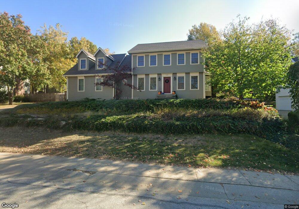
1015 Wildbriar Dr Liberty, MO 64068
Estimated Value: $380,000 - $449,000
4
Beds
3
Baths
2,427
Sq Ft
$175/Sq Ft
Est. Value
About This Home
This home is located at 1015 Wildbriar Dr, Liberty, MO 64068 and is currently estimated at $424,008, approximately $174 per square foot. 1015 Wildbriar Dr is a home located in Clay County with nearby schools including Lewis And Clark Elementary School, Heritage Middle School, and Liberty North High School.
Ownership History
Date
Name
Owned For
Owner Type
Purchase Details
Closed on
Aug 24, 2005
Sold by
Grundy Donald L and Grundy Ann S
Bought by
Gates Kurt E and Taylor Melissa A
Current Estimated Value
Home Financials for this Owner
Home Financials are based on the most recent Mortgage that was taken out on this home.
Original Mortgage
$163,920
Outstanding Balance
$86,938
Interest Rate
5.81%
Mortgage Type
Fannie Mae Freddie Mac
Estimated Equity
$337,070
Create a Home Valuation Report for This Property
The Home Valuation Report is an in-depth analysis detailing your home's value as well as a comparison with similar homes in the area
Home Values in the Area
Average Home Value in this Area
Purchase History
| Date | Buyer | Sale Price | Title Company |
|---|---|---|---|
| Gates Kurt E | -- | Mokan Title Services Llc |
Source: Public Records
Mortgage History
| Date | Status | Borrower | Loan Amount |
|---|---|---|---|
| Open | Gates Kurt E | $163,920 |
Source: Public Records
Tax History Compared to Growth
Tax History
| Year | Tax Paid | Tax Assessment Tax Assessment Total Assessment is a certain percentage of the fair market value that is determined by local assessors to be the total taxable value of land and additions on the property. | Land | Improvement |
|---|---|---|---|---|
| 2025 | $4,335 | $61,540 | -- | -- |
| 2024 | $4,335 | $56,370 | -- | -- |
| 2023 | $4,409 | $56,370 | $0 | $0 |
| 2022 | $3,978 | $50,220 | $0 | $0 |
| 2021 | $3,947 | $50,217 | $7,220 | $42,997 |
| 2020 | $3,693 | $44,120 | $0 | $0 |
| 2019 | $3,692 | $44,118 | $7,220 | $36,898 |
| 2018 | $3,581 | $42,010 | $0 | $0 |
| 2017 | $3,547 | $42,010 | $7,220 | $34,790 |
| 2016 | $3,547 | $42,010 | $7,220 | $34,790 |
| 2015 | $3,548 | $42,010 | $7,220 | $34,790 |
| 2014 | $3,429 | $40,280 | $7,220 | $33,060 |
Source: Public Records
Map
Nearby Homes
- 1107 Wildbriar Dr
- 900 Wildbriar Dr
- 1484 Hemlock Dr
- 1304 Nashua Rd
- 1487 Spruce Dr
- 527 Lancelot Dr
- 523 Lancelot Dr
- 1208 Linden Rd
- 1207 Linden Rd
- 417 Locust St
- 1541 N Withers Rd
- 1014 N Forest Ln
- 1575 Oakwood Ln
- 1548 Timber Ridge Dr
- 815 Kings Ridge
- 907 N Forest Ln
- 1408 Telford Dr
- 1963 Harvest Rd
- 1869 Vintage Ln
- 10505 NE 97th Terrace
- 1007 Wildbriar Dr
- 1019 Wildbriar Dr
- 1012 Wildbriar Dr
- 1001 Wildbriar Dr
- 1006 Wildbriar Dr
- 1101 Wildbriar Dr
- 1192 Lake Rd
- 919 Wildbriar Dr
- 1000 Wildbriar Dr
- 1194 Lake Rd
- 918 Wildbriar Dr
- 913 Wildbriar Dr
- 1195 Lake Rd
- 1196 Lake Rd
- 1120 Wildbriar Ct
- 907 Wildbriar Dr
- 1517 Nancy Ln
- 1200 Lake Rd
- 906 Wildbriar Dr
- 1206 Wildbriar Ct