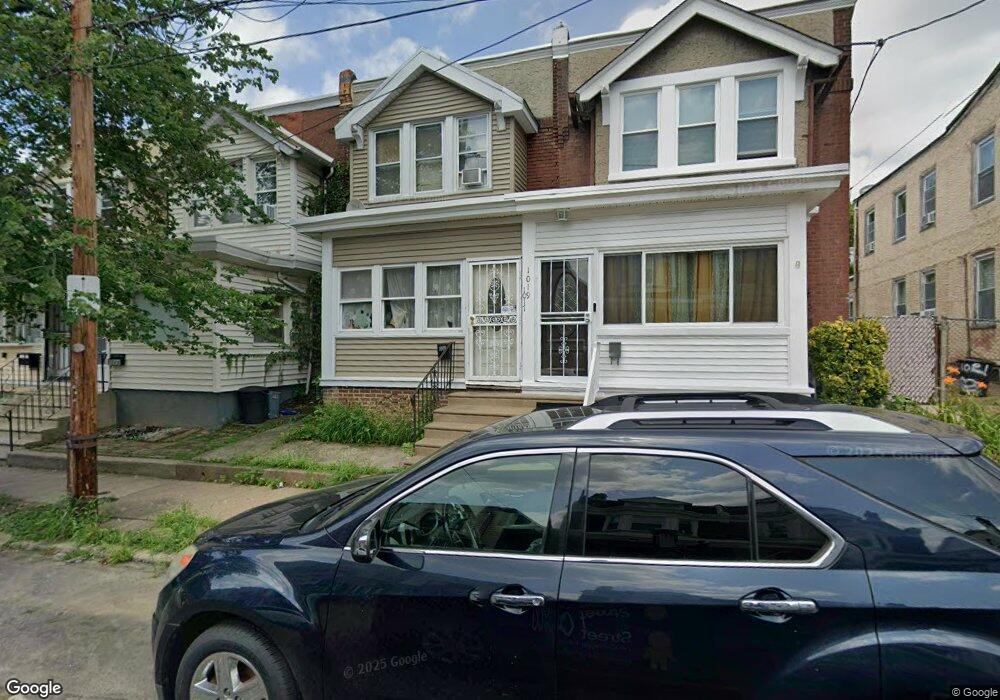
1017 Fillmore St Philadelphia, PA 19124
Frankford NeighborhoodEstimated Value: $190,000 - $232,000
3
Beds
1
Bath
1,144
Sq Ft
$180/Sq Ft
Est. Value
About This Home
This home is located at 1017 Fillmore St, Philadelphia, PA 19124 and is currently estimated at $205,660, approximately $179 per square foot. 1017 Fillmore St is a home located in Philadelphia County with nearby schools including Frankford High School, The Philadelphia Charter School for the Arts & Sciences, and Northwood Academy Charter School.
Ownership History
Date
Name
Owned For
Owner Type
Purchase Details
Closed on
Feb 26, 2004
Sold by
Nguyen Bao
Bought by
Jean Simon Nancy
Current Estimated Value
Home Financials for this Owner
Home Financials are based on the most recent Mortgage that was taken out on this home.
Original Mortgage
$76,000
Outstanding Balance
$34,974
Interest Rate
5.67%
Mortgage Type
Purchase Money Mortgage
Estimated Equity
$170,686
Create a Home Valuation Report for This Property
The Home Valuation Report is an in-depth analysis detailing your home's value as well as a comparison with similar homes in the area
Home Values in the Area
Average Home Value in this Area
Purchase History
| Date | Buyer | Sale Price | Title Company |
|---|---|---|---|
| Jean Simon Nancy | $78,000 | -- |
Source: Public Records
Mortgage History
| Date | Status | Borrower | Loan Amount |
|---|---|---|---|
| Open | Jean Simon Nancy | $76,000 |
Source: Public Records
Tax History Compared to Growth
Tax History
| Year | Tax Paid | Tax Assessment Tax Assessment Total Assessment is a certain percentage of the fair market value that is determined by local assessors to be the total taxable value of land and additions on the property. | Land | Improvement |
|---|---|---|---|---|
| 2026 | $2,094 | $177,200 | $35,440 | $141,760 |
| 2025 | $2,094 | $177,200 | $35,440 | $141,760 |
| 2024 | $2,094 | $177,200 | $35,440 | $141,760 |
| 2023 | $2,094 | $149,600 | $29,920 | $119,680 |
| 2022 | $974 | $104,600 | $29,920 | $74,680 |
| 2021 | $1,604 | $0 | $0 | $0 |
| 2020 | $1,604 | $0 | $0 | $0 |
| 2019 | $1,540 | $0 | $0 | $0 |
| 2018 | $1,162 | $0 | $0 | $0 |
| 2017 | $1,582 | $0 | $0 | $0 |
| 2016 | $1,162 | $0 | $0 | $0 |
| 2015 | $1,112 | $0 | $0 | $0 |
| 2014 | -- | $113,000 | $14,743 | $98,257 |
| 2012 | -- | $10,880 | $828 | $10,052 |
Source: Public Records
Map
Nearby Homes
- 1052 Allengrove St
- 1859 Harrison St
- 4717 Northwood St
- 1001-3 Arrott St
- 926 Foulkrod St
- 1208 Haworth St
- 1300 Harrison St
- 1214 Haworth St
- 1335 Fillmore St
- 4046 E Roosevelt Blvd
- 4632 Oakland St
- 4600 Horrocks St
- 5118 Oakland St
- 1204 Pratt St
- 1241 Orthodox St
- 1218 Pratt St
- 1220 Pratt St
- 5033 Akron St
- 4628 Pilling St
- 4626 Pilling St
- 1015 Fillmore St
- 1013 Fillmore St
- 4710 Large St
- 1019 Fillmore St
- 1011 Fillmore St
- 1021 Fillmore St
- 1023 Fillmore St
- 1016 Fillmore St
- 1010 Fillmore St
- 1025 Fillmore St
- 1014 Fillmore St
- 1012 Fillmore St
- 1018 Fillmore St
- 1020 Fillmore St
- 1008 Fillmore St
- 1004 Harrison St
- 1006 Harrison St
- 1002 Harrison St
- 1008 Harrison St
- 1010 Harrison St