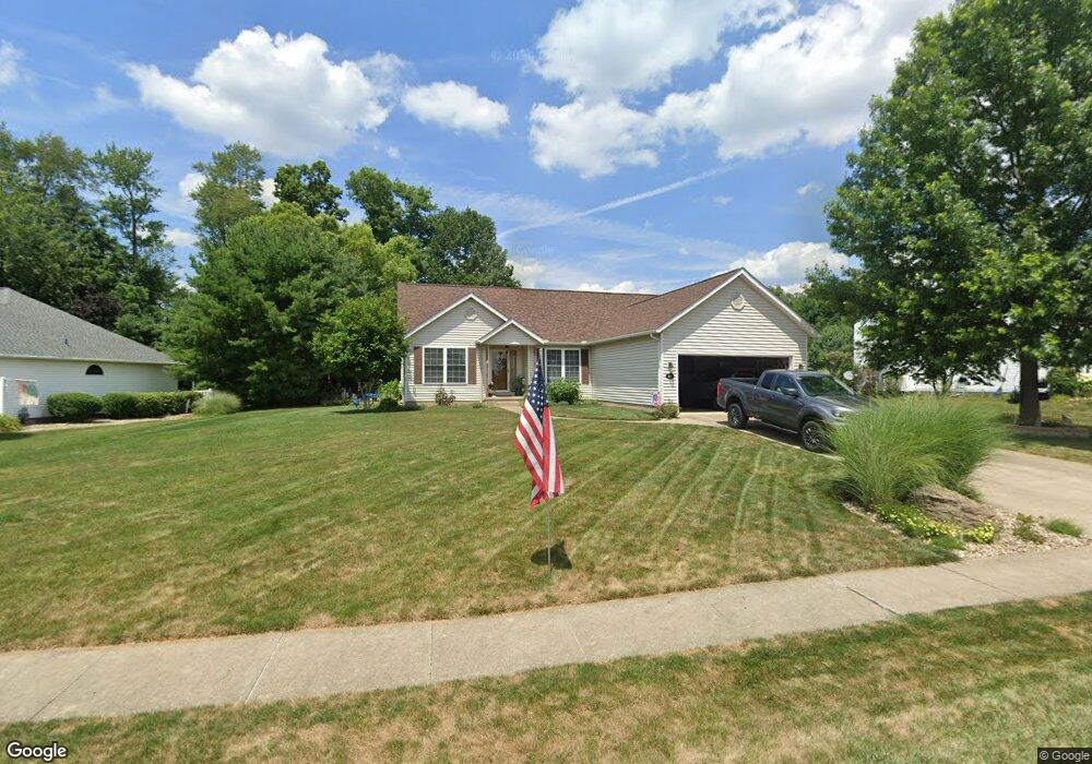
1019 E Reno Dr Louisville, OH 44641
Estimated Value: $272,000 - $331,000
3
Beds
2
Baths
1,510
Sq Ft
$197/Sq Ft
Est. Value
About This Home
This home is located at 1019 E Reno Dr, Louisville, OH 44641 and is currently estimated at $297,312, approximately $196 per square foot. 1019 E Reno Dr is a home located in Stark County with nearby schools including Louisville High School and St. Thomas Aquinas High School & Middle School.
Ownership History
Date
Name
Owned For
Owner Type
Purchase Details
Closed on
Sep 2, 2010
Sold by
Snyder Jeffrey L and Snyder Pamela A
Bought by
Catarouch Jonette A and Zartman Douglas J
Current Estimated Value
Purchase Details
Closed on
Sep 9, 2009
Sold by
Snyder Jeffrey L and Snyder Pamela A
Bought by
Snyder Jeffrey L and Snyder Pamela A
Purchase Details
Closed on
Mar 5, 2001
Sold by
Mckinley Development Company
Bought by
Snyder Jeffrey L and Snyder Pamela A
Home Financials for this Owner
Home Financials are based on the most recent Mortgage that was taken out on this home.
Original Mortgage
$79,000
Outstanding Balance
$31,696
Interest Rate
7.03%
Mortgage Type
Purchase Money Mortgage
Estimated Equity
$265,616
Create a Home Valuation Report for This Property
The Home Valuation Report is an in-depth analysis detailing your home's value as well as a comparison with similar homes in the area
Home Values in the Area
Average Home Value in this Area
Purchase History
| Date | Buyer | Sale Price | Title Company |
|---|---|---|---|
| Catarouch Jonette A | $155,000 | Mkland Title Inc | |
| Snyder Jeffrey L | -- | Attorney | |
| Snyder Jeffrey L | $33,500 | -- |
Source: Public Records
Mortgage History
| Date | Status | Borrower | Loan Amount |
|---|---|---|---|
| Open | Snyder Jeffrey L | $79,000 | |
| Closed | Catarouch Jonette A | $0 |
Source: Public Records
Tax History Compared to Growth
Tax History
| Year | Tax Paid | Tax Assessment Tax Assessment Total Assessment is a certain percentage of the fair market value that is determined by local assessors to be the total taxable value of land and additions on the property. | Land | Improvement |
|---|---|---|---|---|
| 2025 | -- | $82,890 | $36,160 | $46,730 |
| 2024 | -- | $82,890 | $36,160 | $46,730 |
| 2023 | $2,670 | $62,090 | $21,420 | $40,670 |
| 2022 | $2,676 | $62,090 | $21,420 | $40,670 |
| 2021 | $2,686 | $62,160 | $21,420 | $40,740 |
| 2020 | $2,206 | $55,450 | $19,290 | $36,160 |
| 2019 | $2,215 | $55,450 | $19,290 | $36,160 |
| 2018 | $2,207 | $55,450 | $19,290 | $36,160 |
| 2017 | $1,963 | $47,570 | $15,120 | $32,450 |
| 2016 | $2,003 | $47,570 | $15,120 | $32,450 |
| 2015 | $2,009 | $47,570 | $15,120 | $32,450 |
| 2014 | $1,956 | $43,060 | $13,690 | $29,370 |
| 2013 | $982 | $43,060 | $13,690 | $29,370 |
Source: Public Records
Map
Nearby Homes
- 910 Crosswyck Cir
- 1170 Winding Ridge Ave
- 316 E Reno Dr
- 428 Honeycrisp Dr NE
- 3047 Mcintosh Dr NE
- 432 Honeycrisp Dr NE
- 2962 Mcintosh Dr NE
- 2963 Mcintosh Dr NE
- 430 Honeycrisp Dr NE
- 2957 Mcintosh Dr NE
- 5474 Ravenna Ave
- 0 Michigan Blvd
- 325 Lincoln Ave
- 524 Glenbar St
- 300 Kennedy St
- 614 Reno Dr
- 0 Glenbar St
- 308 Superior St
- 2015 E Main St
- 0 Brookridge Ave
- 1019 Reno Dr
- 1103 E Reno Dr
- 1009 E Reno Dr
- 1103 Reno Dr
- 1353 Cheverton Ave
- 1296 Winding Ridge Ave
- 923 E Reno Dr
- 1371 Cheverton Ave
- 1334 Cheverton Ave
- 0 Cheverton Unit 3293569
- 1295 Cheverton Ave
- 1348 Cheverton Ave
- 1004 E Reno Dr
- 1379 Cheverton Ave
- 1322 Cheverton Ave
- 911 E Reno Dr
- 1368 Cheverton Ave
- 1282 Winding Ridge Ave
- 1294 Cheverton Ave
- 1285 Cheverton Ave