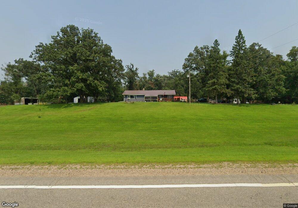
10190 State Highway 9 Sunburg, MN 56289
Estimated Value: $178,000 - $266,000
3
Beds
--
Bath
1,380
Sq Ft
$167/Sq Ft
Est. Value
About This Home
This home is located at 10190 State Highway 9, Sunburg, MN 56289 and is currently estimated at $230,957, approximately $167 per square foot. 10190 State Highway 9 is a home located in Kandiyohi County with nearby schools including Murdock Elementary School and Kerkhoven High School.
Ownership History
Date
Name
Owned For
Owner Type
Purchase Details
Closed on
Feb 23, 2018
Sold by
Traen Thomas J and Traen Veronica R
Bought by
Urban Michael J and Urban Shannon J
Current Estimated Value
Home Financials for this Owner
Home Financials are based on the most recent Mortgage that was taken out on this home.
Original Mortgage
$101,000
Outstanding Balance
$85,645
Interest Rate
4.04%
Mortgage Type
New Conventional
Estimated Equity
$145,312
Purchase Details
Closed on
May 28, 2010
Sold by
Traen Thomas J
Bought by
Urban Michel
Home Financials for this Owner
Home Financials are based on the most recent Mortgage that was taken out on this home.
Original Mortgage
$89,500
Interest Rate
5.14%
Mortgage Type
Seller Take Back
Purchase Details
Closed on
Jul 16, 2008
Sold by
Pearson Raymond C
Bought by
Traen Thomas J
Home Financials for this Owner
Home Financials are based on the most recent Mortgage that was taken out on this home.
Original Mortgage
$72,000
Interest Rate
6.15%
Mortgage Type
New Conventional
Create a Home Valuation Report for This Property
The Home Valuation Report is an in-depth analysis detailing your home's value as well as a comparison with similar homes in the area
Home Values in the Area
Average Home Value in this Area
Purchase History
| Date | Buyer | Sale Price | Title Company |
|---|---|---|---|
| Urban Michael J | $90,000 | -- | |
| Urban Michel | $90,000 | None Available | |
| Traen Thomas J | $90,000 | None Available |
Source: Public Records
Mortgage History
| Date | Status | Borrower | Loan Amount |
|---|---|---|---|
| Open | Urban Michael J | $101,000 | |
| Previous Owner | Urban Michel | $89,500 | |
| Previous Owner | Traen Thomas J | $72,000 |
Source: Public Records
Tax History Compared to Growth
Tax History
| Year | Tax Paid | Tax Assessment Tax Assessment Total Assessment is a certain percentage of the fair market value that is determined by local assessors to be the total taxable value of land and additions on the property. | Land | Improvement |
|---|---|---|---|---|
| 2025 | $1,684 | $193,500 | $68,000 | $125,500 |
| 2024 | $1,536 | $180,800 | $59,000 | $121,800 |
| 2023 | $1,410 | $169,600 | $52,000 | $117,600 |
| 2022 | $1,212 | $161,400 | $52,000 | $109,400 |
| 2021 | $1,192 | $129,100 | $46,400 | $82,700 |
| 2020 | $1,150 | $124,400 | $46,400 | $78,000 |
| 2019 | $1,126 | $121,700 | $44,400 | $77,300 |
| 2018 | $888 | $118,800 | $42,400 | $76,400 |
| 2017 | $908 | $101,100 | $42,400 | $58,700 |
| 2016 | $1,836 | $730 | $0 | $0 |
| 2015 | -- | $0 | $0 | $0 |
| 2014 | -- | $0 | $0 | $0 |
Source: Public Records
Map
Nearby Homes
- 23508 County Road 1 NW
- 24680 County Road 1 NW
- 25757 133rd St NW
- 20983 72nd St NW
- 21631 Kandi-Swift Rd NW
- 24175 County Road 5 NW
- 3614 198th Ave NW
- 4916 189th Ave NW
- 13300 330th St
- 17216 County Road 5 NW
- 13595 320th St
- 23000 5th St NW
- 22869 5th St NW
- 870 S Andrew Dr NE
- 1122 S Andrew Dr NE
- 29800 County Road 37
- 1245 137th Ave NW
- 13112 2nd St NE
- TBD Lot E Co Rd 40
- 311 131st Ave NE