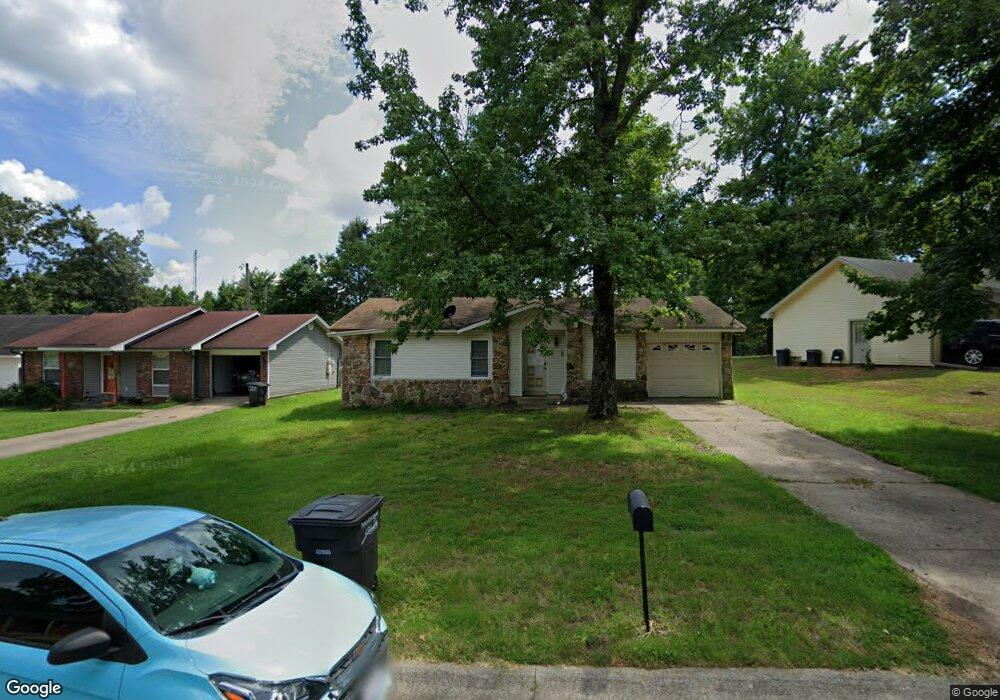
102 Darryl Ct Jacksonville, AR 72076
Estimated Value: $110,718 - $130,000
--
Bed
2
Baths
1,026
Sq Ft
$119/Sq Ft
Est. Value
About This Home
This home is located at 102 Darryl Ct, Jacksonville, AR 72076 and is currently estimated at $122,180, approximately $119 per square foot. 102 Darryl Ct is a home located in Pulaski County with nearby schools including Murrell Taylor Elementary School, Jacksonville Middle School, and Jacksonville High School.
Ownership History
Date
Name
Owned For
Owner Type
Purchase Details
Closed on
May 26, 2010
Sold by
Birmingham John P
Bought by
Stivers Kathryn S
Current Estimated Value
Home Financials for this Owner
Home Financials are based on the most recent Mortgage that was taken out on this home.
Original Mortgage
$53,000
Outstanding Balance
$35,437
Interest Rate
5%
Mortgage Type
New Conventional
Estimated Equity
$86,743
Purchase Details
Closed on
Mar 28, 2003
Sold by
Crook Harold and Crook Mary H
Bought by
Birmingham John P
Home Financials for this Owner
Home Financials are based on the most recent Mortgage that was taken out on this home.
Original Mortgage
$63,897
Interest Rate
5.71%
Mortgage Type
FHA
Purchase Details
Closed on
Nov 26, 1999
Sold by
Burkhard Marcus August
Bought by
Crook Harold and Crook Mary H
Create a Home Valuation Report for This Property
The Home Valuation Report is an in-depth analysis detailing your home's value as well as a comparison with similar homes in the area
Home Values in the Area
Average Home Value in this Area
Purchase History
| Date | Buyer | Sale Price | Title Company |
|---|---|---|---|
| Stivers Kathryn S | $75,000 | United Abstract & Title Co | |
| Birmingham John P | $65,000 | American Abstract & Title Co | |
| Crook Harold | $32,002 | -- |
Source: Public Records
Mortgage History
| Date | Status | Borrower | Loan Amount |
|---|---|---|---|
| Open | Stivers Kathryn S | $53,000 | |
| Previous Owner | Birmingham John P | $63,897 |
Source: Public Records
Tax History Compared to Growth
Tax History
| Year | Tax Paid | Tax Assessment Tax Assessment Total Assessment is a certain percentage of the fair market value that is determined by local assessors to be the total taxable value of land and additions on the property. | Land | Improvement |
|---|---|---|---|---|
| 2025 | $874 | $17,138 | $1,200 | $15,938 |
| 2024 | $703 | $17,138 | $1,200 | $15,938 |
| 2023 | $703 | $17,138 | $1,200 | $15,938 |
| 2022 | $766 | $17,138 | $1,200 | $15,938 |
| 2021 | $729 | $11,880 | $1,600 | $10,280 |
| 2020 | $354 | $11,880 | $1,600 | $10,280 |
| 2019 | $354 | $11,880 | $1,600 | $10,280 |
| 2018 | $379 | $11,880 | $1,600 | $10,280 |
| 2017 | $379 | $11,880 | $1,600 | $10,280 |
| 2016 | $467 | $13,310 | $2,400 | $10,910 |
| 2015 | $716 | $13,310 | $2,400 | $10,910 |
| 2014 | $716 | $13,310 | $2,400 | $10,910 |
Source: Public Records
Map
Nearby Homes
- 1404 Southeastern Ave
- 13 Michelle Ln Unit A
- 219 Lonsdale Cir
- 2003 Old Military Rd
- 2209 Old Military Rd
- 813 Lehman Dr
- 1302 King St
- 720 Southeastern Ave
- 600 Sorrells Dr
- 1305 Glenn Rd
- 1401 Tamara Park
- 910 Ray Rd
- 0 S J P Wright Loop Rd
- 419 Church St
- 32 Ross Cir
- 26 Wright Cir
- 1110 Wright St
- 602 Ray Rd
- 29 Collins Rd
- 10 Park Dr
- 104 Darryl Ct
- 100 Darryl Ct
- 1604 Southeastern Ave
- 106 Darryl Ct
- 1700 Military Rd
- 105 Darryl Ct
- 107 Darryl Ct
- 103 Darryl Ct
- 101 Darryl Ct
- 108 Darryl Ct
- 109 Darryl Ct
- 1412 Southeastern Ave
- 212 Lonsdale Cir
- 210 Lonsdale Cir
- 1605 Southeastern Ave
- 110 Darryl Ct
- 214 Lonsdale Cir
- 208 Lonsdale Cir
- 111 Darryl Ct
- 1607 Southeastern Ave