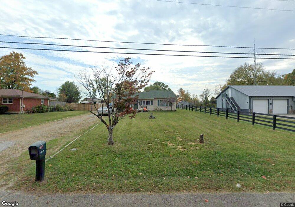
10206 Wingfield Rd Louisville, KY 40291
Estimated Value: $237,000 - $279,060
3
Beds
2
Baths
1,695
Sq Ft
$153/Sq Ft
Est. Value
About This Home
This home is located at 10206 Wingfield Rd, Louisville, KY 40291 and is currently estimated at $258,765, approximately $152 per square foot. 10206 Wingfield Rd is a home located in Jefferson County with nearby schools including Wilt Elementary School, Bates Elementary School, and Fern Creek Elementary School.
Ownership History
Date
Name
Owned For
Owner Type
Purchase Details
Closed on
May 18, 2011
Sold by
Federal National Mortgage Association
Bought by
Bryant Robert E
Current Estimated Value
Home Financials for this Owner
Home Financials are based on the most recent Mortgage that was taken out on this home.
Original Mortgage
$94,541
Outstanding Balance
$65,702
Interest Rate
4.88%
Mortgage Type
FHA
Estimated Equity
$193,063
Purchase Details
Closed on
Feb 23, 2011
Sold by
Dewitt Marty and Dewitt Sheryl
Bought by
Federal National Mortgage Association
Create a Home Valuation Report for This Property
The Home Valuation Report is an in-depth analysis detailing your home's value as well as a comparison with similar homes in the area
Home Values in the Area
Average Home Value in this Area
Purchase History
| Date | Buyer | Sale Price | Title Company |
|---|---|---|---|
| Bryant Robert E | $97,000 | Executive Title | |
| Federal National Mortgage Association | $67,000 | None Available |
Source: Public Records
Mortgage History
| Date | Status | Borrower | Loan Amount |
|---|---|---|---|
| Open | Bryant Robert E | $94,541 |
Source: Public Records
Tax History Compared to Growth
Tax History
| Year | Tax Paid | Tax Assessment Tax Assessment Total Assessment is a certain percentage of the fair market value that is determined by local assessors to be the total taxable value of land and additions on the property. | Land | Improvement |
|---|---|---|---|---|
| 2024 | $2,010 | $175,550 | $46,000 | $129,550 |
| 2023 | $1,577 | $133,900 | $40,000 | $93,900 |
| 2022 | $1,583 | $133,900 | $40,000 | $93,900 |
| 2021 | $1,691 | $133,900 | $40,000 | $93,900 |
| 2020 | $1,524 | $129,440 | $42,000 | $87,440 |
| 2019 | $1,403 | $129,440 | $42,000 | $87,440 |
| 2018 | $1,386 | $129,440 | $42,000 | $87,440 |
| 2017 | $1,358 | $129,440 | $42,000 | $87,440 |
| 2013 | $1,228 | $122,800 | $31,200 | $91,600 |
Source: Public Records
Map
Nearby Homes
- 10212 Reeseman Dr
- 11207 Breezeway St Unit 61A
- 11207 Breezeway St
- 7325 Spring Run Dr
- 10414 Buzzman Dr
- 7911 Windgate Dr
- 6900 Oak Rock Dr
- 6812 Oak Rock Dr
- 6816 Oak Rock Dr
- 6902 Oak Rock Dr
- 10202 Chico Ct
- 10802 Glenway Place
- 6709 Monty Ln
- 6807 Lake Elkhorn Ct
- 6803 Lake Elkhorn Ct
- 6606 El Rancho Rd
- 7016 Hollow Oaks Dr
- 11404 Redbourne Ct
- 10200 El Coco Ct
- 11412 Caswell Springs Way
- 10204 Wingfield Rd
- 10298 Wingfield Rd
- 10200 Wingfield Rd
- 10300 Wingfield Rd
- 10205 Wingfield Rd
- 10201 Wingfield Rd
- 10207 Wingfield Rd
- 10118 Wingfield Rd
- 10115 Wingfield Rd
- 10303 Wingfield Rd
- 10301 Wingfield Rd
- 10304 Wingfield Rd
- 10113 Wingfield Rd
- 10202 Reeseman Dr
- 10200 Reeseman Dr
- 10204 Reeseman Dr
- 10136 Reeseman Dr
- 10206 Reeseman Dr
- 10134 Reeseman Dr
- 10308 Wingfield Rd