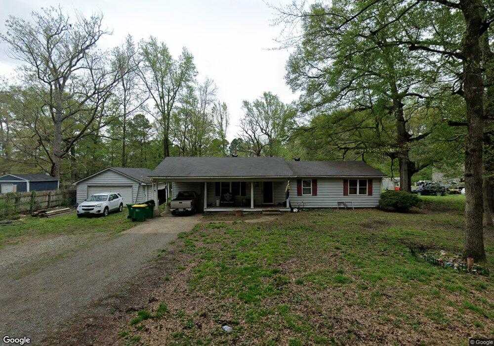
10217 Johnson Rd Little Rock, AR 72206
Landmark NeighborhoodEstimated Value: $107,158 - $154,000
--
Bed
2
Baths
1,272
Sq Ft
$99/Sq Ft
Est. Value
About This Home
This home is located at 10217 Johnson Rd, Little Rock, AR 72206 and is currently estimated at $125,540, approximately $98 per square foot. 10217 Johnson Rd is a home located in Pulaski County with nearby schools including Bates Elementary School, Mills University Studies High School, and Capital City Christian Academy.
Ownership History
Date
Name
Owned For
Owner Type
Purchase Details
Closed on
Nov 10, 2005
Sold by
Deutsche Bank National Trust Co
Bought by
Brock Michael D and Brock Deborah A
Current Estimated Value
Home Financials for this Owner
Home Financials are based on the most recent Mortgage that was taken out on this home.
Original Mortgage
$62,393
Interest Rate
6.23%
Mortgage Type
VA
Create a Home Valuation Report for This Property
The Home Valuation Report is an in-depth analysis detailing your home's value as well as a comparison with similar homes in the area
Home Values in the Area
Average Home Value in this Area
Purchase History
| Date | Buyer | Sale Price | Title Company |
|---|---|---|---|
| Brock Michael D | $61,000 | Associates Closing & Title |
Source: Public Records
Mortgage History
| Date | Status | Borrower | Loan Amount |
|---|---|---|---|
| Previous Owner | Brock Michael D | $62,393 |
Source: Public Records
Tax History Compared to Growth
Tax History
| Year | Tax Paid | Tax Assessment Tax Assessment Total Assessment is a certain percentage of the fair market value that is determined by local assessors to be the total taxable value of land and additions on the property. | Land | Improvement |
|---|---|---|---|---|
| 2025 | $824 | $22,367 | $370 | $21,997 |
| 2024 | $755 | $22,367 | $370 | $21,997 |
| 2023 | $755 | $22,367 | $370 | $21,997 |
| 2022 | $720 | $22,367 | $370 | $21,997 |
| 2021 | $686 | $14,110 | $280 | $13,830 |
| 2020 | $283 | $14,110 | $280 | $13,830 |
| 2019 | $256 | $14,110 | $280 | $13,830 |
| 2018 | $254 | $14,110 | $280 | $13,830 |
| 2017 | $226 | $14,110 | $280 | $13,830 |
| 2016 | $199 | $14,470 | $410 | $14,060 |
| 2015 | $483 | $10,370 | $410 | $9,960 |
| 2014 | $483 | $9,510 | $410 | $9,100 |
Source: Public Records
Map
Nearby Homes
- 10816 Dreher Rd
- 11601 Mona Ln
- 11505 Mona Ln
- 000 Mail Route Cir
- 20 Calion Dr
- 10 Callan Ln
- 14222 Ironton Cut-Off Rd
- 11300 Arch St
- 0 Baseline Rd Unit 25029813
- 3300 Green Dr
- 28 Hogan Dr
- 3508 Green Dr
- 3603 Rosepoint Cove
- 3629 Williams Rd
- 2820 Bonnie Ln
- 3810 Vinson Rd
- 3938 Wooddale Dr
- 00 Pratt Rd
- 7109 Ahart Ln
- 2815 Willow Springs Rd
- 10021 Ruth Ln
- 10015 Ruth Ln
- 10005 Ruth Ln
- 10026 Ruth Ln
- 10001 Ruth Ln
- 10115 Ruth Ln
- 10112 Ruth Ln
- 10319 Johnson Rd
- 10116 Ruth Ln
- 10305 Johnson Rd
- 10203 Ruth Ln
- 10202 Ruth Ln
- 1424 Russenberger Rd
- 1412 Russenberger Rd
- 1400 Russenberger Rd
- 1418 Russenberger Rd
- 1523 Russenberger Rd
- 1716 Russenberger Rd
- 1716 Russenberger Rd
- 1715 Russenberger Rd