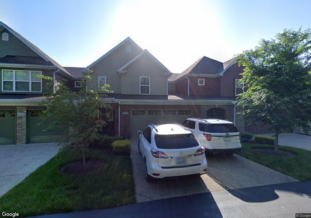
10222 Dorsey Pointe Cir Unit 12 Louisville, KY 40223
Estimated Value: $410,352 - $432,000
3
Beds
3
Baths
2,360
Sq Ft
$180/Sq Ft
Est. Value
About This Home
This home is located at 10222 Dorsey Pointe Cir Unit 12, Louisville, KY 40223 and is currently estimated at $425,838, approximately $180 per square foot. 10222 Dorsey Pointe Cir Unit 12 is a home located in Jefferson County with nearby schools including Middletown Elementary School, Bowen Elementary School, and Hite Elementary School.
Ownership History
Date
Name
Owned For
Owner Type
Purchase Details
Closed on
Apr 6, 2018
Sold by
Summit Investments Llc
Bought by
Lampton Richard W and White Cheryl R
Current Estimated Value
Home Financials for this Owner
Home Financials are based on the most recent Mortgage that was taken out on this home.
Original Mortgage
$225,000
Outstanding Balance
$193,765
Interest Rate
4.5%
Mortgage Type
Adjustable Rate Mortgage/ARM
Estimated Equity
$232,073
Create a Home Valuation Report for This Property
The Home Valuation Report is an in-depth analysis detailing your home's value as well as a comparison with similar homes in the area
Home Values in the Area
Average Home Value in this Area
Purchase History
| Date | Buyer | Sale Price | Title Company |
|---|---|---|---|
| Lampton Richard W | $300,000 | Kemp Title Agency Llc |
Source: Public Records
Mortgage History
| Date | Status | Borrower | Loan Amount |
|---|---|---|---|
| Open | Lampton Richard W | $225,000 |
Source: Public Records
Tax History Compared to Growth
Tax History
| Year | Tax Paid | Tax Assessment Tax Assessment Total Assessment is a certain percentage of the fair market value that is determined by local assessors to be the total taxable value of land and additions on the property. | Land | Improvement |
|---|---|---|---|---|
| 2024 | $3,409 | $299,570 | $0 | $299,570 |
| 2023 | $3,469 | $299,570 | $0 | $299,570 |
| 2022 | $3,481 | $300,000 | $0 | $300,000 |
| 2021 | $3,765 | $300,000 | $0 | $300,000 |
| 2020 | $3,456 | $300,000 | $0 | $300,000 |
| 2019 | $3,386 | $300,000 | $0 | $300,000 |
| 2018 | $2,935 | $263,080 | $0 | $263,080 |
| 2017 | $2,761 | $263,080 | $0 | $263,080 |
| 2013 | -- | $0 | $0 | $0 |
Source: Public Records
Map
Nearby Homes
- 10339 Shelbyville Rd Unit 2B3
- 105 Dorsey Way
- 105 Sycamore Dr
- 101 Sycamore Dr
- 701 Forest Park Rd Unit 701
- 121 Blue Fields Rd
- 10330 Dorsey Village Dr Unit 10330
- 327 S Dorsey Ln Unit 327
- 707 La Fontenay Ct Unit 707
- 10205 Afton Rd
- 706 La Fontenay Ct Unit 706
- 806 La Fontenay Ct
- 812 La Fontenay Ct Unit 812
- 212 La Fontenay Ct Unit 212
- 211 La Fontenay Ct Unit 211
- 207 La Fontenay Ct Unit 207
- 404 La Fontenay Ct Unit 404
- 402 Blue Rose Ct
- 1002 La Fontenay Ct Unit 1102
- 1116 La Fontenay Ct Unit 1116
- 10222 Dorsey Pointe Cir
- 10224 Dorsey Pointe Cir Unit 13
- 10224 Dorsey Pointe Cir Unit 10224
- 10220 Dorsey Pointe Cir Unit 11
- 10218 Dorsey Point Cir
- 10218 Dorsey Pointe Cir Unit 10
- 10218 Dorsey Pointe Cir
- 10216 Dorsey Pointe Cir
- 10216 Dorsey Pointe Cir Unit 9
- 10214 Dorsey Pointe Cir
- 10208 Dorsey Pointe Cir
- 10208 Dorsey Pointe Cir Unit 10208
- 10208 Dorsey Pointe Cir Unit 10206
- 10204 Dorsey Pointe Cir
- 10210 Dorsey Pointe Cir
- 10202 Dorsey Pointe Cir
- 10202 Dorsey Point Cir
- 10200 Dorsey Pointe Cir
- 10200 Dorsey Pointe Cir
- 10212 Dorsey Pointe Cir