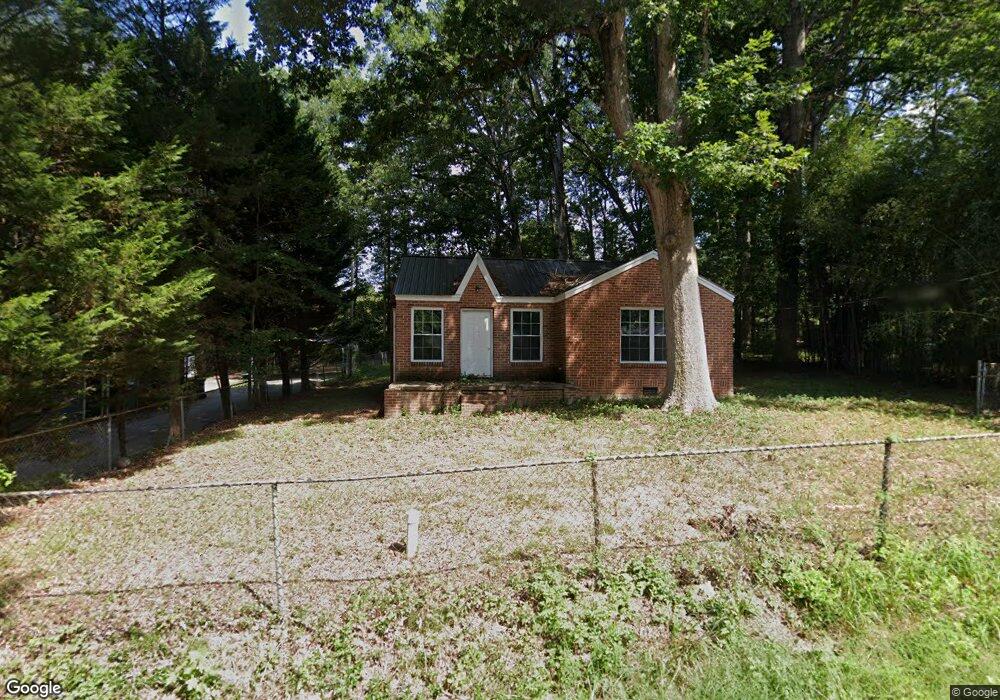
1023 Virginia Rd Thomasville, NC 27360
Estimated Value: $84,000 - $188,000
2
Beds
1
Bath
1,051
Sq Ft
$125/Sq Ft
Est. Value
About This Home
This home is located at 1023 Virginia Rd, Thomasville, NC 27360 and is currently estimated at $130,999, approximately $124 per square foot. 1023 Virginia Rd is a home located in Davidson County with nearby schools including Thomasville Primary School, Liberty Drive Elementary School, and Thomasville Middle School.
Ownership History
Date
Name
Owned For
Owner Type
Purchase Details
Closed on
Jul 31, 2025
Sold by
Surratt Wavel B
Bought by
Gordon Trent
Current Estimated Value
Home Financials for this Owner
Home Financials are based on the most recent Mortgage that was taken out on this home.
Original Mortgage
$55,000
Outstanding Balance
$54,810
Interest Rate
5.96%
Mortgage Type
Seller Take Back
Estimated Equity
$76,189
Purchase Details
Closed on
Jul 1, 1986
Create a Home Valuation Report for This Property
The Home Valuation Report is an in-depth analysis detailing your home's value as well as a comparison with similar homes in the area
Home Values in the Area
Average Home Value in this Area
Purchase History
| Date | Buyer | Sale Price | Title Company |
|---|---|---|---|
| Gordon Trent | $85,000 | None Listed On Document | |
| Gordon Trent | $85,000 | None Listed On Document | |
| -- | $16,000 | -- |
Source: Public Records
Mortgage History
| Date | Status | Borrower | Loan Amount |
|---|---|---|---|
| Open | Gordon Trent | $55,000 | |
| Closed | Gordon Trent | $55,000 |
Source: Public Records
Tax History Compared to Growth
Tax History
| Year | Tax Paid | Tax Assessment Tax Assessment Total Assessment is a certain percentage of the fair market value that is determined by local assessors to be the total taxable value of land and additions on the property. | Land | Improvement |
|---|---|---|---|---|
| 2025 | $639 | $55,930 | $0 | $0 |
| 2024 | $622 | $54,430 | $0 | $0 |
| 2023 | $622 | $54,430 | $0 | $0 |
| 2022 | $622 | $54,430 | $0 | $0 |
| 2021 | $622 | $54,430 | $0 | $0 |
| 2020 | $495 | $44,070 | $0 | $0 |
| 2019 | $502 | $44,070 | $0 | $0 |
| 2018 | $502 | $44,070 | $0 | $0 |
| 2017 | $502 | $44,070 | $0 | $0 |
| 2016 | $485 | $44,070 | $0 | $0 |
| 2015 | $485 | $44,070 | $0 | $0 |
| 2014 | $489 | $44,430 | $0 | $0 |
Source: Public Records
Map
Nearby Homes
- 708 Ferndale Dr
- 0 Smith Dr
- 715 Dillon St
- 307 Fisher Ferry St
- 1 Westwood Ave
- 122 S Old Fisher Ferry Rd
- 6 Curtis Ct
- 217 Moon St
- 106 Kincemac Dr
- 223 S Westwood Ave
- 512 Concord St
- 14 Welloski Dr
- 2619 N Carolina 109
- 208 Wagstaff St
- 25 Cedar Lodge Rd
- 296 Fairgrove Rd
- 305 Spring St
- 415 Spring St
- 300 Willowbrook Dr
- 314 Spring St
- 1021 Virginia Rd
- 1021 Virginia St
- 1025 Virginia Rd
- 1024 Virginia St
- 1019 Virginia St
- 1027 Virginia Rd
- 1020 Virginia St
- 930 Ferndale Dr
- 1026 Virginia Rd
- 1022 Virginia Rd
- 1016 Virginia St
- 1028 Virginia Rd
- 1015 Virginia St
- 1015 Virginia Rd
- 926 Ferndale Dr
- 1013 Virginia Rd
- 1014 Virginia Rd
- 1012 Virginia St
- 1012 Virginia St