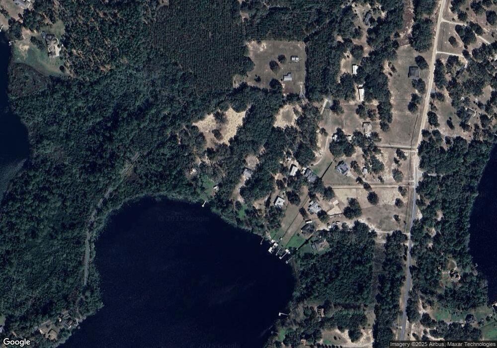
10235 SE 141st Avenue Rd Ocklawaha, FL 32179
Estimated Value: $391,000 - $692,000
3
Beds
2
Baths
1,406
Sq Ft
$368/Sq Ft
Est. Value
About This Home
This home is located at 10235 SE 141st Avenue Rd, Ocklawaha, FL 32179 and is currently estimated at $517,936, approximately $368 per square foot. 10235 SE 141st Avenue Rd is a home located in Marion County with nearby schools including Stanton-Weirsdale Elementary School, Lake Weir Middle School, and Lake Weir High School.
Ownership History
Date
Name
Owned For
Owner Type
Purchase Details
Closed on
Mar 1, 2017
Bought by
Hammons Lauren A
Current Estimated Value
Purchase Details
Closed on
Jul 21, 2000
Sold by
Twin Lakes Ranchettes Inc Trs and Clifford A
Bought by
Hammons George Thomas and Hammons Lauren A
Home Financials for this Owner
Home Financials are based on the most recent Mortgage that was taken out on this home.
Original Mortgage
$35,600
Interest Rate
8.23%
Create a Home Valuation Report for This Property
The Home Valuation Report is an in-depth analysis detailing your home's value as well as a comparison with similar homes in the area
Home Values in the Area
Average Home Value in this Area
Purchase History
| Date | Buyer | Sale Price | Title Company |
|---|---|---|---|
| Hammons Lauren A | $100 | -- | |
| Hammons George Thomas | $44,500 | Advance Homestead Title |
Source: Public Records
Mortgage History
| Date | Status | Borrower | Loan Amount |
|---|---|---|---|
| Previous Owner | Hammons George Thomas | $35,600 |
Source: Public Records
Tax History Compared to Growth
Tax History
| Year | Tax Paid | Tax Assessment Tax Assessment Total Assessment is a certain percentage of the fair market value that is determined by local assessors to be the total taxable value of land and additions on the property. | Land | Improvement |
|---|---|---|---|---|
| 2024 | $2,880 | $209,876 | -- | -- |
| 2023 | $2,804 | $203,763 | $0 | $0 |
| 2022 | $2,796 | $197,828 | $0 | $0 |
| 2021 | $2,792 | $192,066 | $0 | $0 |
| 2020 | $2,769 | $189,414 | $0 | $0 |
| 2019 | $2,727 | $185,155 | $0 | $0 |
| 2018 | $2,584 | $181,703 | $0 | $0 |
| 2017 | $2,545 | $177,966 | $0 | $0 |
| 2016 | $2,501 | $174,306 | $0 | $0 |
| 2015 | $2,517 | $173,094 | $0 | $0 |
| 2014 | $2,375 | $172,129 | $0 | $0 |
Source: Public Records
Map
Nearby Homes
- 0 Fisher Rd Unit MFRR4909879
- 0 Fisher Rd Unit MFROM706302
- 0 Fisher Rd Unit OM642725
- 0 Fisher Rd Unit MFROM697213
- 10893 SE 141st Avenue Rd
- 15919 SE 108th Loop
- TBD Sequoia Drive Radial
- Lot 15 Sequoia Lp Track
- 00 Sequoia Dr
- 16535 SE 100 St
- 0 Sequoia Dr Unit MFROM710533
- 0 Sequoia Dr Unit MFROM682182
- 0 Sequoia Dr Unit MFRS5129413
- TBD Sequoia Loop Dr
- 0 Sequoia Dr Unit MFROM705464
- TBD Sequoia Drive Course
- 10835 SE Highway 464c
- 16345 SE 113th Street Rd
- TBD Sequioa Drive Course
- 0 Sequoia Lp Trace Unit MFRO6343209
- 10225 SE 141st Avenue Rd
- 10215 SE 141st Avenue Rd
- 10205 SE 141st Avenue Rd
- 10410 SE 160th Court Rd
- 10350 SE 160th Court Rd
- 10380 SE 160th Court Rd
- 10470 SE 160th Court Rd
- 10220 SE 141st Avenue Rd
- 0 SE 141 Ave Rd
- 0 SE 141 Ave Rd Unit OM384414
- 0 SE 141 Ave Rd Unit OM314651
- 0 SE 141 Ave Rd Unit OM298596
- 10271 SE 141st Avenue Rd
- 10312 SE 160th Court Rd
- 10550 SE 160th Court Rd
- 10121 SE 160th Court Rd
- 10580 SE 160th Court Rd
- 10240 SE 160th Court Rd
- 10128 SE 160th Ave
- 10620 SE 160th Court Rd
