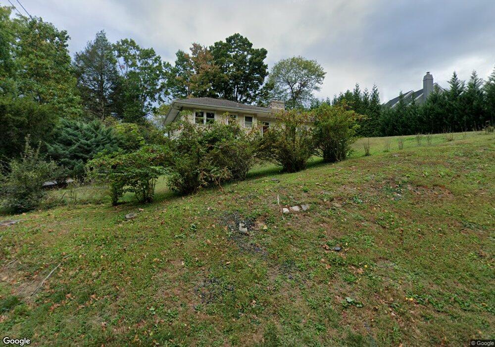
1024 Sproul Rd Bryn Mawr, PA 19010
Estimated Value: $710,000 - $734,323
3
Beds
3
Baths
1,599
Sq Ft
$454/Sq Ft
Est. Value
About This Home
This home is located at 1024 Sproul Rd, Bryn Mawr, PA 19010 and is currently estimated at $725,831, approximately $453 per square foot. 1024 Sproul Rd is a home located in Delaware County with nearby schools including Coopertown Elementary School, Haverford Middle School, and Haverford Senior High School.
Ownership History
Date
Name
Owned For
Owner Type
Purchase Details
Closed on
Sep 23, 2020
Sold by
Biscardi Genevieye S
Bought by
Dunn Michael Conrad and Mauran Anne Laure
Current Estimated Value
Home Financials for this Owner
Home Financials are based on the most recent Mortgage that was taken out on this home.
Original Mortgage
$416,500
Outstanding Balance
$369,616
Interest Rate
2.9%
Mortgage Type
New Conventional
Estimated Equity
$356,215
Purchase Details
Closed on
Oct 28, 1987
Sold by
Tomlinson William M And
Bought by
Biscardi Gilberto R and Biscardi Genevieve S
Create a Home Valuation Report for This Property
The Home Valuation Report is an in-depth analysis detailing your home's value as well as a comparison with similar homes in the area
Home Values in the Area
Average Home Value in this Area
Purchase History
| Date | Buyer | Sale Price | Title Company |
|---|---|---|---|
| Dunn Michael Conrad | $490,000 | Trident Land Transfer Co Lp | |
| Biscardi Gilberto R | $136,000 | -- |
Source: Public Records
Mortgage History
| Date | Status | Borrower | Loan Amount |
|---|---|---|---|
| Open | Dunn Michael Conrad | $416,500 |
Source: Public Records
Tax History Compared to Growth
Tax History
| Year | Tax Paid | Tax Assessment Tax Assessment Total Assessment is a certain percentage of the fair market value that is determined by local assessors to be the total taxable value of land and additions on the property. | Land | Improvement |
|---|---|---|---|---|
| 2025 | $11,129 | $432,810 | $199,390 | $233,420 |
| 2024 | $11,129 | $432,810 | $199,390 | $233,420 |
| 2023 | $10,812 | $432,810 | $199,390 | $233,420 |
| 2022 | $10,560 | $432,810 | $199,390 | $233,420 |
| 2021 | $17,203 | $432,810 | $199,390 | $233,420 |
| 2020 | $9,084 | $195,440 | $98,700 | $96,740 |
| 2019 | $8,916 | $195,440 | $98,700 | $96,740 |
| 2018 | $8,763 | $195,440 | $0 | $0 |
| 2017 | $8,578 | $195,440 | $0 | $0 |
| 2016 | $1,094 | $195,440 | $0 | $0 |
| 2015 | $1,094 | $195,440 | $0 | $0 |
| 2014 | $1,094 | $195,440 | $0 | $0 |
Source: Public Records
Map
Nearby Homes
- 3920 Darby Rd
- 124 Carli Dr
- 127 Deerfield Rd
- 119 Bella Dr Unit 2MD
- 117 Bella Dr Unit 3AD
- 820 Darby Paoli Rd
- 739 S Roberts Rd
- 12 Lincoln Ln
- 560 S Bryn Mawr Ave
- 633 Foxfields Rd
- 6205 Parkview Dr
- 202 Barren Rd
- 2604 Cynwyd Ave
- Lot 2 Cynwyd
- Lot1 Cynwyd
- 202 Summit Dr Unit B
- 103 Summit Dr Unit B
- 115 Newby Dr
- 307 B B000 Summit Dr Unit B
- 408 Barbara Ln Unit B
- 5069 Brittany Ln
- 5073 Brittany Ln
- 5065 Brittany Ln
- 1030 Sproul Rd
- 5061 Brittany Ln
- 5057 Brittany Ln
- 1036 Sproul Rd
- 4016 Darby Rd
- 5038 Brittany Ln
- 5030 Brittany Ln
- 5053 Brittany Ln
- 1039 Sproul Rd
- 5034 Brittany Ln
- 4004 Darby Rd
- 5026 Brittany Ln
- 4008 Darby Rd
- 5049 Brittany Ln
- 1040 Sproul Rd
- 5022 Brittany Ln
- 5006 Brittany Ln