Estimated Value: $183,000 - $232,000
3
Beds
2
Baths
1,204
Sq Ft
$168/Sq Ft
Est. Value
About This Home
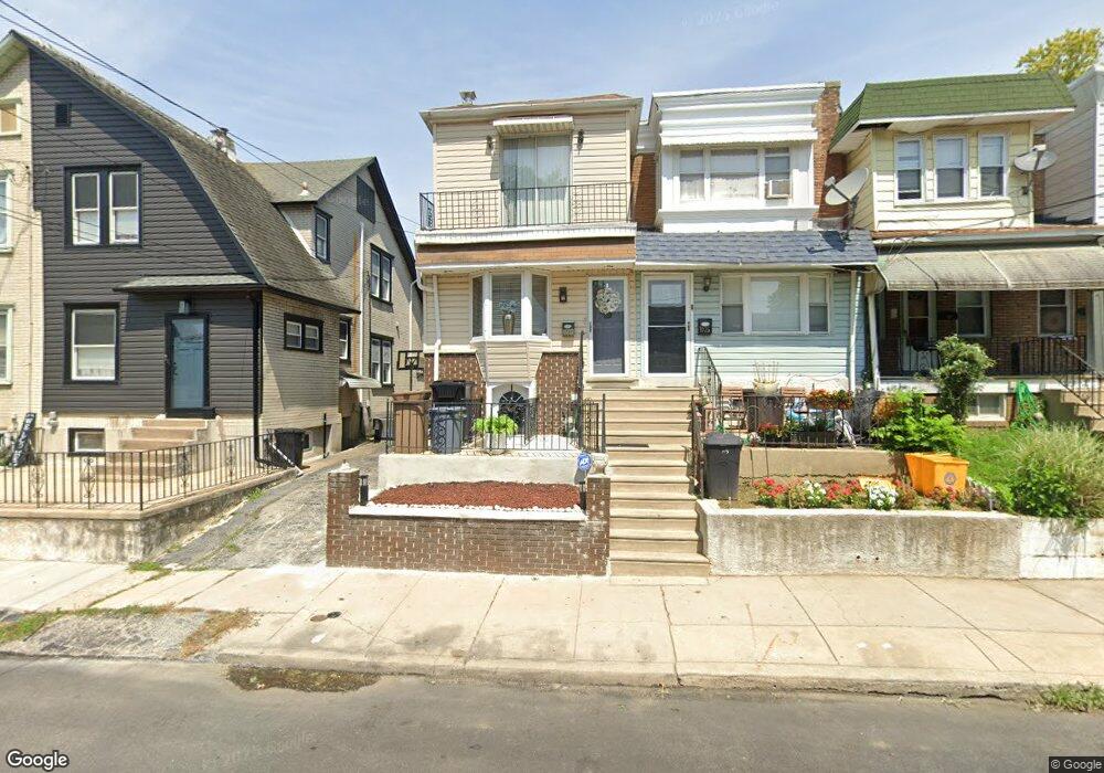
This home is located at 1027 Andrews Ave, Darby, PA 19023 and is currently estimated at $202,759, approximately $168 per square foot. 1027 Andrews Ave is a home located in Delaware County with nearby schools including Harris School, Academy Park High School, and Liberty Baptist Academy.
Ownership History
Date
Name
Owned For
Owner Type
Purchase Details
Closed on
Dec 9, 2005
Sold by
Raspa John and Raspa Carol
Bought by
Williams Hassaan
Current Estimated Value
Home Financials for this Owner
Home Financials are based on the most recent Mortgage that was taken out on this home.
Original Mortgage
$88,200
Outstanding Balance
$49,319
Interest Rate
6.28%
Mortgage Type
Purchase Money Mortgage
Estimated Equity
$153,440
Create a Home Valuation Report for This Property
The Home Valuation Report is an in-depth analysis detailing your home's value as well as a comparison with similar homes in the area
Home Values in the Area
Average Home Value in this Area
Purchase History
| Date | Buyer | Sale Price | Title Company |
|---|---|---|---|
| Williams Hassaan | $98,000 | Old Republic National Title |
Source: Public Records
Mortgage History
| Date | Status | Borrower | Loan Amount |
|---|---|---|---|
| Open | Williams Hassaan | $88,200 |
Source: Public Records
Tax History Compared to Growth
Tax History
| Year | Tax Paid | Tax Assessment Tax Assessment Total Assessment is a certain percentage of the fair market value that is determined by local assessors to be the total taxable value of land and additions on the property. | Land | Improvement |
|---|---|---|---|---|
| 2025 | $3,944 | $87,100 | $19,850 | $67,250 |
| 2024 | $3,944 | $87,100 | $19,850 | $67,250 |
| 2023 | $3,840 | $87,100 | $19,850 | $67,250 |
| 2022 | $3,694 | $87,100 | $19,850 | $67,250 |
| 2021 | $5,088 | $87,100 | $19,850 | $67,250 |
| 2020 | $4,041 | $63,580 | $16,350 | $47,230 |
| 2019 | $3,896 | $63,580 | $16,350 | $47,230 |
| 2018 | $3,809 | $63,580 | $0 | $0 |
| 2017 | $3,739 | $63,580 | $0 | $0 |
| 2016 | $349 | $63,580 | $0 | $0 |
| 2015 | $349 | $63,580 | $0 | $0 |
| 2014 | $349 | $63,580 | $0 | $0 |
Source: Public Records
Map
Nearby Homes
- 1025 Andrews Ave
- 1011 Andrews Ave
- 222 Collingdale Ave
- 933 Bedford Ave
- 164 Wayne Ave
- 924 Pitman Ave
- 149 Wayne Ave
- 126 Hansen Terrace
- 921 Pitman Ave
- 539 Pershing Ave
- 308 Clifton Ave
- 1119 Chestnut St
- 50 Foster Ave
- 44 High St
- 1018 Broad St
- 909 Walnut St
- 118 Juliana Terrace
- 815 Clifton Ave
- 605 Andrews Ave
- 81 Florence Ave
- 1023 Andrews Ave
- 1029 Andrews Ave
- 1031 Andrews Ave
- 1019 Andrews Ave
- 1017 Andrews Ave
- 1013 Andrews Ave
- 305 Lafayette Ave
- 303 Lafayette Ave
- 301 Lafayette Ave
- 309 Lafayette Ave
- 1009 Andrews Ave
- 1022 Andrews Ave
- 1020 Andrews Ave
- 1018 Andrews Ave
- 1007 Andrews Ave
- 1016 Andrews Ave
- 1026 Andrews Ave
- 1028 Andrews Ave
- 1014 Andrews Ave
- 1005 Andrews Ave